STORM WATCH: State of emergency in NY |Bitter blast midday Friday through holiday weekend
News 12 Storm Watch Team Meteorologist Matt Hammer says we'll see high winds and icy travel by Friday afternoon.
•
Dec 22, 2022, 12:30 PM
•
Updated 624 days ago
Share:
More Stories
2:09

Saturn to be visible this weekend, with best viewing on Sunday
21h ago1:39

Why has hurricane season quieted down?
yesterday
LIVE BLOG: News 12 weather updates
10ds ago1:04

Cooler temperature trend into start of meteorological fall
10ds ago1:34

Greenwood Lake leaders warn visitors to use common sense in the heat
10ds ago2:26

Heat & humidity strengthen, storm chances weaken, to bring a pleasant end to week
11ds ago2:09
Saturn to be visible this weekend, with best viewing on Sunday
21h ago1:39
Why has hurricane season quieted down?
yesterdayLIVE BLOG: News 12 weather updates
10ds ago1:04
Cooler temperature trend into start of meteorological fall
10ds ago1:34
Greenwood Lake leaders warn visitors to use common sense in the heat
10ds ago2:26
Heat & humidity strengthen, storm chances weaken, to bring a pleasant end to week
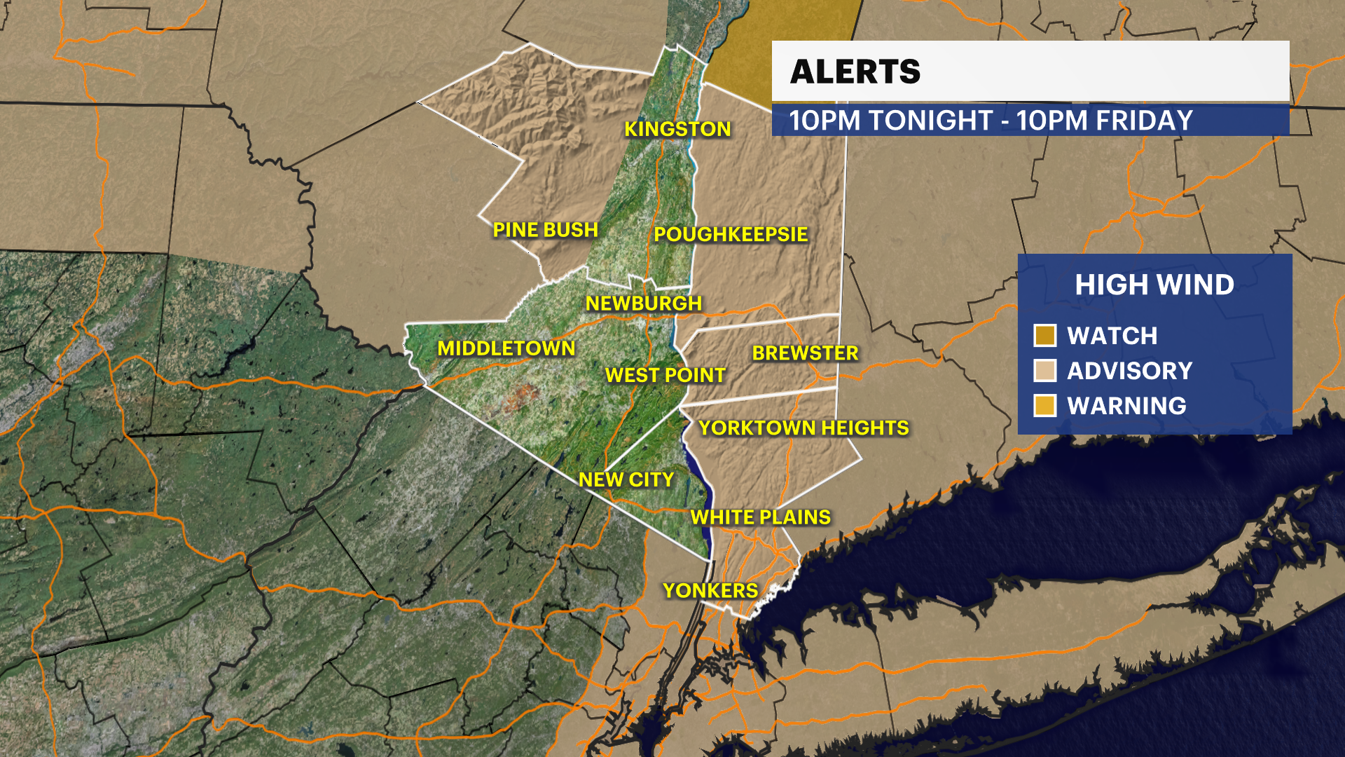
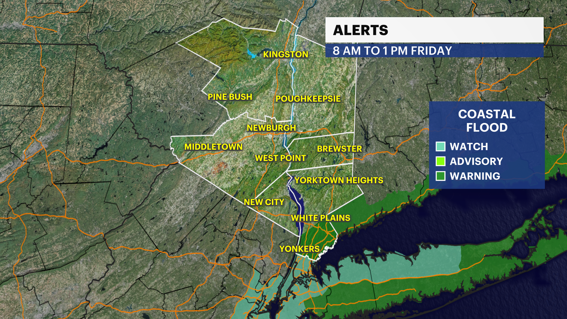
11ds agoWHAT'S NEW: There is a wind advisory for the entire Hudson Valley until 10 p.m. A coastal flood warning for the Sound Shore is in effect for Westchester County from 8 a.m. to 1 p.m.
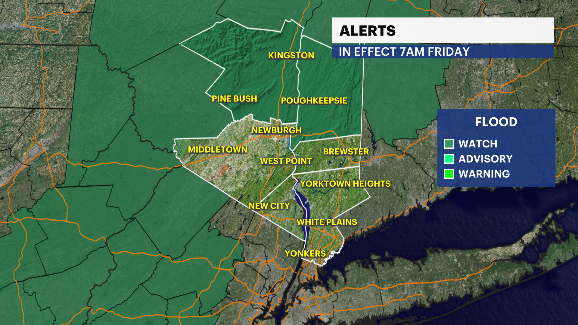
WHAT'S NEXT: Rain ends as a few snow showers as temperatures crash toward the 20s into the afternoon. It will feel even colder with the wind. Dangerous travel possible overnight and through all of Friday.
News 12 Storm Watch Team Meteorologist Matt Hammer says it will be wet and windy, with rain totals between 1 and 3 inches. There will be localized flooding and wind gusts between 30 mph and 60 mph.
Gov. Kathy Hochul has declared a state of emergency for all of New York starting at 6 a.m. Friday due to the incoming storm.
FORECAST:
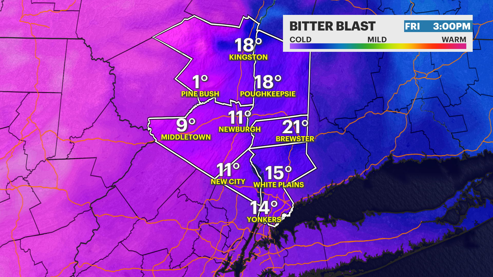
FRIDAY:STORM WATCH - BITTER BLAST - Temperatures in the 50s to start. Wet and windy with rain totals between 1 and 3 inches. Localized flooding. Wind gusts between 30 and 60 mph. Rain may briefly end as a wintry mix or wet snow, not amounting to much. However, temperatures crash into the teens and 20s Friday afternoon-evening, and this can lead to dangerous, icy travel in time for the evening commute!
SATURDAY: CHRISTMAS EVE - BITTER BLAST - Sun and clouds, breezy and frigid. Highs around 20 degrees but feeling colder with the wind between 10-20 degrees. Lows near 11 with feels like well below zero.
SUNDAY: CHRISTMAS DAY - BITTER BLAST - Mostly sunny and still very cold. Highs around 27. Lows around 16.
More from News 12
2:09

Emergency sewer repair project in Greenburgh stinks – but it’s necessary, officials say
1:57

Chilly morning, pleasant afternoon Sunday in the Hudson Valley
0:53

Nearly $2 million to fund intelligence center, body cameras for Orange County law enforcement
2:00

Dobbs Ferry neighbors unite to protect wooded area
2:07

Doctors urge men to get screened during Prostate Cancer Awareness Month
1:50
