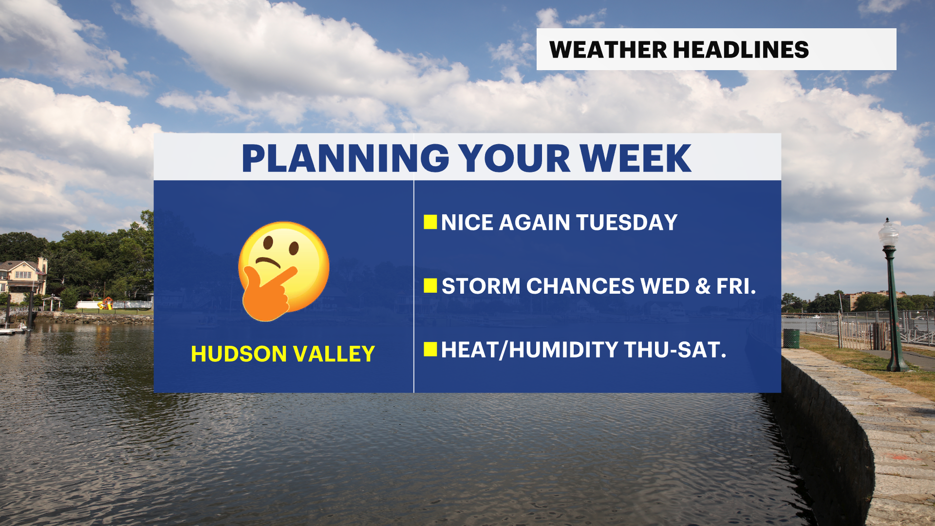
Pleasant start gives way to heat, humidity and storm chances later this week
Tuesday stays warm and comfortable before increasing rain chances on Wednesday, and near-100 heat indices arrive late week.
More Stories


High pressure remains in control to start the workweek, providing comfortable conditions and excellent outdoor weather.
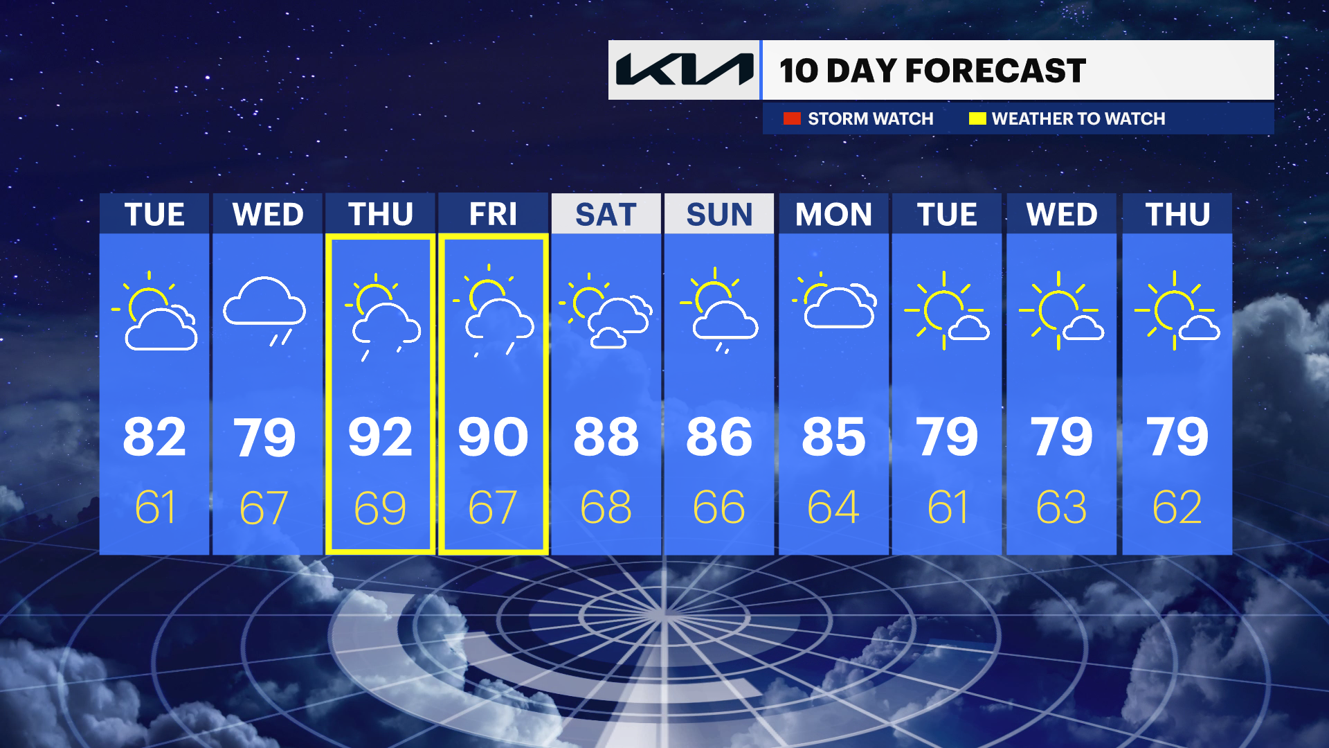
The pleasant stretch continues Tuesday as temperatures climb into the low 80s under sunny skies until Tuesday evening, as clouds increase. Humidity levels will remain manageable, making for another enjoyable summer-like day across the region.
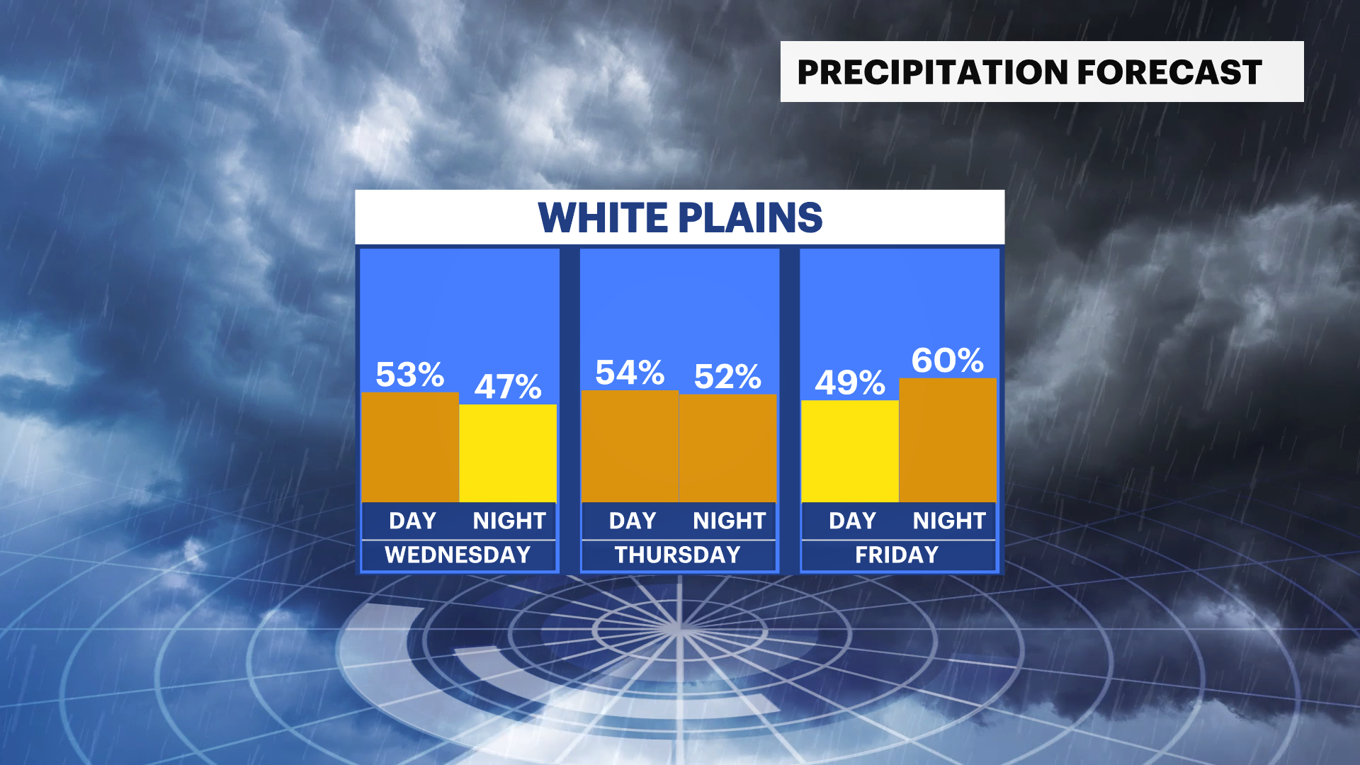
Changes begin to arrive on Wednesday as cloud cover increases throughout the day, and an unsettled weather pattern develops. Scattered showers and thunderstorms are possible during the afternoon and evening hours as the first of several disturbances moves through the Northeast.
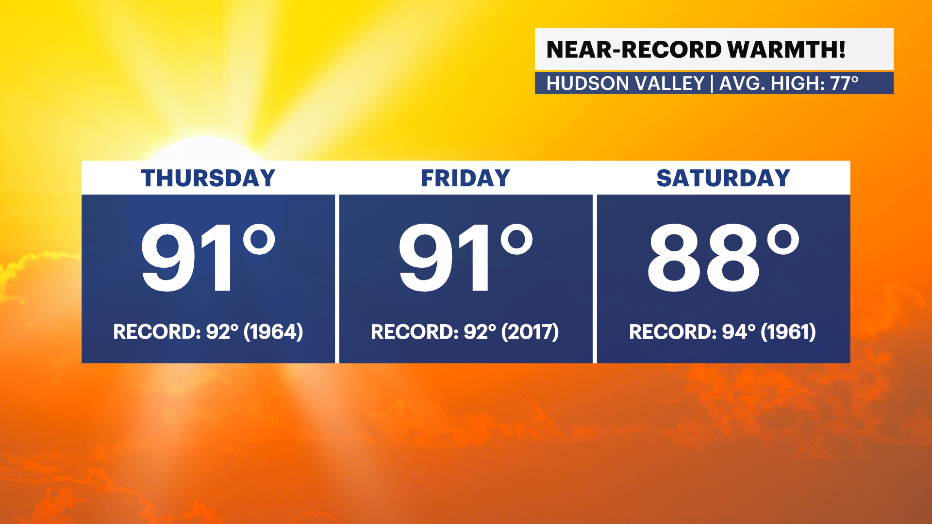
Following Wednesday's system, a surge of heat and tropical moisture will build into the Hudson Valley for the latter half of the week. Temperatures will climb into the upper 80s and lower 90s on Thursday and Friday, while increasing humidity levels push heat index values close to 100 degrees in some locations.
The combination of heat, humidity and approaching disturbances will also increase the likelihood of evening showers and thunderstorms on Thursday and Friday. While it is too early to determine the exact severity of any storms, the late-week period bears watching for potentially impactful weather.
A weak cold front is expected to move through over the weekend, bringing a slight reduction in temperatures and humidity. While conditions will remain warm, the air mass should become somewhat more comfortable heading into early next week.
For now, Thursday and Friday are the days to keep an eye on. Those will likely be the hottest and most humid days of the week, with the greatest potential for showers and thunderstorms.
THE FORECAST:
TONIGHT: Clear skies, cool temperatures and a light breeze. Lows: Mid-50s.
TUESDAY: Mostly sunny to partly cloudy. Highs: Low 80s. Lows: Upper 50s to low 60s.
WEDNESDAY: Partly cloudy with rain and storms moving in for the afternoon hours. Highs: Upper 70s. Lows: Mid- to upper 60s.
THURSDAY: Partly cloudy with an afternoon storm threat. Highs: Upper 80s to low 90s. Lows: Upper 60s to low 70s. Heat indices in the mid-to-upper 90s.
FRIDAY: Mostly sunny to mostly cloudy with an afternoon storm threat. Highs: Upper 80s to low 90s. Lows: Mid- to upper 60s. Heat indices in the mid-to-upper 90s.