Spring showers tonight, then a refreshing and dry finish to the week
Umbrellas will be needed for any evening plans. And with cooler temperatures in sight, keep those jackets handy.
More Stories


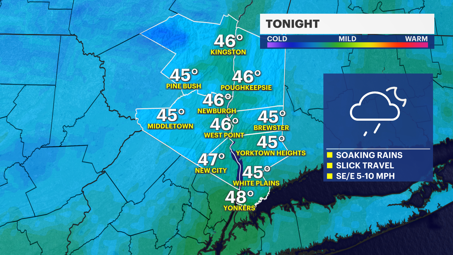
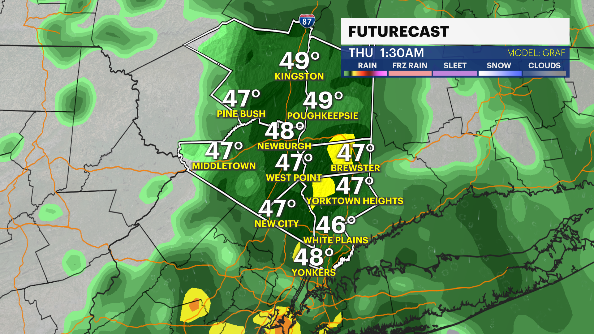
Put your umbrellas up as the heaviest rain is moving in overnight. Watch out for some deep puddles and ponding on the roads if you’re driving. Visibility is going to be an issue as well through the early morning hours.
That rain looks to move out just in time for Thursday morning's commute. By the afternoon, it will still be cool with high pressure moving back in.
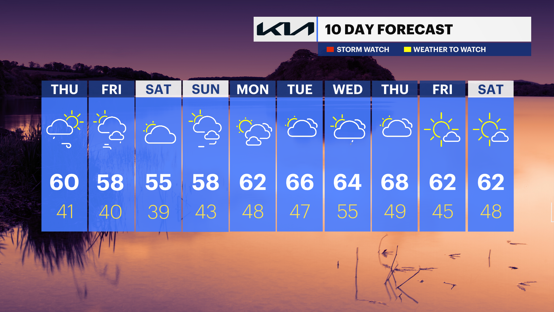
Expect those winds to stick around into Friday alongside a mix of sun and clouds. Unfortunately, we’re stuck in a bit of a "cool" rut. Temperatures are staying below average through the first weekend of May. We dodged a bullet for Saturday, though—the next rain system looks like it’ll stay well to our south, leaving the Hudson Valley mostly cloudy but dry. Just keep the light jacket handy, as we’ll be about 10 degrees cooler than normal.
The good news? Next week is finally looking up! Temperatures are on the rise and will finally start feeling like true Spring, though we’ll have to dodge a few more rain chances along the way.
ALMANAC:
Average High: 64 | Average Low: 45
Record High: 89 (1974) | Record Low: 32 (2019)
Sunrise: 5:55 a.m. | Sunset: 7:49 p.m.
THE FORECAST:
TONIGHT: Shower batches, quick downpours and slick travel. Lows: Mid-40s.
THURSDAY: Showers fade in the morning hours with drier skies and breezy winds to follow. Highs: Upper 50s to low 60s. Lows: Upper 30s to low 40s.
FRIDAY: MAY 1st - Partly sunny and breezy. Highs: Mid- to upper 50s. Lows: Upper 30s to low 40s.
SATURDAY: Mostly cloudy and cool. Highs: Mid-50s. Lows: Upper 30s to low 40s.