A gusty cooldown leads to Sunday perfection
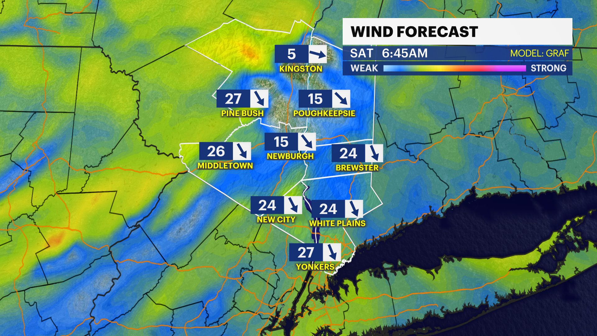
Gusty winds tonight that roll on for a breezy Saturday.
More Stories


Calm weather continues into tonight as clouds decrease and the winds start to pick up again.
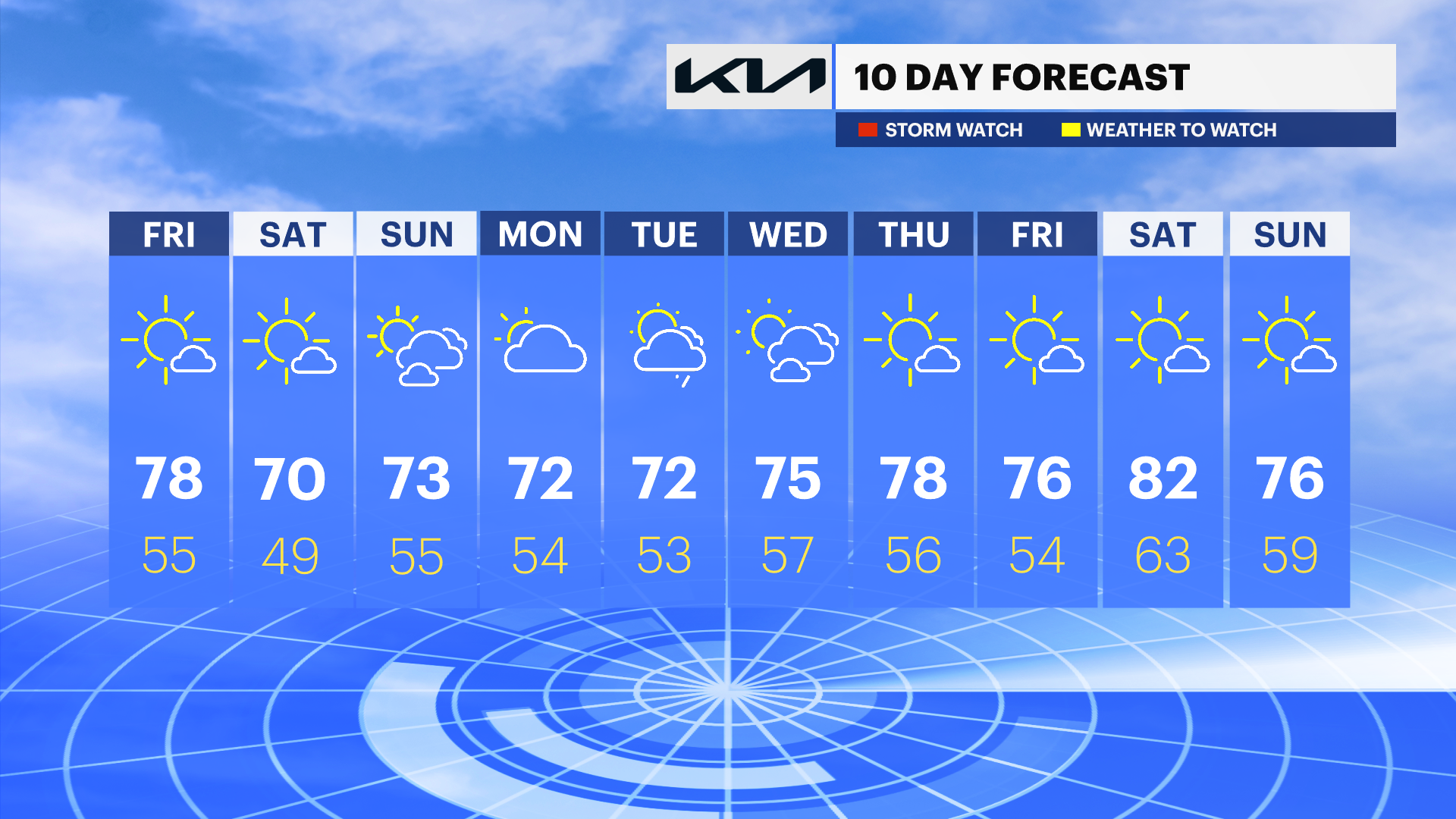
Expect a noticeably cooler, gusty Saturday with highs in the low 60s and wind gusts whipping up to 35 mph. Some may not make it out of the 50s for some spots, so light jackets or hoodies aren't a bad idea heading out.
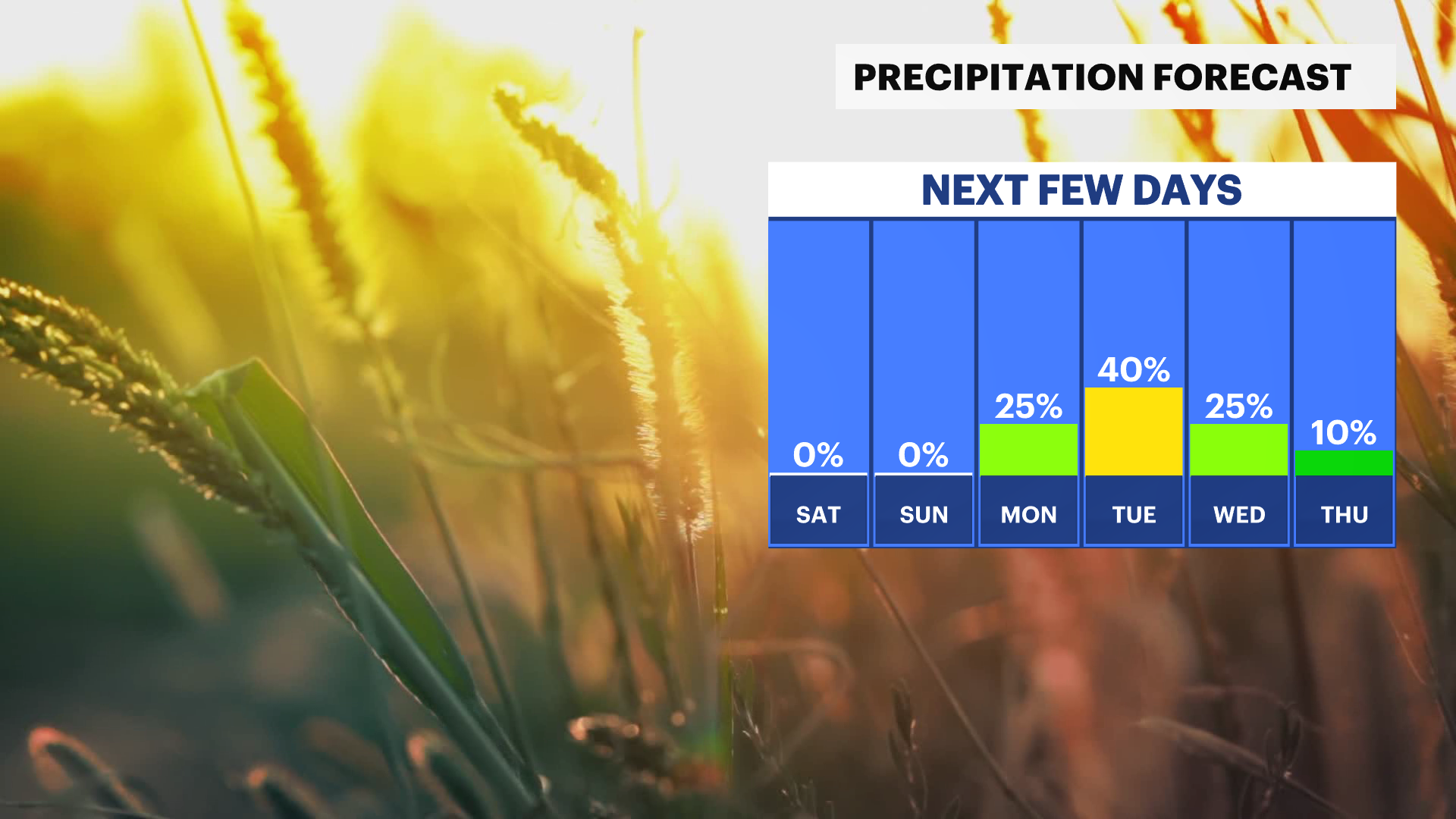
The payoff arrives on Sunday, a picture-perfect day with plenty of sunshine and highs in the mid-70s. Keep the umbrella handy for the start of the workweek, as rain chances return Monday and continue into Tuesday and Wednesday.
TONIGHT: Increasing clouds and breezy. Lows in the upper 50s.
SATURDAY: Sunny, windy and slightly cooler. Gusts up to 35 mph. Highs in the low 60s.
SUNDAY: Sunny, warmer. Highs in the mid-70s.
MONDAY: Mostly sunny, shower chance. Highs in the low 70s.