Favorable weather arrives Sunday for the Hudson Valley
The return of sunshine and 70s are on the way to end the weekend.
More Stories

WHAT TO KNOW
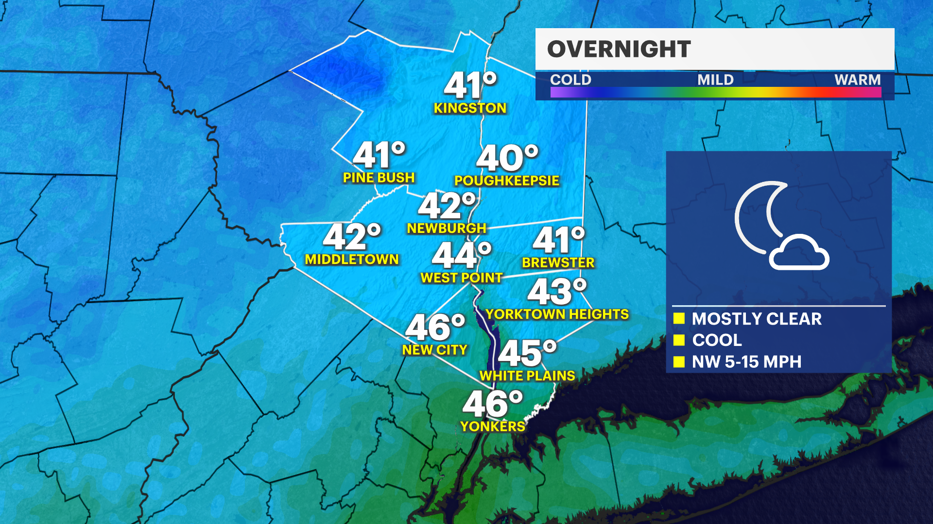
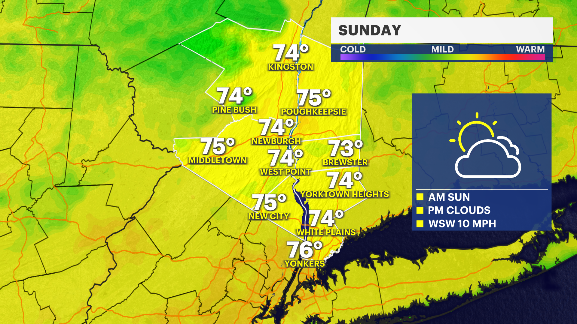
After a chilly and breezy Saturday, conditions improve on Sunday with more sunshine returning to the region. Expect a bright start to the day with sunshine mixing with a few fair-weather clouds through the afternoon. Temperatures will be noticeably milder, climbing into the 70s for many locations, while winds will be much lighter compared to Saturday.
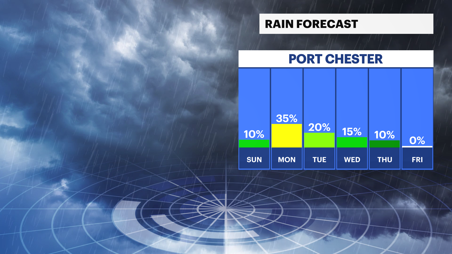
Clouds will gradually increase during the evening hours ahead of an approaching disturbance. While most of Sunday remains dry, there is a chance for a few spotty rain showers to develop overnight Sunday into early Monday morning. Any rainfall is expected to be light and scattered.
If you have outdoor plans on Sunday, weather conditions will be much more favorable with comfortable temperatures, lighter winds and plenty of dry hours before clouds increase later in the day.
FORECAST
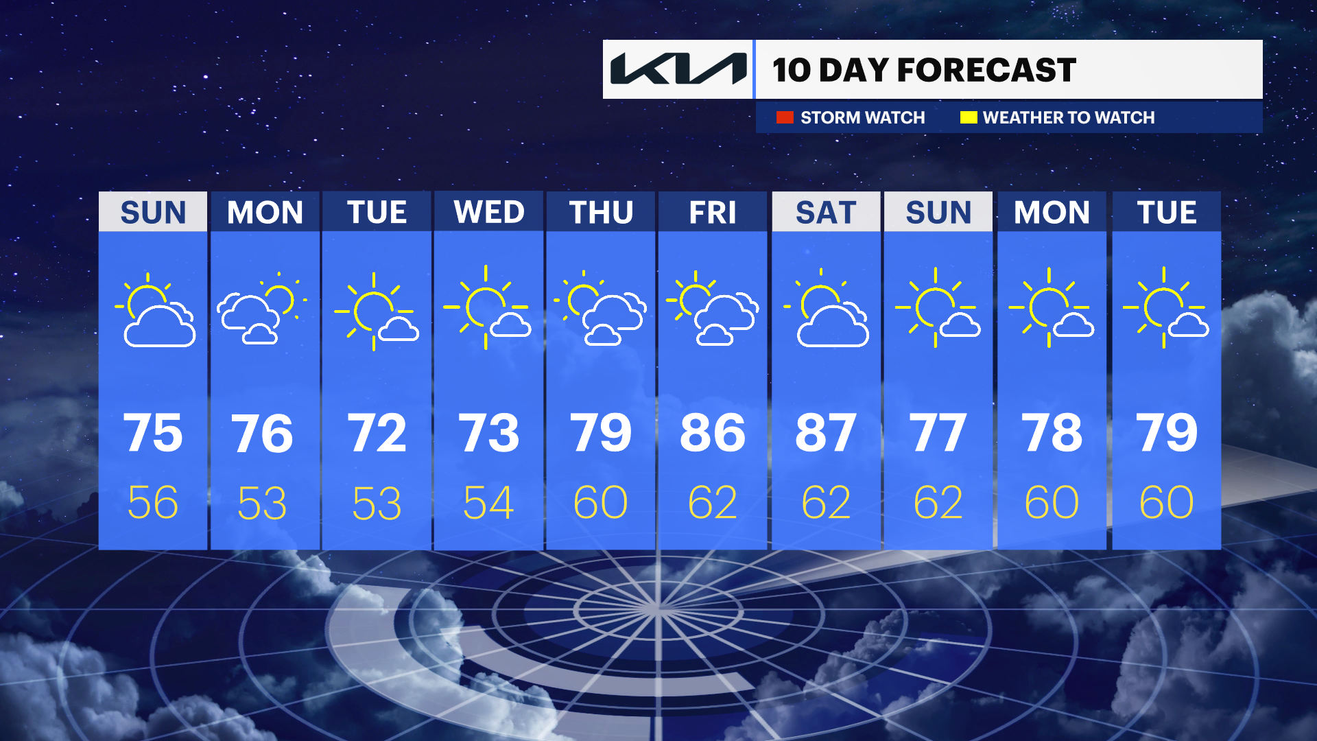
SUNDAY: The pick of the weekend. Expect a good deal of sunshine early, with some clouds increasing later in the day. Winds will be much lighter and temperatures will rebound into the low to mid-70s. Most of the day stays dry, making it a great day for the beach, boating, backyard gatherings and outdoor activities.
MONDAY: A mix of sun and clouds, with the chance for a passing shower. It will be mild, with temperatures in the low to mid-70s. Keep an eye on the forecast for changes, but the weather will trend dry as of Saturday morning's forecast.
TUESDAY: Mostly sunny and comfortable. Temperatures will be around the upper 60s to near 70, with a stray midday shower or storm.
WEDNESDAY: A mix of sun and clouds, with a slight chance for a passing shower. Temperatures will reach around 70, with plenty of dry time.
THURSDAY: Mostly sunny and a bit warmer. Temperatures will be in the low to mid-70s, with pleasant conditions for outdoor plans.
FRIDAY: A warm finish to the week, with a mix of sun and clouds. Temperatures will climb into the upper 70s, making it feel much more like early summer.