Pleasant start of the work week before first potential heat wave late next week in the Hudson Valley
Pleasant Monday gives way to rising heat, humidity and late-week storm chances.
More Stories


WHAT TO KNOW
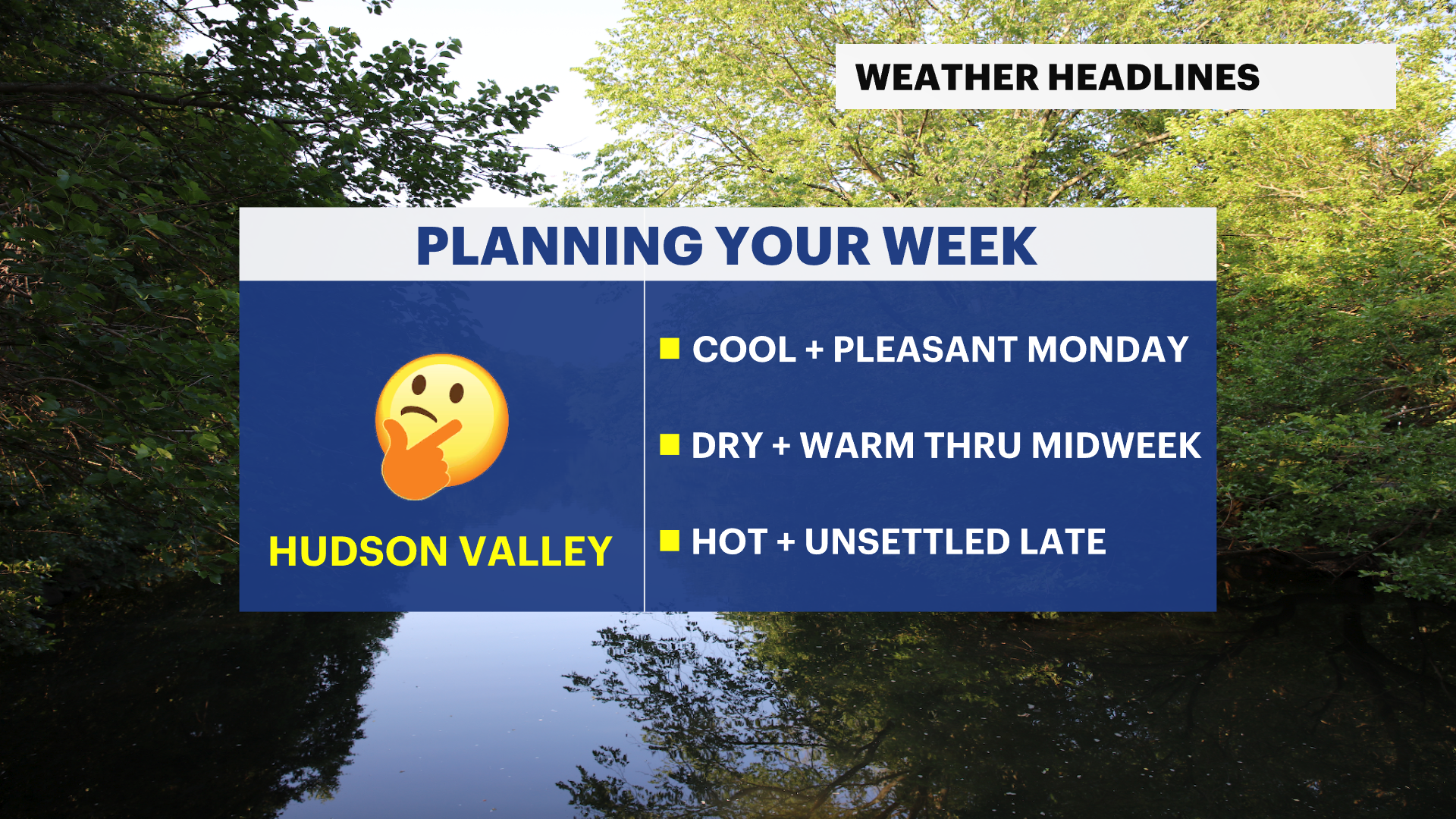
The Hudson Valley will enjoy a quiet and comfortable start to the work week before summer heat and a more unsettled weather pattern return later this week.
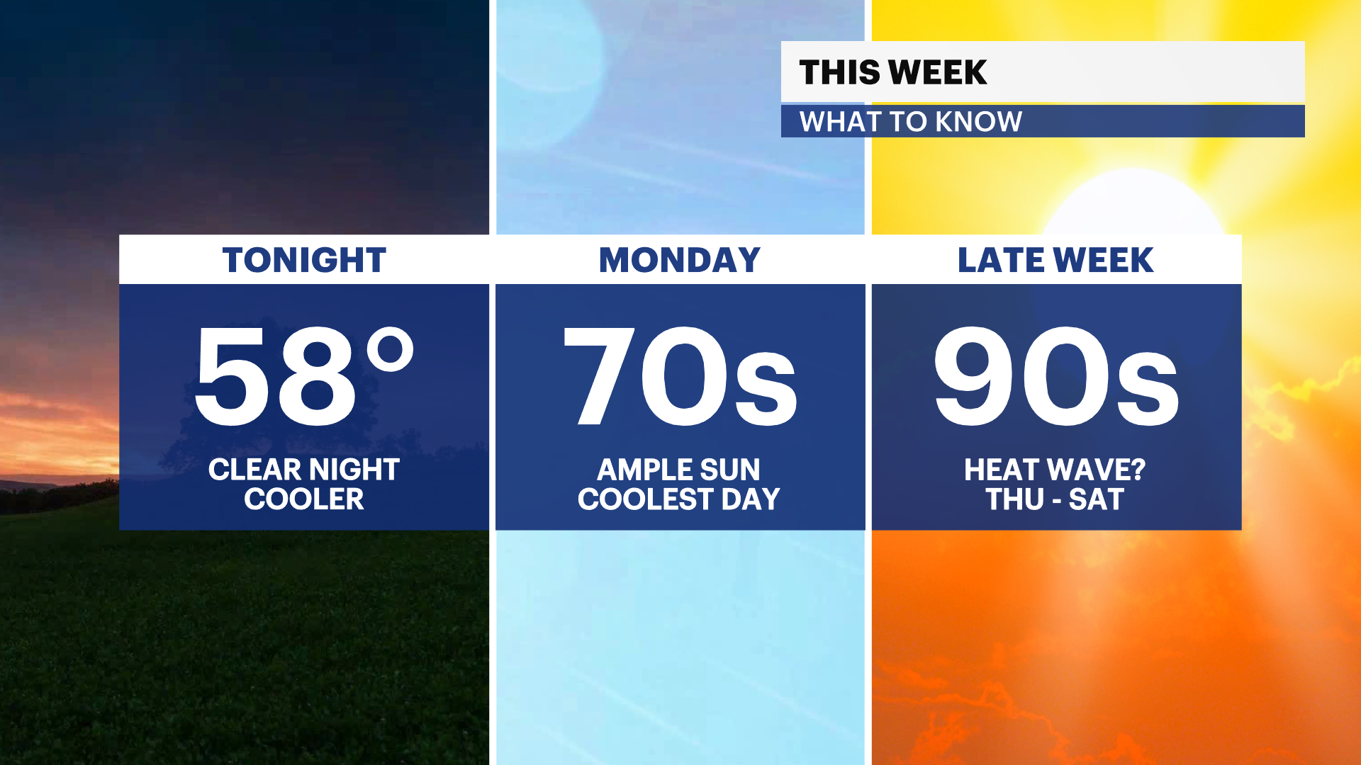
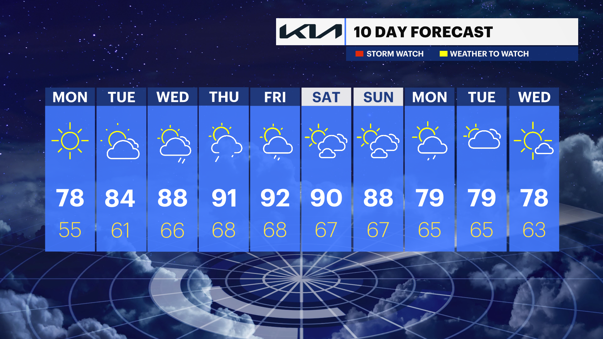
Monday looks to be the coolest and most pleasant day of the upcoming week, with plenty of sunshine, low humidity, and afternoon temperatures in the 70s. It will be a great day to spend time outdoors as dry weather remains in place across the region.
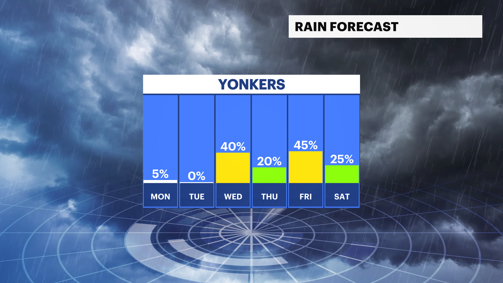
Temperatures will gradually climb through the middle of the week, reaching the 80s by Tuesday and Wednesday. While much of Wednesday stays dry, an isolated shower or thunderstorm cannot be ruled out by the evening as the weather pattern begins to change.
THE WEEK AHEAD
Summer heat will make a strong comeback after a comfortable start of the week. High temperatures are expected to climb into the upper 80s and low 90s Thursday through Saturday. Some locations could experience their first heat wave since July 2025, which is defined as three consecutive days of temperatures reaching 90 or above.
Humidity levels will also increase late in the week, making conditions feel noticeably muggier heading into the weekend.
Along with the heat, there will be opportunities for unsettled weather. Spotty showers and thunderstorms are possible Friday, with additional chances for rain and storms continuing into portions of the weekend. While the forecast is not a washout, residents should stay updated as timing and coverage of any rainfall become clearer over the next several days.