Heat Alert: Hot and humid air will aid in severe storm development later
A heat advisory is in effect as temperatures climb to potentially record levels
More Stories


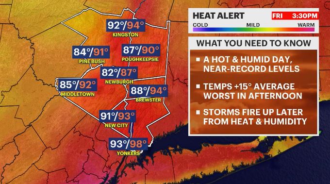
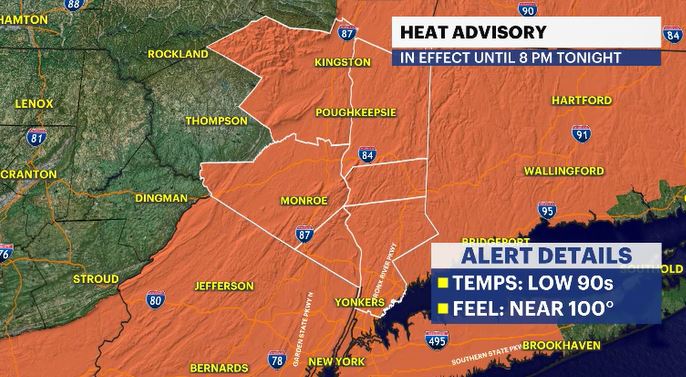
HEAT ADVISORY UNTIL 8 PM TONIGHT FOR THE ENTIRE HUDSON VALLEY
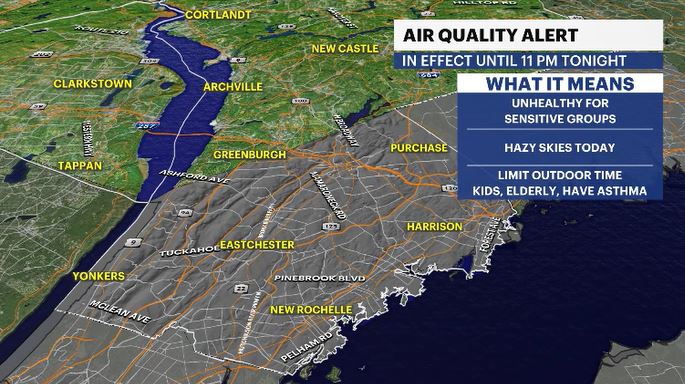
AIR QUALITY ALERT UNTIL 11 PM TONIGHT FOR S. WESTCHESTER COUNTY
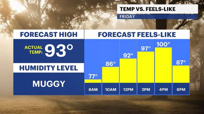
Heading into tonight, keep the AC running. It’s going to stay mostly cloudy, stuffy, and uncomfortably muggy out there, with a few scattered showers lingering early in the night. Temperatures won't offer much relief, only dropping into the upper 60s to low 70s. Get ready for a repeat of the heat on Friday, but dial it up a notch. We’re forecasting a high of 93, which would actually break the old record of 92 set back in 2017. With tropical-level humidity, it’s going to feel closer to 100 degrees during the afternoon hours.
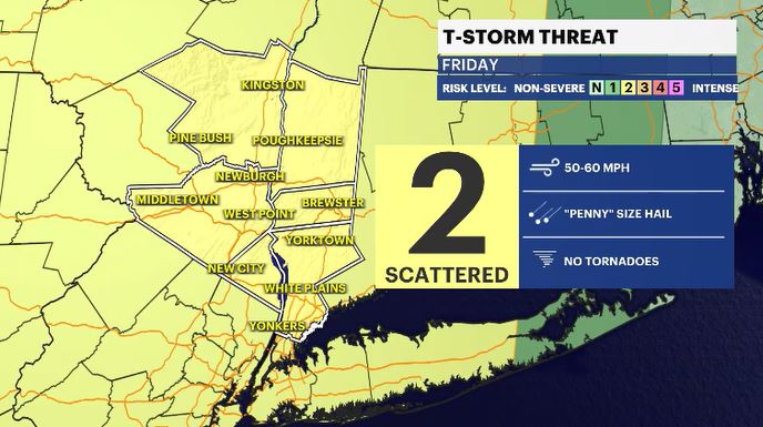
By the late afternoon and evening, that intense heat and humidity will act as rocket fuel for potentially severe thunderstorms. The main threats are widespread across the Hudson Valley, bringing the potential for damaging wind gusts over 40-50 mph and penny-sized hail. Make sure you stay weather-aware and keep the app handy to check the radar if you have evening plans.
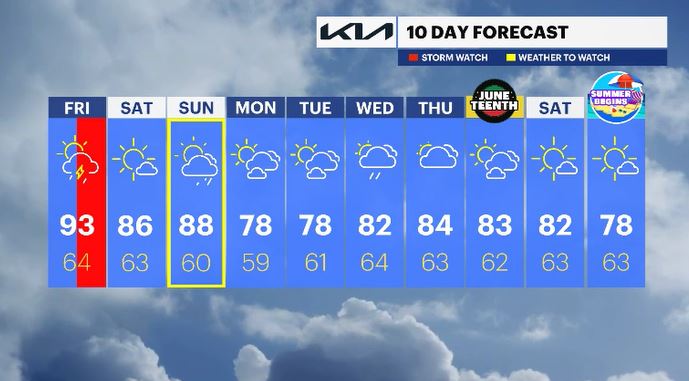
Saturday brings a little relief! The oppressive heat and humidity will break, leaving us with a beautiful, mostly sunny start to the weekend. Highs will be much more manageable in the mid-80s. It will feel significantly easier actually to get out and enjoy the day. Sunday, we’ll wrap up the weekend with a mix of sun and clouds as temperatures warm back up into the upper 80s. Most of the day looks fair and dry, but keep an eye out for a late-day shower chance if you're wrapping up any outdoor weekend projects.
ALMANAC:
Average High: 77 | Average Low: 58
Record High: 92 (2017) | Record Low: 41 (1980)
Sunrise: 5:22 a.m. | Sunset: 8:27 p.m.
THE FORECAST:
TODAY: STORM WATCH (PM) - HEAT ALERT - Hazy, hot and humid with a threat of afternoon to evening severe storms. Highs: low 90s.
TONIGHT: Mostly cloudy, stuffy, with scattered showers early on in the night. Lows: upper 60s to low 70s.
SATURDAY: Mostly sunny, less humid but still warm. Highs: mid-80s. Lows: low 60s.
SUNDAY: WEATHER TO WATCH - Partly to mostly cloudy with rain moving in later in the day. Humid will be returning as well. Highs: upper 80s. Lows: upper 50s to low 60s.
MONDAY: Mix of sun and clouds. Highs: upper 70s. Lows: upper 50s to low 60s.
TUESDAY: Mix of sun and clouds. Highs: upper 70s. Lows: upper 50s to low 60sLows: Upper 50s to low 60s.