Strong storms possible late Sunday before a beautiful start to the workweek
The Hudson Valley faces a risk for damaging thunderstorms late Sunday, followed by cooler, less humid air Monday and Tuesday before shower chances return later in the week.
More Stories


What to Expect
The primary weather concern will be the potential for strong to severe thunderstorms Sunday afternoon and evening. While instability is not expected to be extreme, stronger upper-level support may allow storms to organize, with damaging wind gusts posing the greatest threat.
Once Sunday's cold front passes, a stretch of comfortable weather arrives for Monday and Tuesday with lower humidity, cooler nights, and seasonable temperatures. By midweek, temperatures gradually warm again while shower chances begin to increase heading into Thursday.
For residents with outdoor plans Sunday evening, it's worth paying close attention to weather updates and having a way to receive warnings if severe weather develops.
Overnight:
Mostly clear and comfortably warm with overnight temperatures falling into the lower to middle 60s. Humidity levels remain manageable, and winds become light. It will be a pleasant night for outdoor dining, evening walks, or backyard activities. Sleeping conditions should remain comfortable for most locations.
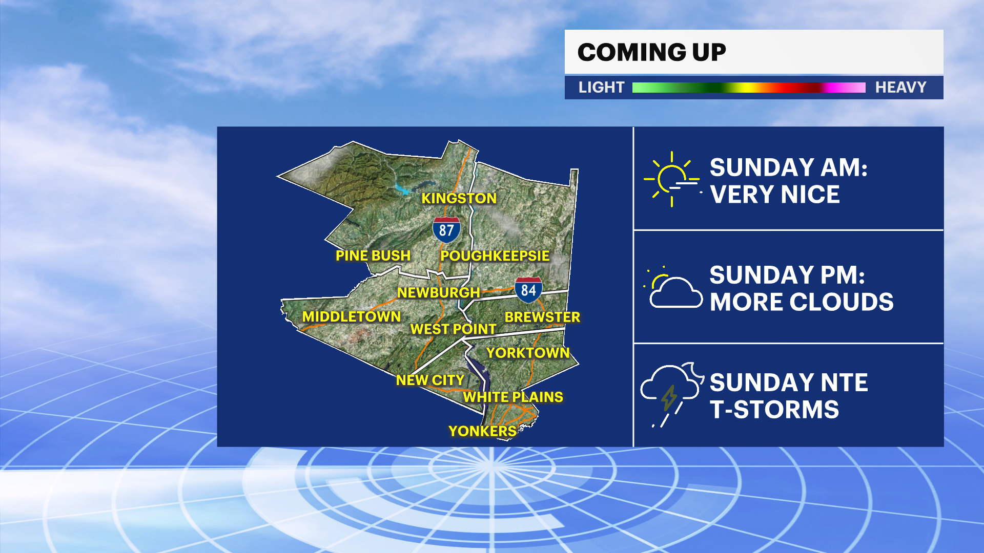
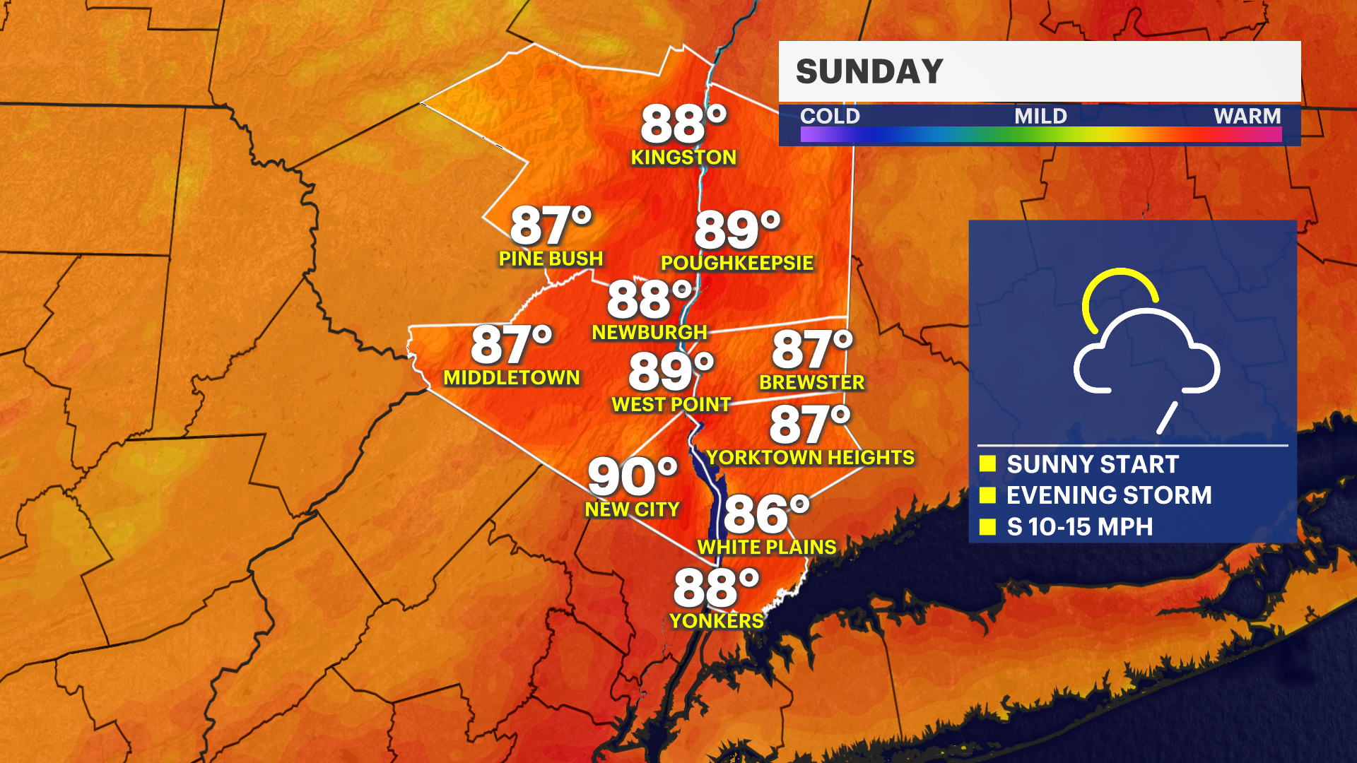
Sunday:
Partly sunny during the morning with increasing clouds through the afternoon. Temperatures will climb into the middle to upper 80s, making it another warm summer day across the Hudson Valley. Humidity will be noticeable but not excessive.
By late afternoon and especially toward evening, scattered showers and thunderstorms may develop. While many hours of the day will remain dry, any storms that form could become strong to severe. If you have outdoor plans later in the day, especially at parks, sporting events, or community gatherings, be prepared to move indoors quickly if storms approach.
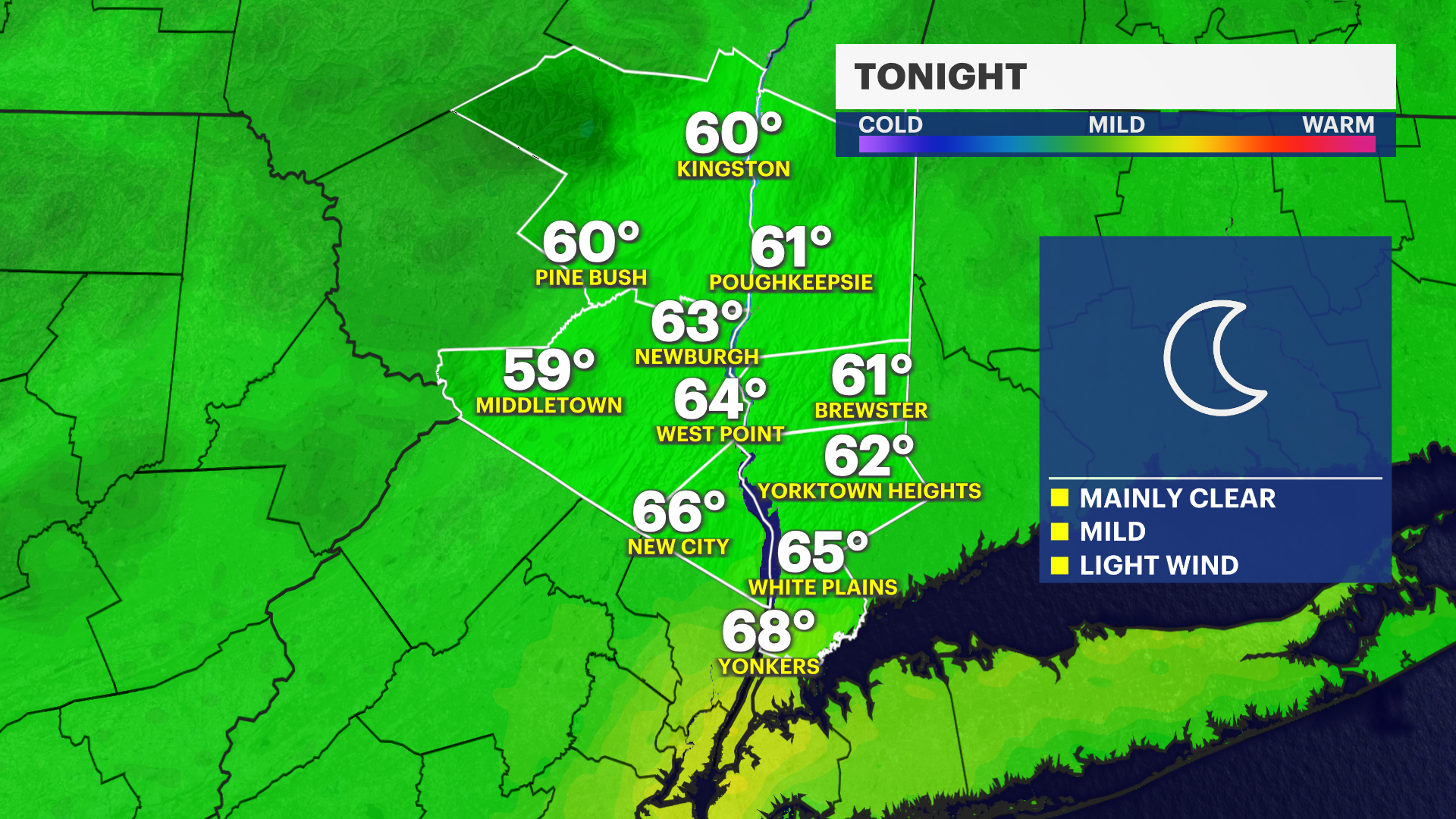
Sunday Night:
Showers and thunderstorms become more likely during the evening and early overnight hours as a cold front moves through the region. Some storms may produce damaging wind gusts, which is the primary severe weather threat. Brief heavy downpours and dangerous lightning are also possible.
Conditions gradually improve later at night as the front moves east. Temperatures will fall into the lower to middle 60s by daybreak, with noticeably less humidity arriving toward morning.
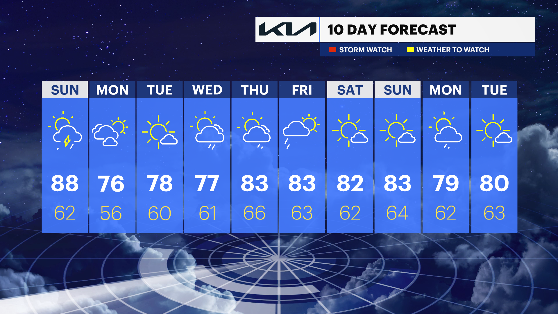
Monday:
Mostly sunny, less humid, and much more comfortable with afternoon temperatures reaching the middle to upper 70s. A refreshing west breeze will make it feel significantly different from the warmth and humidity of the weekend. Excellent weather is expected for outdoor work, recreation, and travel.
Monday Night:
Partly cloudy and pleasantly cool with temperatures dropping into the middle to upper 50s. Great sleeping weather returns across the region.
Tuesday:
Mostly sunny and seasonably warm with highs reaching the upper 70s to around 80 degrees. Humidity remains relatively comfortable, making for another excellent summer day. Outdoor activities should have no weather-related issues.
Wednesday:
Mostly sunny and warm with highs in the upper 70s to lower 80s. Clouds may increase during the afternoon, and a few scattered showers could develop later in the day. Most of the daylight hours should remain dry.
Thursday:
Partly sunny and warmer with highs climbing into the lower to middle 80s. Showers become more likely during the day as another weather disturbance approaches the region. While it does not appear to be a washout, periods of rain could affect outdoor plans, especially during the afternoon and evening.