Comfortable summer weather for the Hudson Valley continues on Tuesday before a midweek shower chance
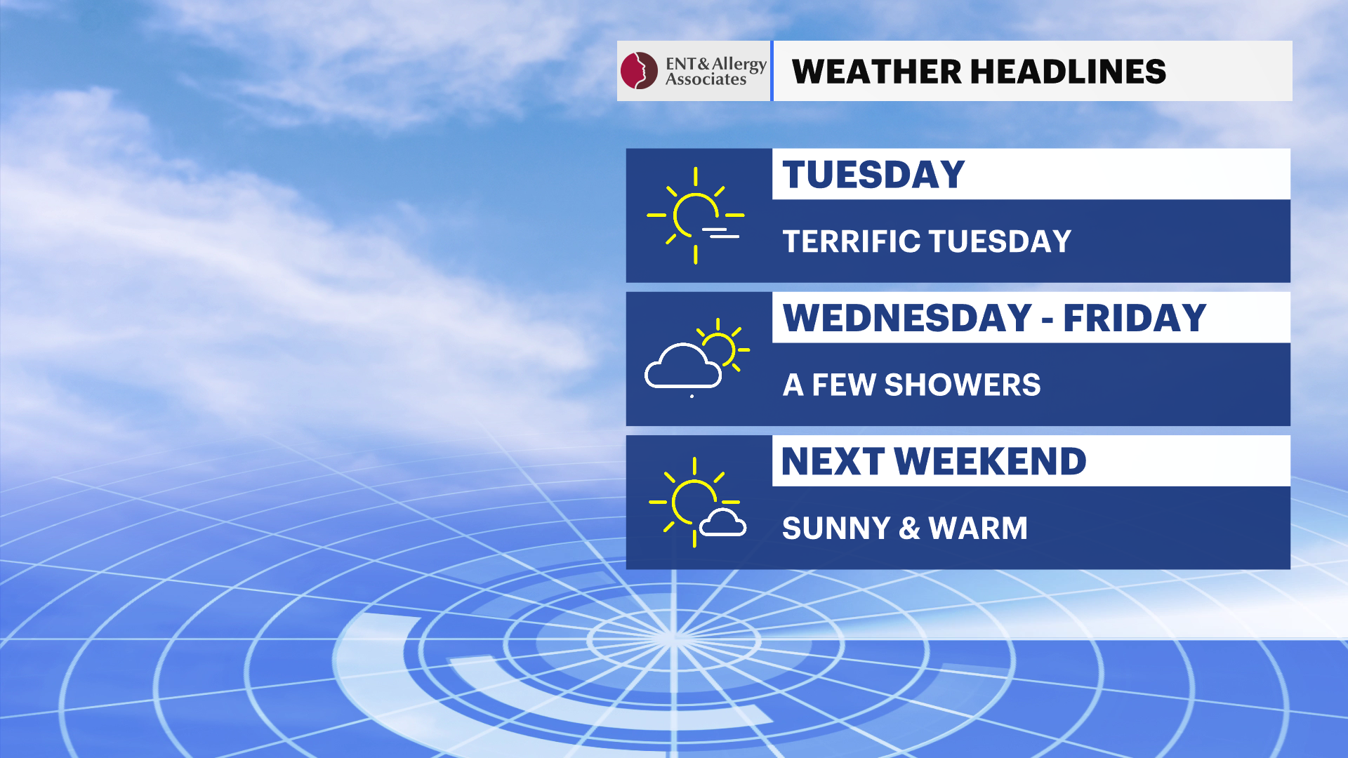
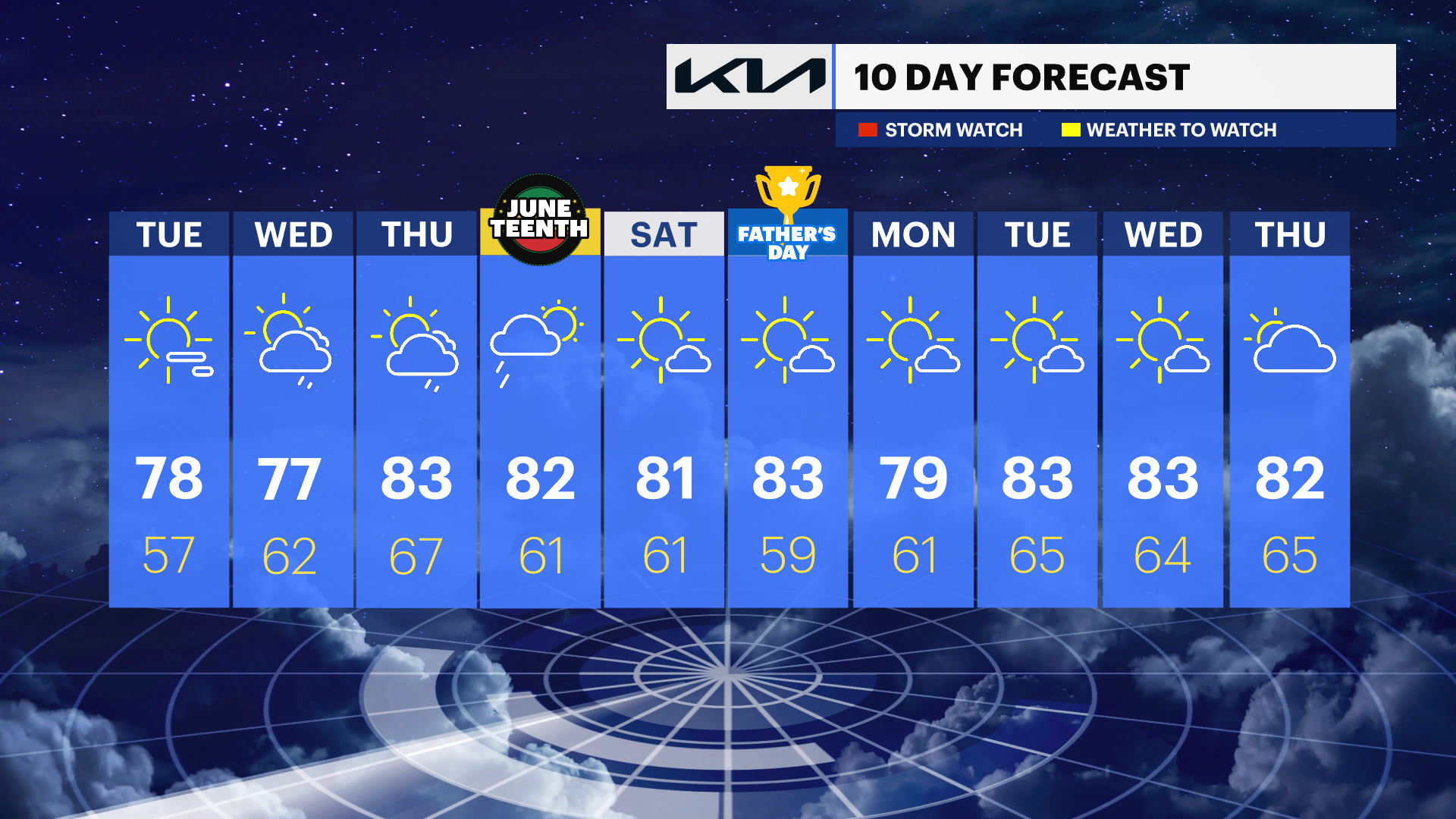
The Hudson Valley stays dry and pleasant through Tuesday, then turns a bit more unsettled Wednesday and Thursday before sunshine and seasonable warmth return for Juneteenth and the weekend.
More Stories
The Hudson Valley will enjoy a stretch of comfortable and seasonable weather through Tuesday before humidity gradually increases on Wednesday. A few scattered showers and thunderstorms are possible late Wednesday, followed by a better chance for showers on Thursday as a stronger weather system approaches.
Fortunately, conditions improve in time for the Juneteenth holiday and the upcoming weekend, with sunshine, warm temperatures, and comfortable humidity levels returning across the region.
Overnight:
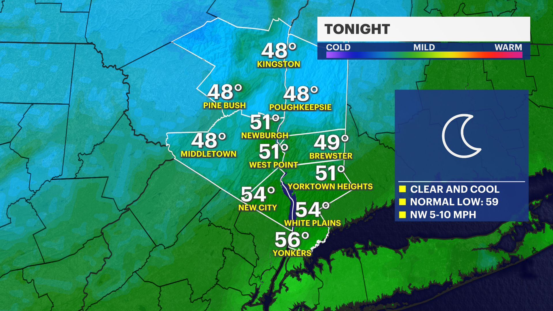
Mostly clear and comfortably cool with overnight temperatures dropping into the low to mid-50s. A light northwest breeze will continue through the evening before gradually easing overnight. It will be an excellent night for sleeping with low humidity and refreshing air across the region.
Tuesday:
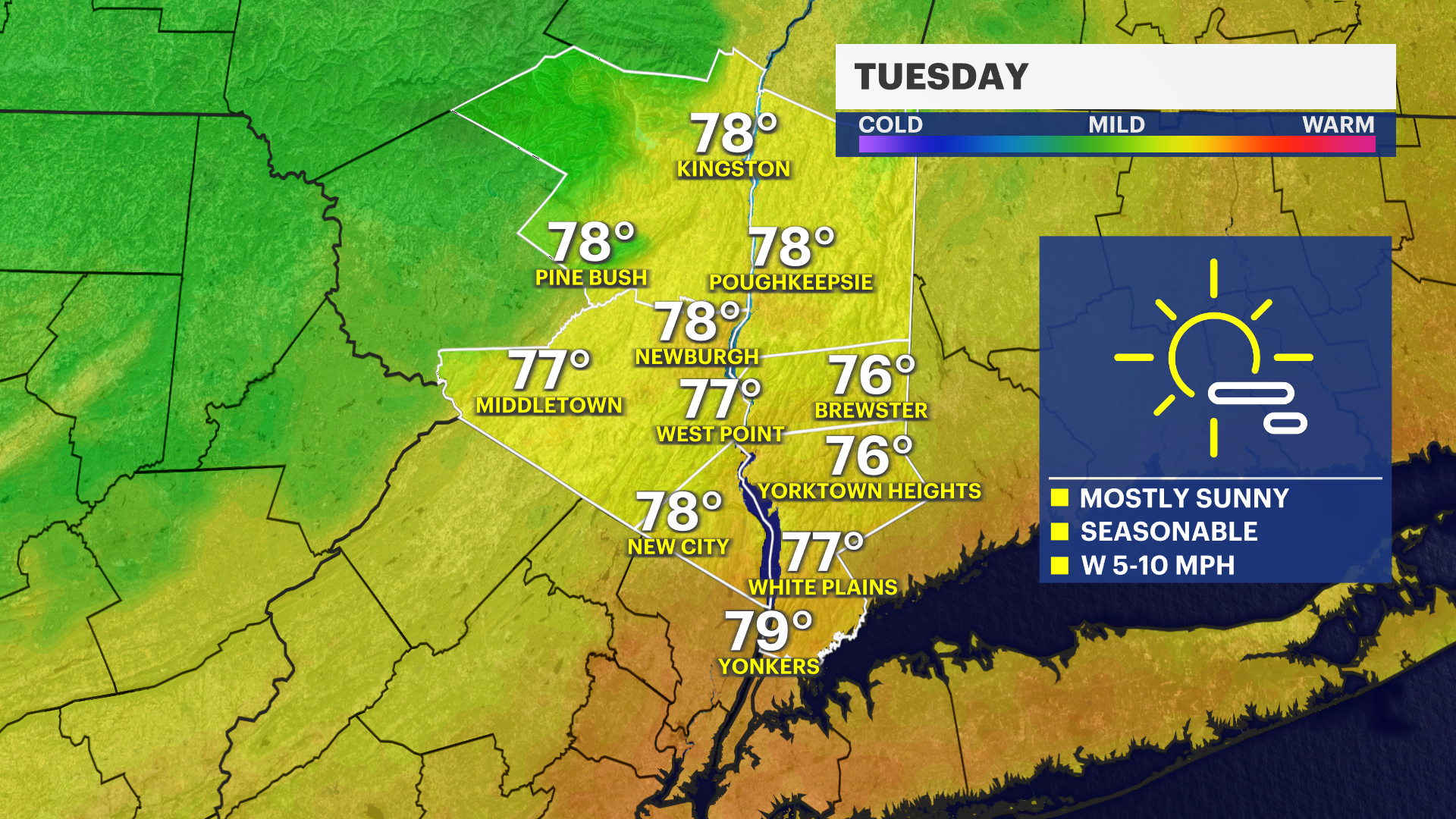
Sunny and seasonably pleasant with afternoon temperatures reaching the mid- to upper 70s. Humidity levels remain comfortable, making it a great day for outdoor work, hiking, recreation, and travel. Sunshine will be plentiful from start to finish with no weather-related concerns expected.
Tuesday Night:
Partly cloudy and cool with temperatures settling into the mid- to upper 50s. Winds become light and conditions remain comfortable overnight.
Wednesday:
Partly sunny with increasing clouds and humidity during the afternoon. Temperatures will reach the mid to upper 70s. While much of the day remains dry, scattered showers may develop during the mid- to late afternoon, with a few thunderstorms possible toward evening. This is not expected to be a washout, but anyone with late-day outdoor plans should keep an eye on the sky and have an umbrella available.
Thursday:
Mostly cloudy, warmer, and more humid with temperatures climbing into the lower to mid-80s. Showers become more likely as a stronger weather system approaches from the west. While there will still be dry periods, outdoor activities could be interrupted at times by passing rain showers. Keep rain gear handy if you'll be spending extended time outdoors.
Juneteenth (Friday):
Mostly sunny and pleasant with highs in the lower to mid-80s. Humidity levels should be more manageable, and conditions look favorable for holiday celebrations, barbecues, outdoor festivals, and travel. Overall, it appears to be one of the better weather days of the week.
Saturday:
Sunny and seasonably warm with highs in the lower to mid-80s. Comfortable humidity and abundant sunshine will make for excellent conditions for outdoor recreation, hiking, boating, and sporting events throughout the Hudson Valley.
Sunday:
Sunny and pleasant with highs in the lower to mid-80s. Another beautiful summer day is expected with low humidity, light winds, and plenty of sunshine.