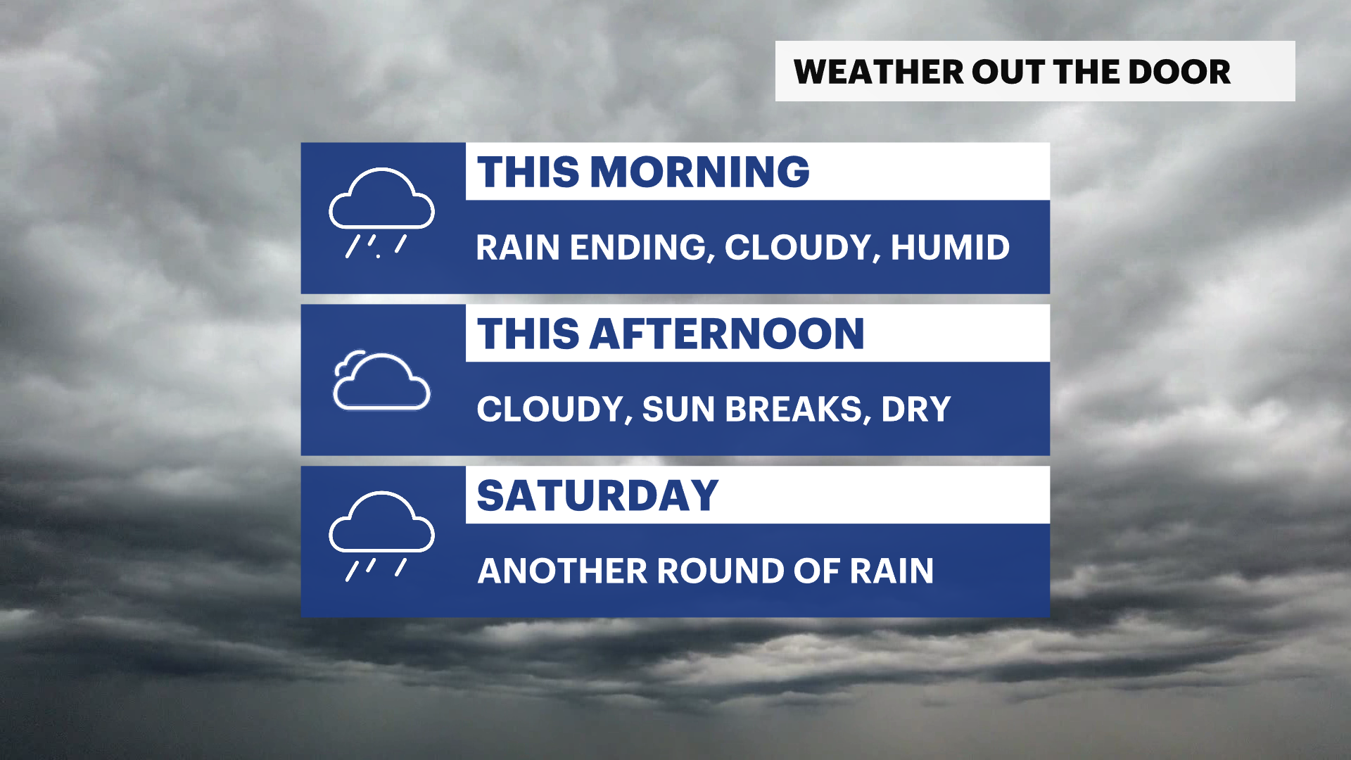
Morning rain ends making for a steamy finish to the week in the Hudson Valley
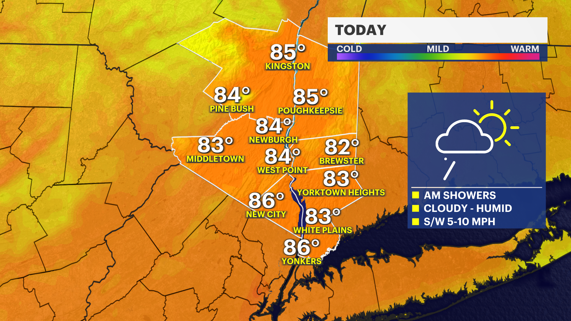
The rain is ending this morning, leaving behind a slippery a.m. commute. Heat and humidity will make for a steamy Friday afternoon to end the week.
More Stories


FORECAST:
The overnight storm system has brought heavy downpours across the region this morning. Travel hazards spawned as low visibility, slick roads, and soggy conditions impacted the early morning commute.
The good news is that improvements are expected by mid-morning. It will remain cloudy, mild, and humid with a periodic gust of wind. However, you can expect the rest of the day to no longer feature rainfall and even possibly feature sunshine late in the afternoon.
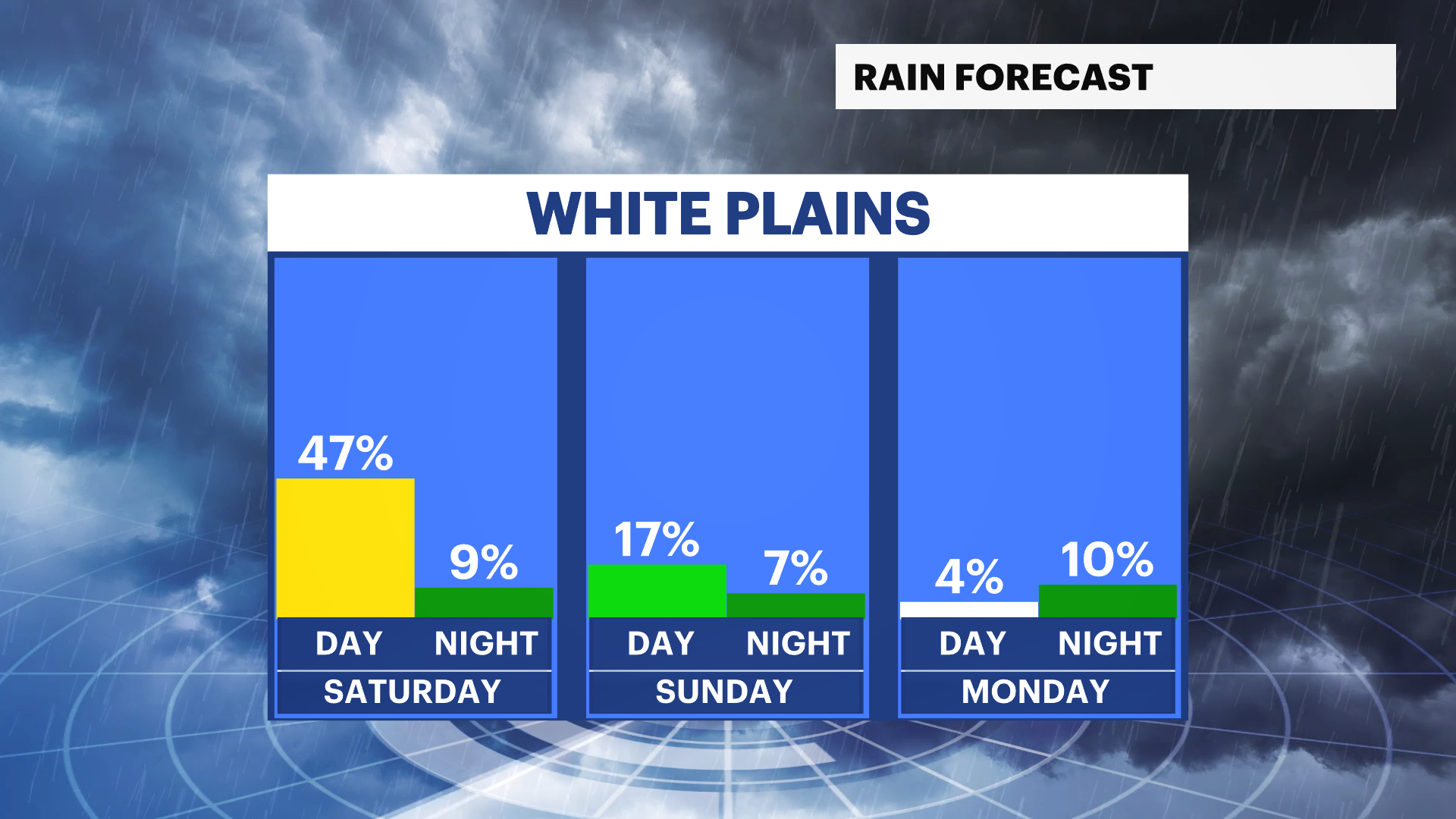
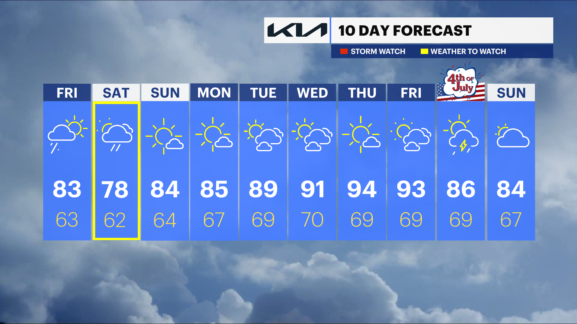
Heading into the weekend, there is another system from the west that will bring rain showers early Saturday morning and through Saturday afternoon. Temperatures will be slightly cooler than normal for this time of year, topping out in the upper 70s under mostly cloudy skies.
Sunday will be the best day of the weekend. Normal summer conditions are expected as temperatures warm into the mid-80s, mostly sunny skies with noticeable amounts of humidity, but it will not be overwhelming.
The following week is a warming trend that could bring another heat wave to the region starting on Wednesday.
Today: Showers are likely with a chance for thunderstorms, especially later in the day. Highs in the upper 70s to low 80s.
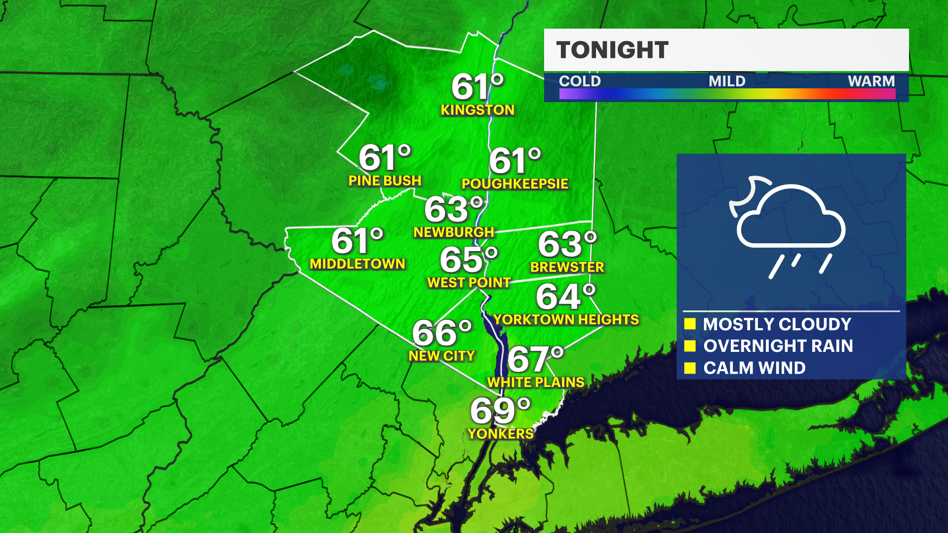
Tonight: Mostly cloudy, mild, and humid. Rain will develop overnight. Lows in the mid-60s.
Saturday: Lingering showers are possible into the early afternoon hours. Followed by a gradual improvement throughout the day. Highs in the upper 70s to near 80 degrees.
Sunday: Sunny and warmer with highs in the low to mid-80s.
Monday: Mostly sunny and summer-like with highs in the mid to upper 80s.
Tuesday: Mostly sunny and warm with highs in the mid to upper 80s.