Weekend Forecast: A Saturday shower, but a spectacular Sunday in the Hudson Valley
It's a muggy Saturday with a midday shower or storm, but big improvements are on the way for Sunday before a potential heat wave next week.
More Stories



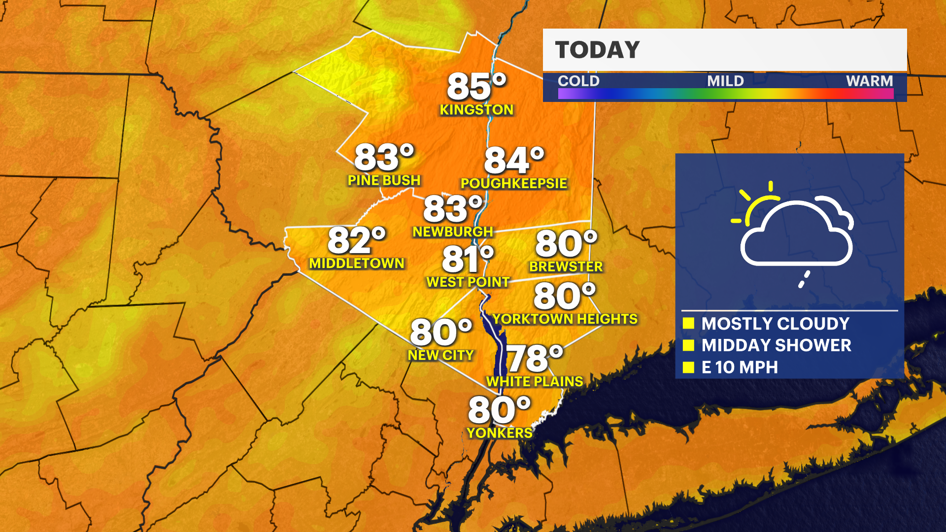
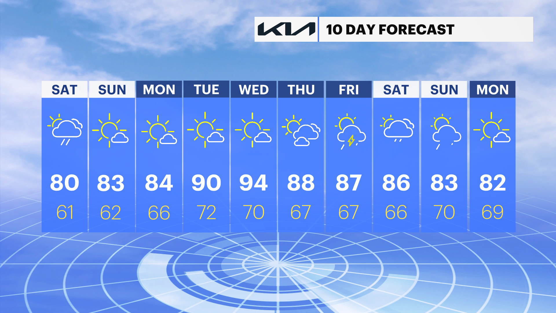
It's a muggy start to the weekend with cloudy skies and a chance for a midday shower or storm today; however, plans later today or on Sunday are dry and looking great. After today, rain is not expected until at least next Thursday or Friday with the potential for temperatures to soar into the 90s for several days after Tuesday.
A Saturday Shower
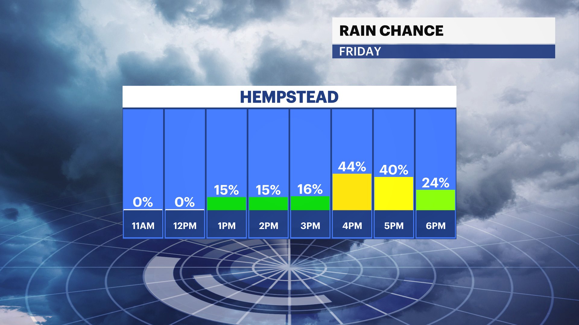
It's a muggy day with temperatures in the low 80s and a pop up shower or storm expected through the middle of the afternoon. The chance for rain will lower after 4 p.m. and any plans after 8 p.m. will be dry.
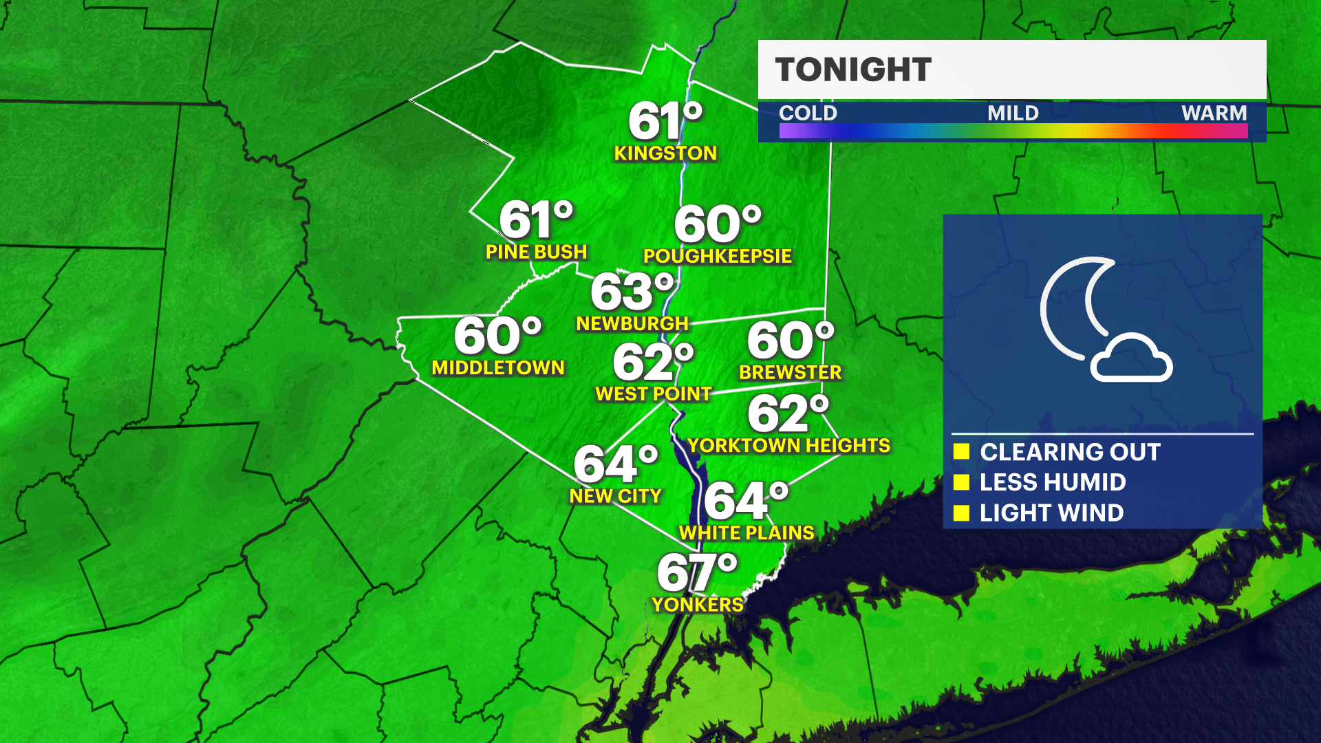
There is a noticeable drop in the humidity later this evening with skies clearing out and low temperatures in the low to mid 60s by Sunday morning.
Spectacular Sunday
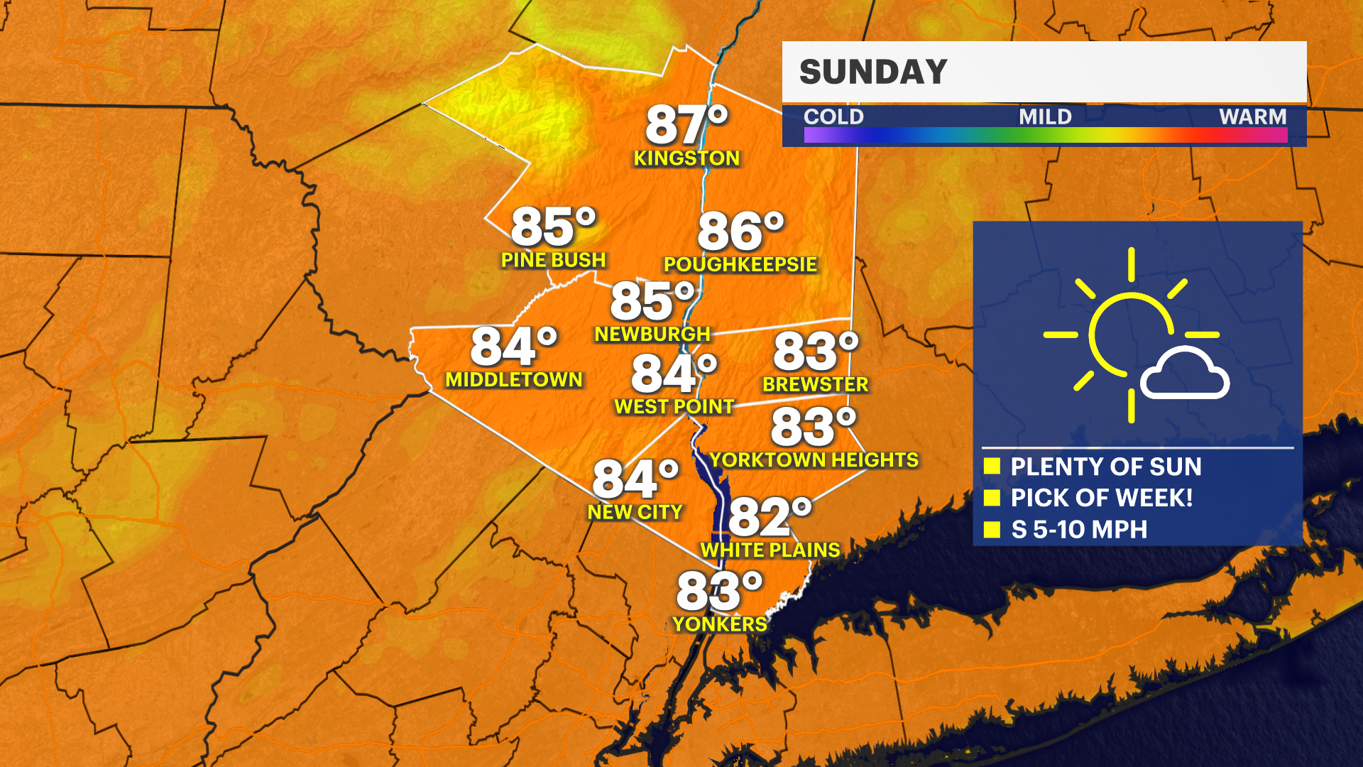
Sunday is shaping up to be fantastic. We're expecting a lot of sunshine and a lot less humidity. High temperatures will be in the low to mid 80s Sunday afternoon.
Next Week
Monday will also feature lower humidity levels and high temperatures in the mid 80s which will feel fantastic, but heat and humidity levels will climb starting Tuesday. Tuesday through Friday will be hot. The heat index each afternoon will be in the low to mid 90s, potentially 100-degrees on the hottest day which is Wednesday.