Sunny skies, warm temperatures for Sunday in the Hudson Valley before wet pattern returns late Monday and Tuesday
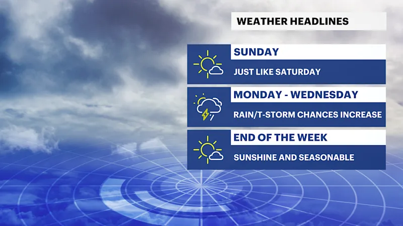
Dry and comfortable weather continues through the weekend before a slow-moving frontal system brings increasing chances for showers and thunderstorms from late Monday into Wednesday.
More Stories


What to Expect:
Sunny, comfortable weather continues through Sunday and much of Monday.
Temperatures remain near to slightly below normal, with low humidity through the weekend.
A few showers or thunderstorms are possible late Monday, but many locations stay dry during the day.
The greatest chance for showers and thunderstorms arrives Tuesday into Tuesday night.
Unsettled weather may linger into Wednesday before improving late in the week.
FORECAST
Overnight
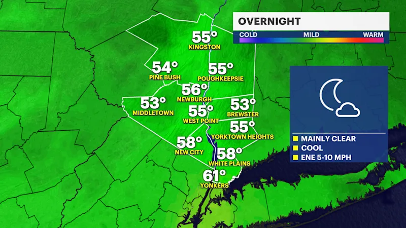
Mostly clear skies, with comfortable humidity and cool overnight temperatures. Light winds will make for another pleasant summer night. Temperatures fall into the upper 50s to around 60.
Sunday
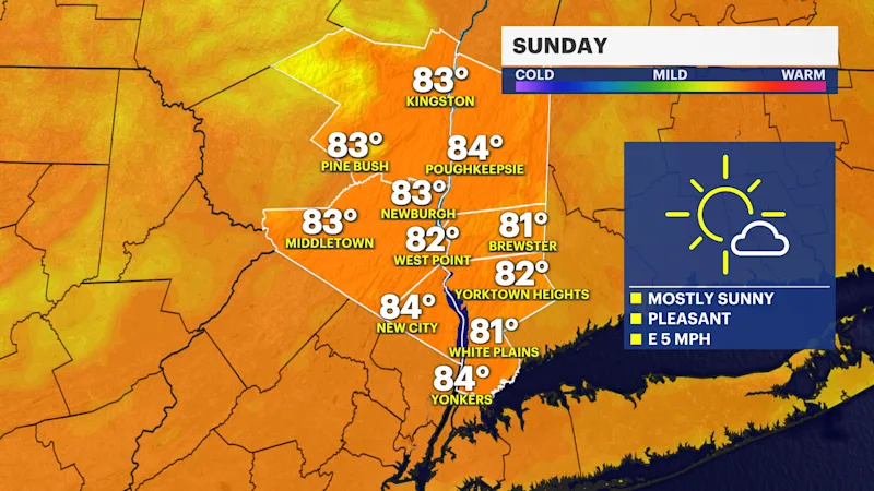
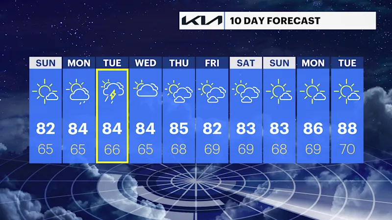
Sunny skies and comfortable conditions continue, with light winds and low humidity. Temperatures reach the low 80s.
Sunday Night
Mostly clear and quiet, with another comfortable night. Temperatures settle into the low 60s.
Monday
Mostly sunny for much of the day, with seasonable temperatures. A few isolated showers or thunderstorms may develop late in the afternoon, but most areas remain dry through daylight hours. Temperatures reach the low to mid-80s.
Tuesday
Periods of showers become likely, with thunderstorms developing during the afternoon. Some storms may produce heavy downpours as a slow-moving frontal system moves into the region. Temperatures hold in the upper 70s.
Wednesday
Partly sunny, with scattered showers still possible as the system slowly exits the region. Temperatures reach the upper 70s.
Thursday
Mostly sunny, with lower humidity returning. Temperatures near 80.
Friday
Mostly sunny and pleasant, with seasonable summer temperatures. Temperatures warm into the low 80s.
Weather Alerts, Watches & Hazards
Current Hazards
No watches, warnings or advisories are in effect for the Hudson Valley as of Saturday night.