Nicer weather is moving in for Friday; more rain chances arrive into next week
It will stay humid, but dry out into Friday with a pair of drier days on the way before rain chances increase late in the weekend.
More Stories


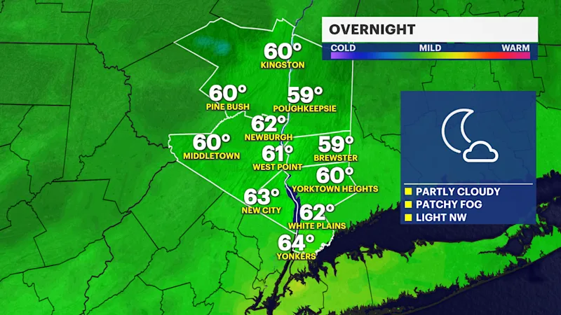
OVERNIGHT
Partly cloudy to mostly clear overnight, but areas of patchy fog are possible into Friday morning with low temperatures in the 60s.
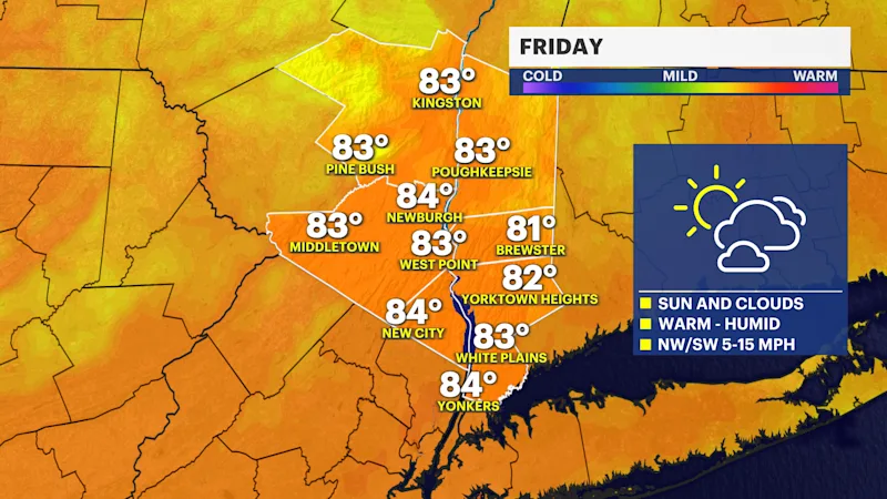
NICER FOR FRIDAY
While a brief and light rain shower cannot be ruled out Friday, most of the day is dry with a mix of sun and clouds. It will be warm and humid with high temperatures in the 80s - enjoy!
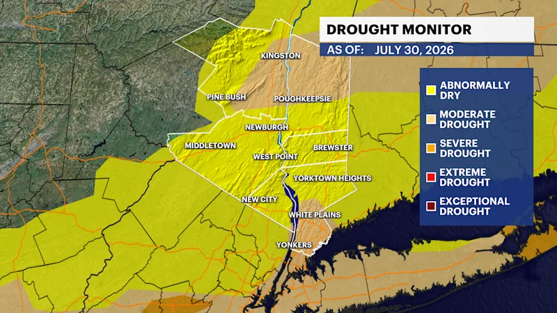
LOCAL DROUGHT UPDATE
Every Thursday morning, a new update to our local drought conditions is released. You can see this week's update below. This only takes in data through this past Tuesday. Rain from this Wednesday will be included in next week's update.
THE WEEKEND
Saturday will be the better weekend day. There will be a mix of sun and clouds with temperatures in the mid-80s, and it will still be humid.
Sunday is mainly cloudy with scattered showers developing in the afternoon and evening. It does not look like a washout, but it will not be perfect. High temperatures are in the low 80s.
EXTENDED FORECAST
OVERNIGHT: Partly cloudy and a bit muggy with areas of patchy fog overnight and lows in the lower to middle 60s early Friday morning. Wind: light out of the northwest.
FRIDAY: Sun and clouds. A stray pop-up light rain shower is possible, but most of the day is dry. Enjoy! It will feel humid with high temperatures in the 80s. Wind: northwest to southwest around 5 to 15 mph.
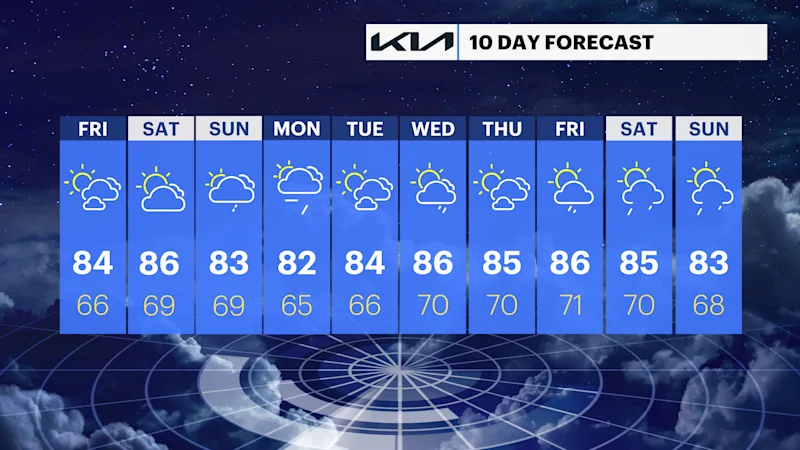
SATURDAY: Partly sunny. Warm and humid. Highs around 86 degrees. Lows near 69 degrees.
SUNDAY: Mostly cloudy with late-day showers into the evening and overnight. Warm and humid with highs around 83 degrees. Lows near 69 degrees.
MONDAY: Mostly cloudy and breezy with periods of rain likely. Highs around 82 degrees. Lows near 65 degrees.
TUESDAY: Sun and clouds. Highs around 84 degrees. Lows near 66 degrees.
WEDNESDAY: Partly sunny with scattered showers possible. Highs around 86 degrees. Lows near 70 degrees.
THURSDAY: Sun and clouds. Highs around 85 degrees. Lows near 70 degrees.