Today is pick of the week in the Hudson Valley; late week storms ahead
A marvelous summer day follows a soaking start to the week. Enjoy the weather; rain chances ramp up late week
More Stories


SUNDAY NIGHT INTO MONDAY'S RAINFALL
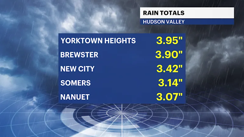
FULL LIST OF LATEST STORM RAINFALL TOTALS
WHAT YOU NEED TO KNOW:
High pressure settles into the region, bringing sunshine and calm weather Today.
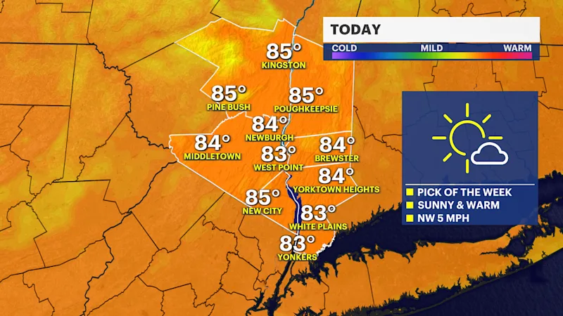
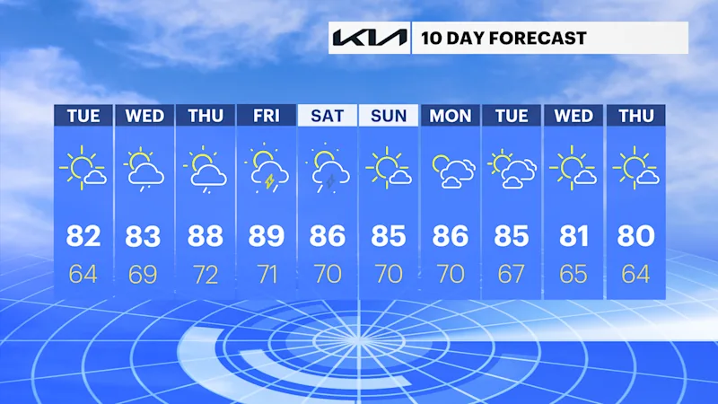
Today is the pick of the week! Temps in the low 80s, low humidity, and sunny.
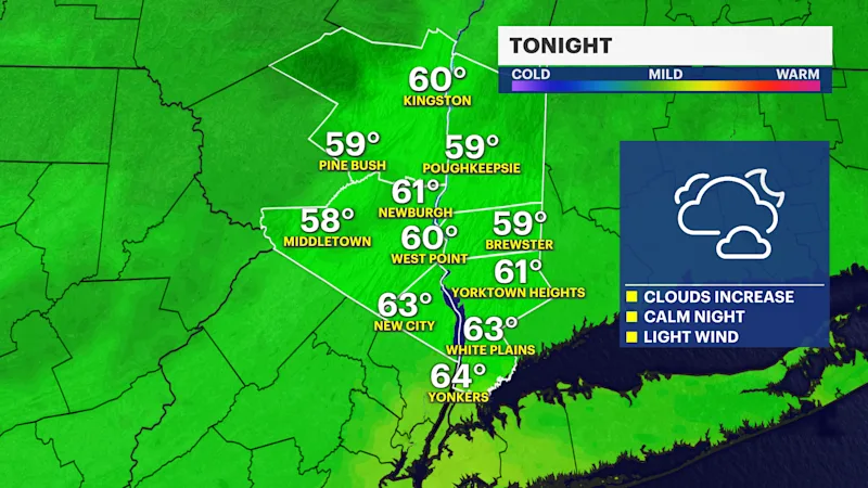
Clouds will increase tonight.
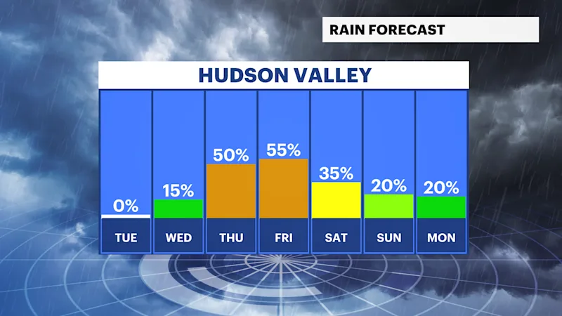
More humid, warm, with spotty rain chances Wednesday afternoon.
Unsettled weather picks up Thursday and Friday as thunderstorm chances, rising heat, and humidity are expected.
FORECAST:
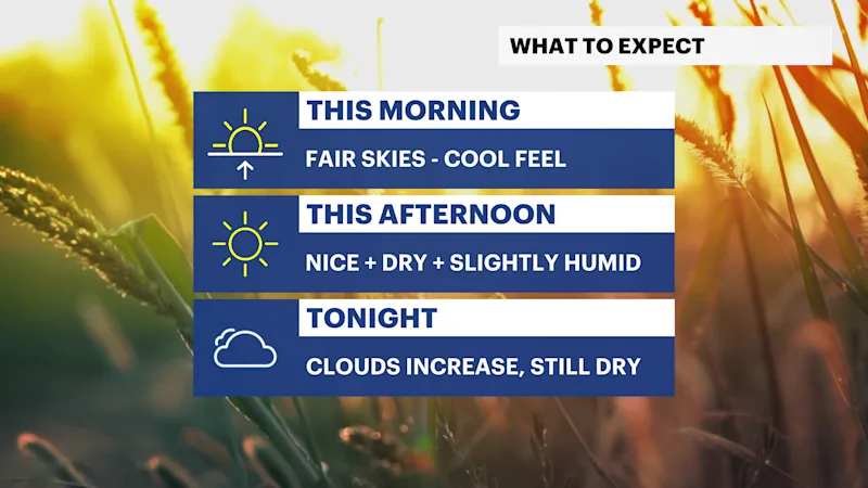
Today is the pick of the week! As we say goodbye to the flooding rains that swept the region on Monday, we have a gorgeous start to Tuesday, leading to a very nice summer day in the afternoon!
Expect plenty of sunshine, relatively low humidity, and temperatures near normal. The high-pressure system will continue to keep things quiet through tonight, but a shift in winds and our air pattern will come rather quickly tonight. This will lead to increasing clouds, more humid conditions, and slightly warmer feels for some areas on Wednesday.
There is a spotty chance for a rain shower on Wednesday afternoon. However, the real unsettled weather you will need to keep an eye on will arrive Thursday afternoon. Expect a few chances for thunderstorms from Thursday into Saturday, before improvements arrive once more on Sunday.