Record highs possible today in the Hudson Valley ahead of afternoon showers
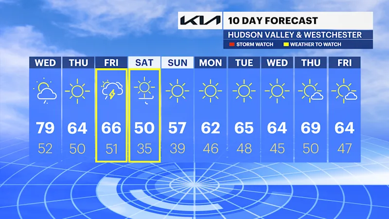
Today is the warmest day this week with highs close to 80 degrees. A few passing showers arrive this afternoon and evening.
More Stories





White Plains Information

FORECAST
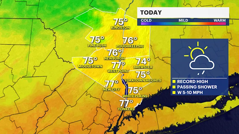
Summer-like warmth and humidity makes a brief appearance today with a few passing afternoon showers. An isolated downpour can't be ruled out between noon and 4 p.m. Record highs are possible in White Plains this afternoon. The record is 78 degrees setback in 1954 and our forecast high is 79 degrees. A cold front passes through the region this evening bringing a drier, cooler and refreshing airmass into tomorrow.
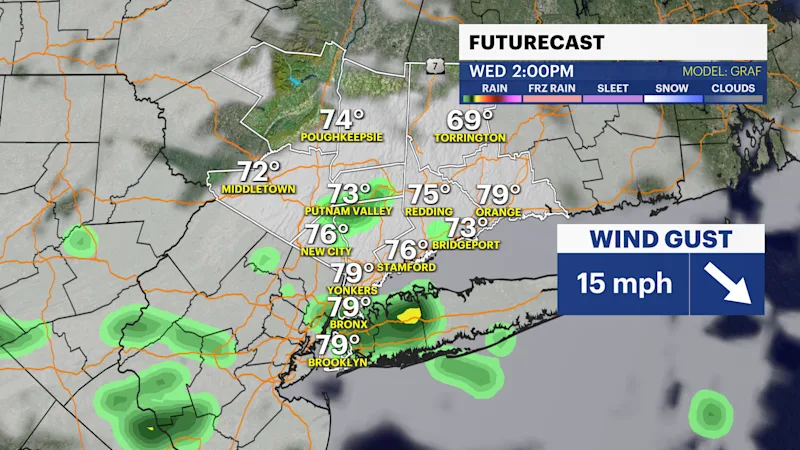
Thursday will feel like a classic fall day with beautiful sunshine, pleasant temperatures in the 60s and a comfortable breeze.
A stronger storm system moves in Thursday night into Friday, bringing the potential for afternoon showers and some gusty thunderstorms. The latest trends brings the heaviest rain over parts of the region. As of now, we're not seeing a threat of severe weather or flash flooding. Gusty winds from 30 to 40 mph are possible on Friday and Saturday. Rain totals could range from .5" to 1" by Friday evening. Stay tuned for any changes.
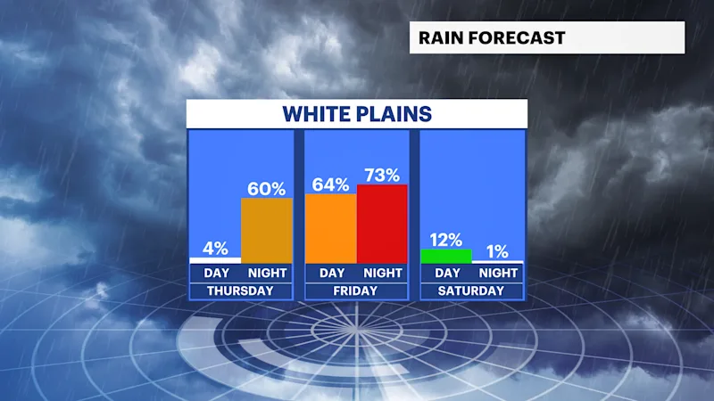
After the storm passes, the first dry weekend in over a month is within reach, along with the coolest air of the season so far. Despite the unseasonably cool temperatures in the 50s this weekend, it is trending dry with lots of sunshine and blustery winds up to 35 mph. Check back with the News 12 Storm Watch Team for updates.