Back and forth temperatures in the Hudson Valley, cooler and drier tomorrow before another surge of warmth and humidity Friday
Showers with a risk of thunderstorms for Friday with isolated downpours possible.
More Stories





White Plains Information

FORECAST
The weather will continue to change abruptly over the next several days. After warmer temperatures and some showers today, things will turn more classis Fall for tomorrow. It will turn cooler and drier after the passage of a cold front tonight. There will be another round of rain Friday before we see the coldest air of the season arrive for the weekend.
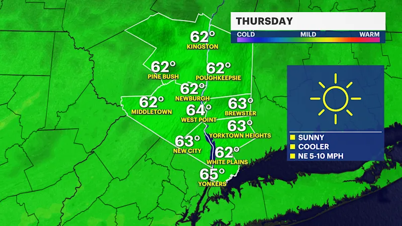
Thursday will have beautiful sunshine and pleasant temperatures in the 60s with a northwest breeze.
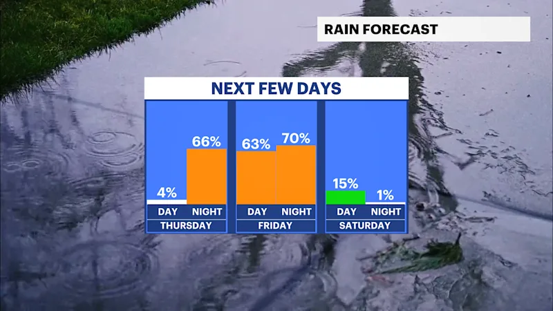
Another system, this time much stronger arrives for tomorrow night into Friday. Winds will change direction again and usher in warmer and more humid weather, increasing the chance to see some thunderstorms on Friday.
The latest trends brings the heaviest rain and some storms north earlier in the day, and then we can get clipped by some more later in the evening. Some storms could have stronger winds and there is a chance some could become severe just south and outside of the city.
Rain totals could range from .5" to 1" by Friday evening. Winds will be gusty and up to 30-40 mph with the passage of the front. Rain may linger overnight and into early Saturday before the sun returns.
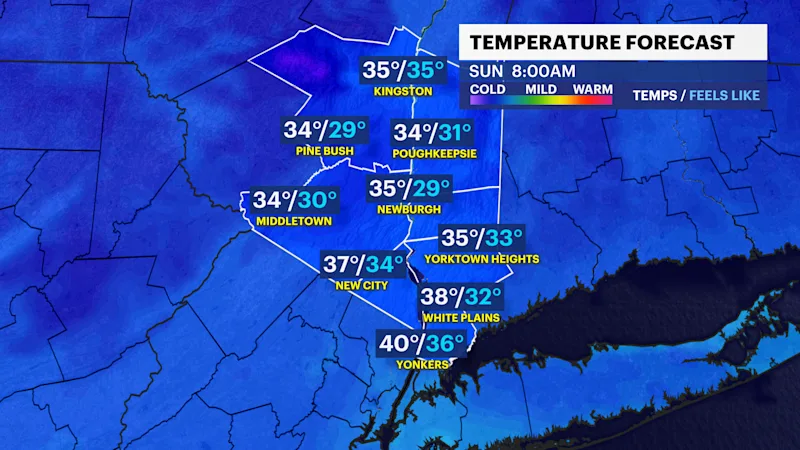
Temperatures over the weekend will struggle to warm up. Daytime highs will be in the 50s and overnight lows in the 30s up north and 40s south. Winds on Saturday will create some really low wind chills and Saturday night could feel like it's in the mid-30s and even upper 20s up north.