STORM WATCH: Strong to severe thunderstorms today with a dramatic drop in temps this weekend
Scattered showers and storms will last through this morning before another round of storms this evening.
More Stories





White Plains Information

FORECAST
Grab the rain gear today. Showers and storms will last through 9 a.m. this morning. There will be a lull this afternoon with rising temperatures to the mid-70s, increasing humidity, gusty southwest winds and a few breaks of sunshine. This will help fuel the atmosphere and set the stage for a line of strong to severe thunderstorms to develop this evening.
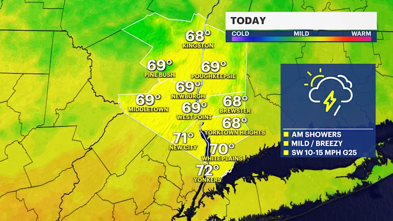
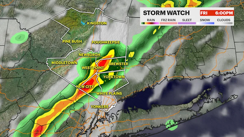
Heavy rain and strong to damaging winds are the primary threat of this storm system tonight. The line of storms will develop west of the region and slide east around 4 p.m. through 9 p.m. this evening. Downed trees, tree limbs, isolated power outages and localized flooding is possible. There is a low risk of a brief tornado this evening across parts of the Hudson Valley. Storms will weaken after 10 p.m. and exit early Saturday morning.
Behind this storm lies the coldest air of the season so far with plenty of sunshine and blustery winds. Frost and freeze alerts are likely over parts of the region this weekend. Daytime high temperatures will struggle to get to the mid-50s this weekend. A combination of a gusty northerly wind and a cold pocket of air will bring wind chills to the 40s on Saturday, despite the sunshine. It gets colder Saturday night into Sunday morning, as the winds subside temperatures fall to the low to mid 30s with some wind chills in the upper 20s. Temperatures ease into next week to near seasonable with lots of sunshine as an offshore storm lingers nearby.
Stay with your News 12 team of meteorologists for any updates.