Seasonable highs, breezy midweek winds on tap for the Hudson Valley
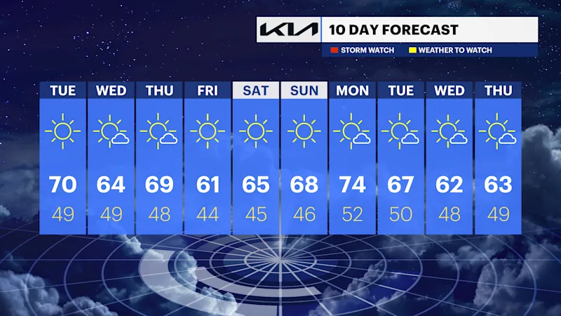
Temperatures bounce back to seasonable this week with highs in the 60s.
More Stories




White Plains Information

FORECAST
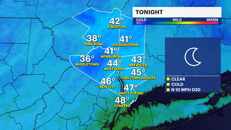
A marvelous stretch of weather continues into Tuesday with a cool start but a nice rebound with midday highs in the mid- to upper 60s. Winds will be noticeably breezy up to 25 to 30 mph through the midweek. A nearby offshore storm will bring indirect impacts to the immediate coast.
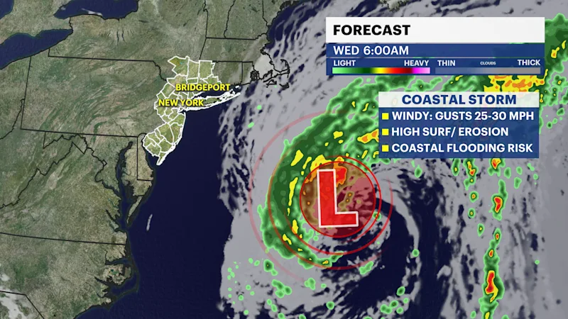
A large coastal storm is expected to strengthen throughout the midweek. The National Hurricane Center has a 40% chance that this storm could develop into a subtropical cyclone later this week and slowly track northeast. This storm is forecast to bring high surf, large swells, beach erosion, coastal flooding, and a persistent gusty north to northeast wind to the Mid-Atlantic states. If the storm tracks slightly closer, winds will become a bigger concern inland, with rain likely along the east end of Long Island and southeastern Connecticut on Wednesday into Thursday.
As of now, the storm is expected to stay away from the Hudson Valley with little to no impacts. As the storm tracks away from our region, dry and slightly cooler weather is expected through this weekend.
Stay tuned for updates with the News 12 team.