Sunshine first, then rain makes a return for the Hudson Valley
A mostly sunny Wednesday leads into a wetter end to the week, with showers developing Thursday and into Friday.
More Stories





White Plains Information
WHAT TO KNOW:
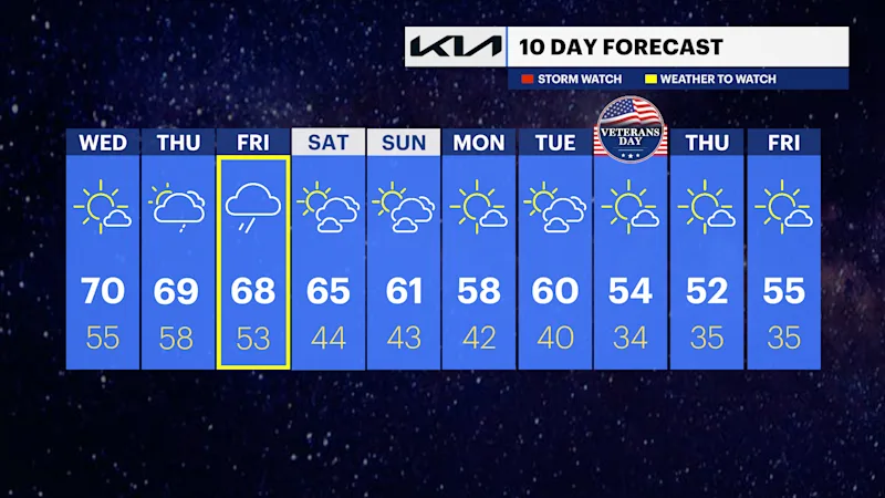
Patchy fog is possible overnight and into early Wednesday morning, but sunshine takes over during the day. Temperatures climb into the low 70s, making Wednesday the pick of the week before cloud and rain chances increase.
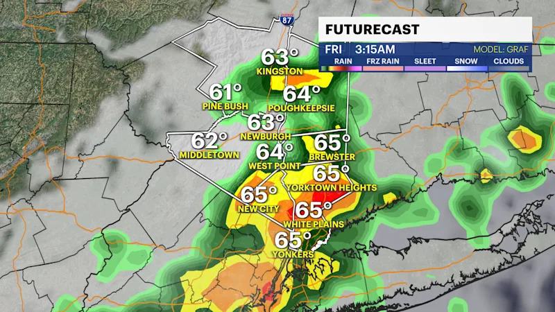
Showers become more likely Thursday, with periods of rain continuing into Friday. Friday could bring the steadiest rainfall, along with a chance of thunderstorms during the afternoon. Rainfall totals could approach an inch in some spots before the system gradually moves out Friday night into Saturday.
A cooler, quieter pattern settles in for the weekend. Saturday may start with a lingering shower, but sunshine returns for the afternoon. Temperatures then drop back into the upper 50s to around 60 for Sunday through early next week, with plenty of sunshine expected.

FORECAST:
Wednesday: Patchy morning fog gives way to sunny skies. Highs in the upper 60s to low 70s.
Thursday: Mostly cloudy with showers possible throughout the day. Highs in the upper 60s to around 70.
Friday: Periods of rain, with a chance of afternoon thunderstorms. Highs in the mid-to-upper 60s.
Saturday: A morning shower is possible, followed by mostly sunny skies. Highs in the low to mid-60s.
Sunday: Mostly sunny and cooler. Highs in the upper 50s to around 60.
Monday: Mostly sunny with temperatures around 60.
Tuesday: Mostly sunny and seasonably cool. Highs around 60.