STORM WATCH: Areas of fog, rain and breezy conditions expected today in the Hudson Valley
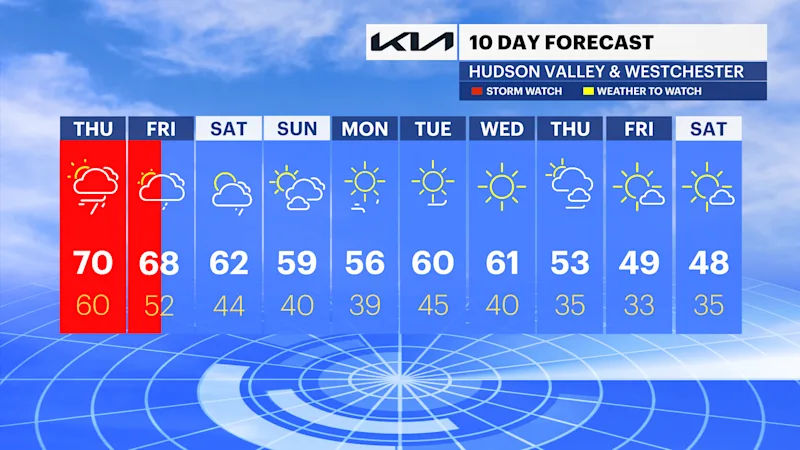
The dry streak has ended and spotty showers and possible storms take us through tomorrow.
More Stories




White Plains Information
FORECAST
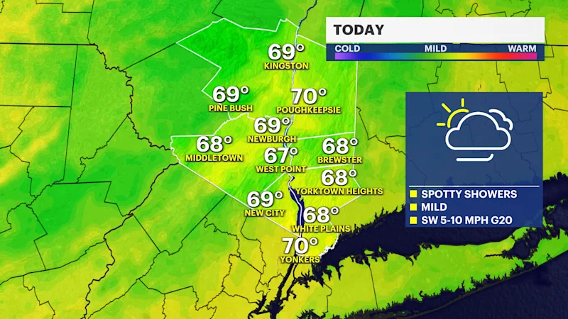
Areas of patchy to dense fog and light rain will slow you down for the morning commute. Umbrellas will be needed periodically throughout the day as a frontal system approaches the region. Temperatures are still unseasonably mild and noticeably humid this afternoon with highs in the upper 60s to near 70 degrees.
The heaviest rain is still on track to stay south and east of the area tonight into Friday morning. However, as the front slows down on Friday and moves east, showers are expected to linger longer across portions of the area through Friday afternoon. Up to an inch of rainfall is expected with locally higher amounts with any downpours. Plan for wet roads, reduced visibility and some ponding on the side streets due to clogged drains and fallen leaves.
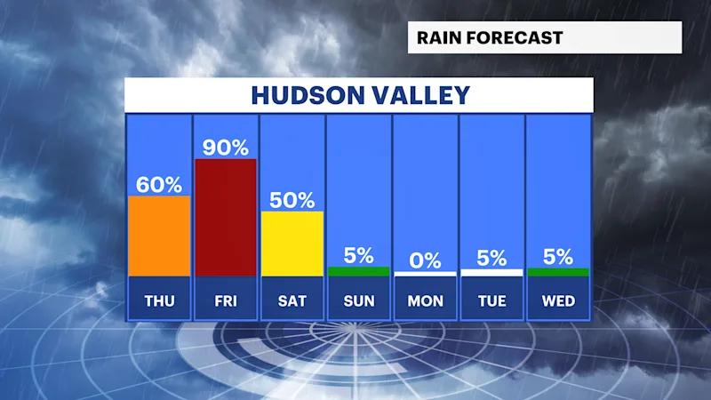
Another low pressure system will move through on Saturday bringing cooler air and a few stray showers during the afternoon and evening. Most of the weekend will be dry but seasonably cool with highs in the upper 50s to low 60s.
A sunny stretch of weather returns next week, but with cool temperatures in the 50s and windy conditions. Highs will be in the 50s with lows in the 30s to low 40s. Stay tuned for updates.