STORM WATCH: Hudson Valley face heavy rain Thursday, with wet snowflakes possible in higher elevations
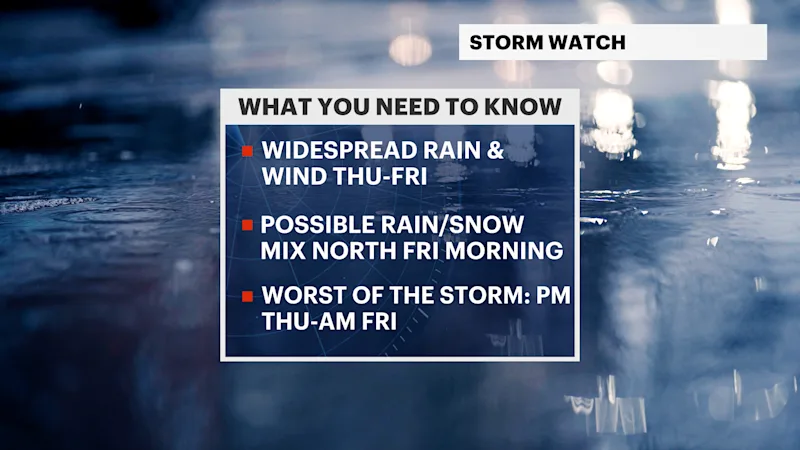
Rainfall totals could reach 1-2 inches before colder air brings the potential for a brief wintry mix across higher elevations Thursday night into Friday.
More Stories




White Plains Information
FORECAST
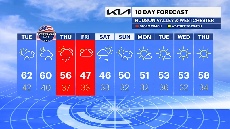
A pleasant Veterans Day is ahead for the Hudson Valley and Westchester, with partly to mostly sunny skies and temperatures climbing to near 60 degrees.
Expect some passing clouds throughout the day, but overall conditions will remain very fair, with light winds and comfortable November temperatures.
Clouds will increase tonight, with a chance of showers developing overnight as a developing nor’easter approaches from the west.
NOR'EASTER DETAILS
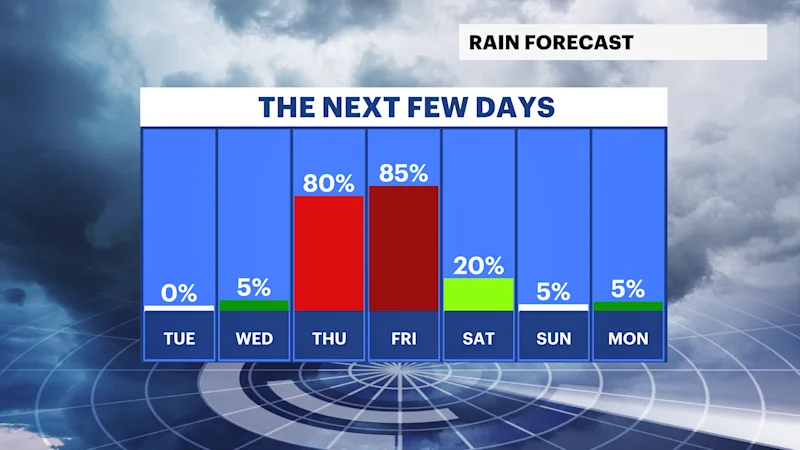
Thursday will be the day to watch most closely, as the approaching coastal storm brings periods of rain across the region. Initial showers are expected to move in from the west before becoming more widespread and persistent throughout the day.
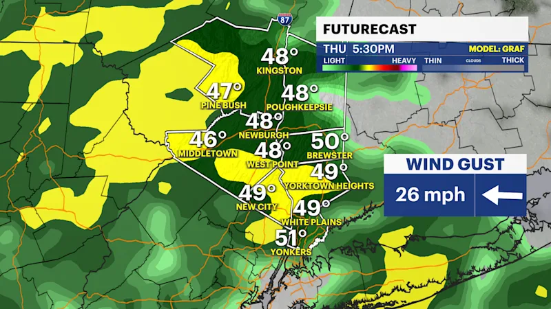
The heaviest rainfall is expected during the afternoon and evening hours, particularly between 2 and 8 p.m. Several rounds of rain and locally heavy downpours are possible, making for a wet and potentially difficult afternoon commute.
Rainfall totals are expected to range between 1 and 2 inches across much of the Hudson Valley and Westchester, with locally higher amounts possible where heavier rain bands linger.
Gusty winds will accompany the storm, with gusts generally between 20 and 30 mph and isolated gusts potentially approaching 35 mph. The combination of heavy rainfall and gusty winds will make Thursday an unsettled day from start to finish.
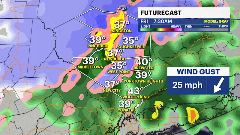
As colder air filters into the region Thursday night into early Friday morning, some locations could experience a brief transition to a wintry mix. Areas farther north and at higher elevations, particularly Orange and Putnam counties, have the greatest potential to see pockets of freezing rain, sleet and wet snowflakes.
Communities in the lower elevations and closer to Westchester County’s southern and coastal areas are expected to see primarily rain. No significant snow accumulation is anticipated, but a few wet flakes could mix in before the storm exits. Precipitation should gradually wind down by Friday evening.
COLDEST AIR OF THE SEASON SO FAR
The colder air will become more noticeable heading into the weekend, with Friday and Saturday bringing some of the coldest temperatures of the season so far.
Daytime highs will generally remain in the 40s, while overnight lows dip near or below freezing, especially across the interior Hudson Valley.
Saturday morning should be mainly dry, although a lingering sprinkle or shower cannot be ruled out. Breezy conditions will continue through Sunday, with temperatures gradually improving into the lower 50s heading into next week. Even with that improvement, nighttime temperatures will remain near or below freezing in many inland communities.