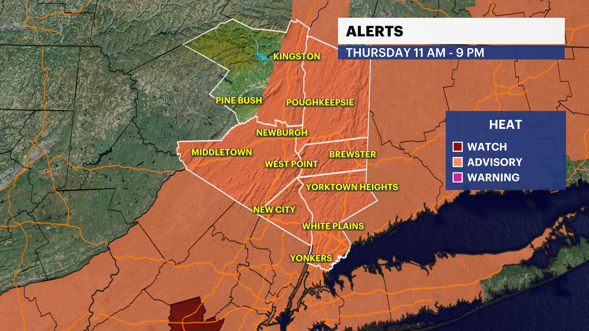
Heat Alert: Dangerously hot weather moves in for the next 4 days, heat index over 100 starting Thursday
News 12 Storm Watch Team Meteorologist Hilda Estevez says dangerously hot and humid weather is moving across the Hudson Valley into the weekend.
More Stories


NOW: Calm conditions tonight with humidity increasing setting the stage up for a hotter day tomorrow.
NEXT: Tracking the heat wave until Saturday! Strong and severe storms will arrive tomorrow morning. Heat relief holds off until the weekend with another round of storms.
RELATED: 13 cool tips to help you stay healthy during the summer heat
MORE: News 12 Storm Watch Team Blog
News 12 Storm Watch Team Meteorologist Hilda Estevez says dangerously hot and humid weather is moving across the Hudson Valley into the weekend.
FORECAST:
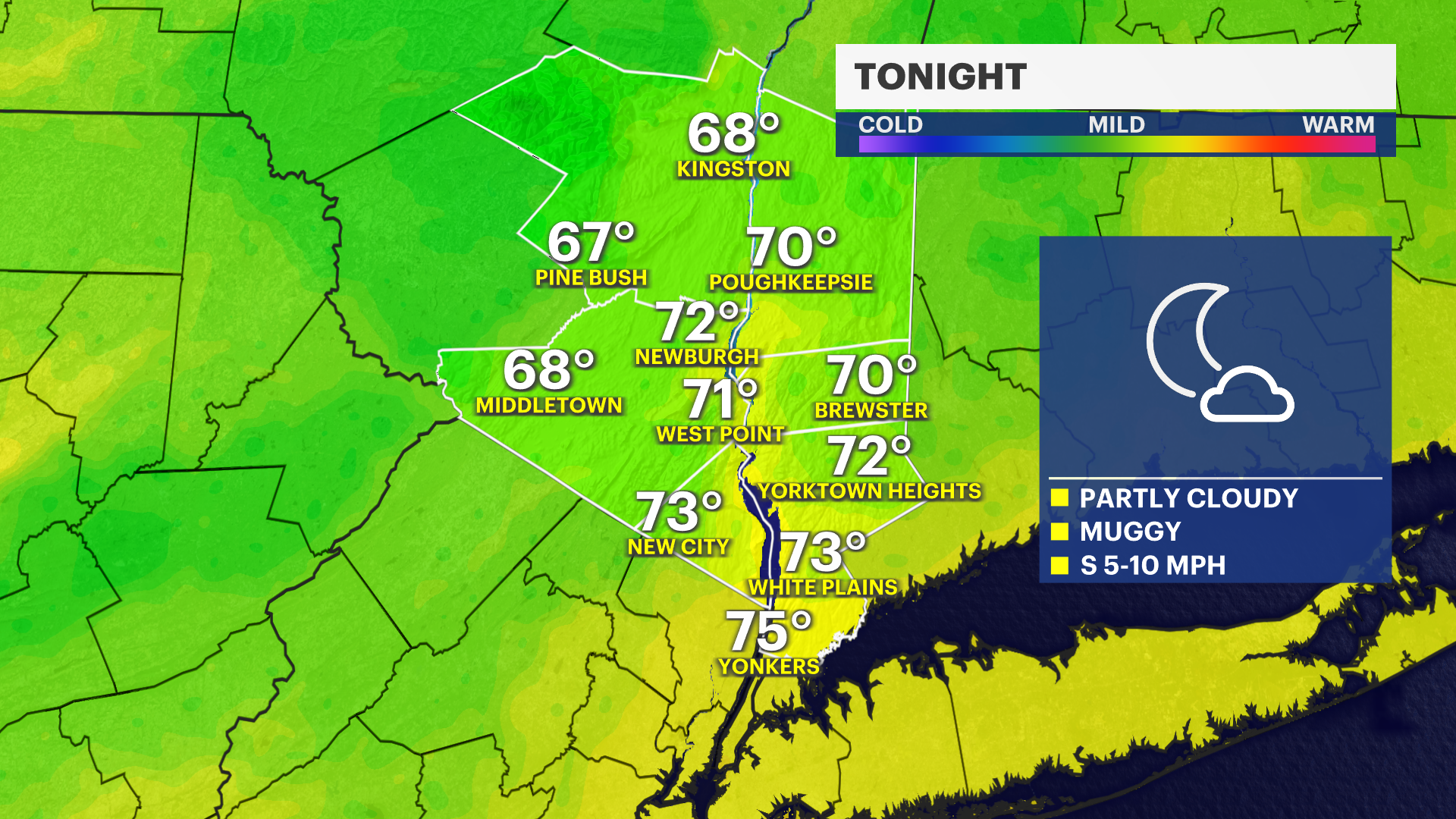
TONIGHT: Calm and quiet evening as humidity increases. Overnight lows stay seasonal near 71.
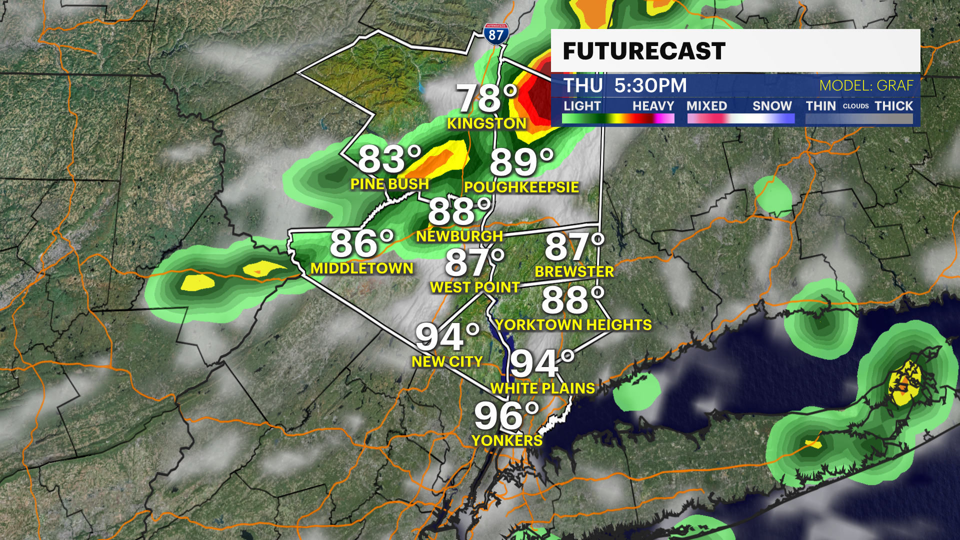
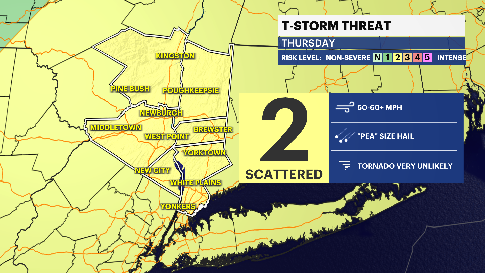
THURSDAY: Clouds and rain arriving by 6 a.m. Strong to severe thunderstorms could be expected. Sky clears and another wave of showers and scattered storms return by the evening.
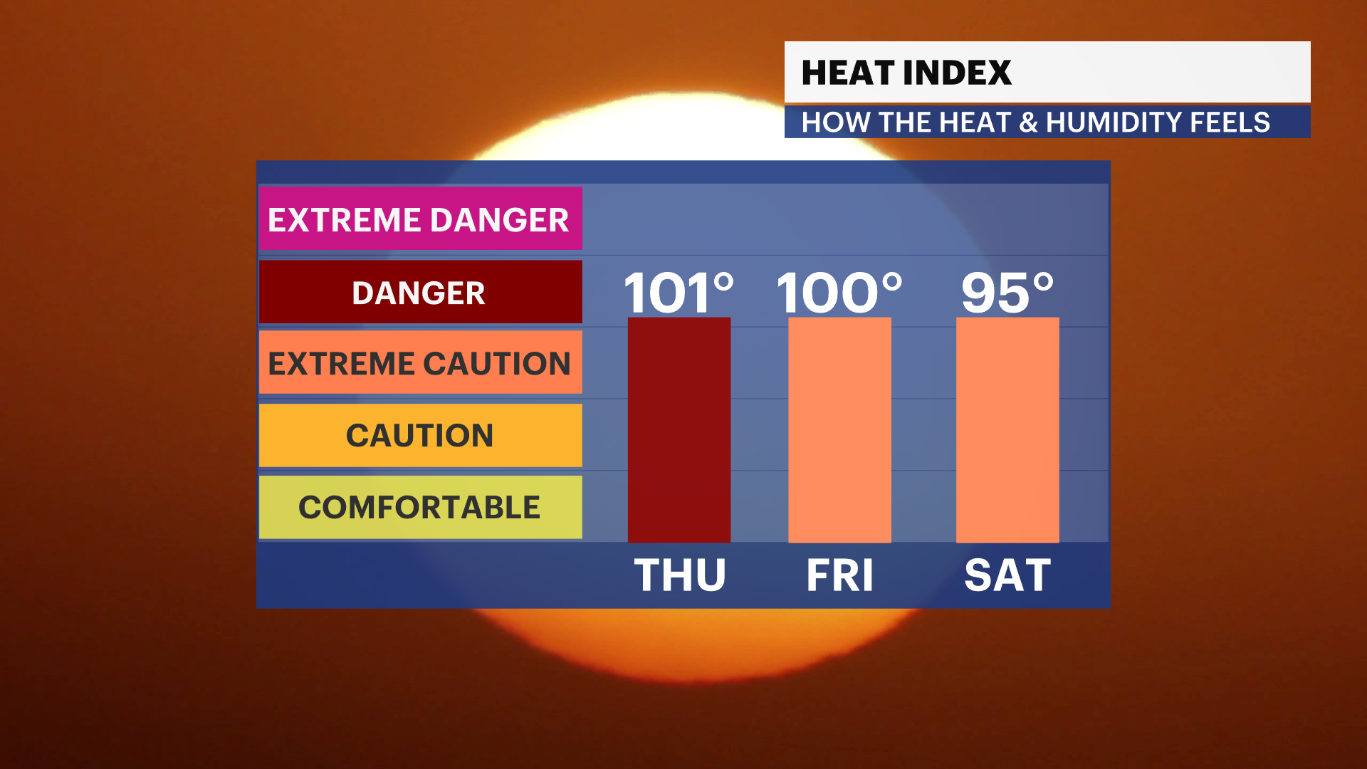
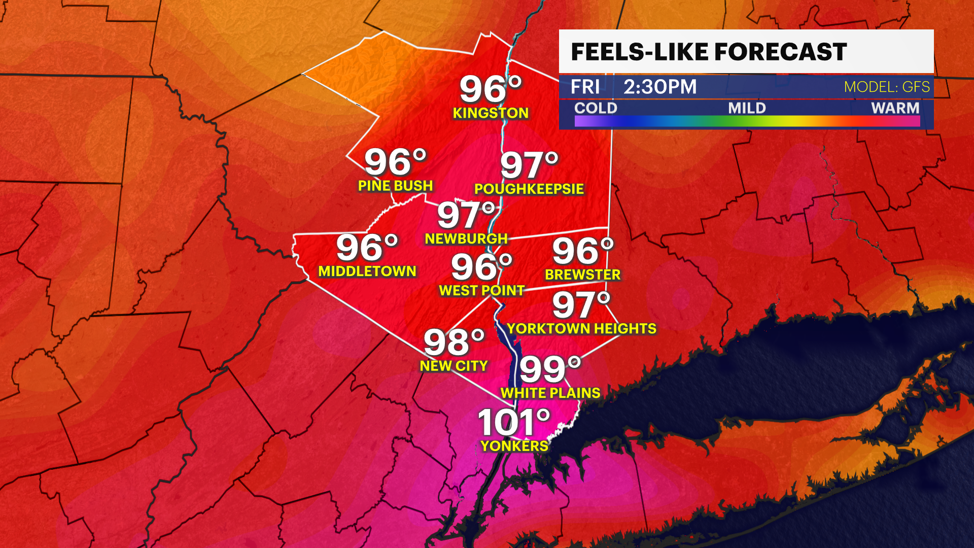
FRIDAY: Hot, hazy and humid. Highs soar 96. Feels like 105! Lows stay very mild near 78.
SATURDAY: Sunny and hot with heat busting cold front and storms. Highs near 92! Feels like 98! Lows near 69.
SUNDAY: RELIEF! Mostly sunny, lower heat and humidity. Highs near 82 degrees. Lows around 64 degrees.
MONDAY: Mostly sunny. Highs around 83 degrees. Lows around 64 degrees.
TUESDAY: Sun and clouds. Spotty shower or thunderstorm. Highs near 82 degrees. Lows around 64 degrees.


