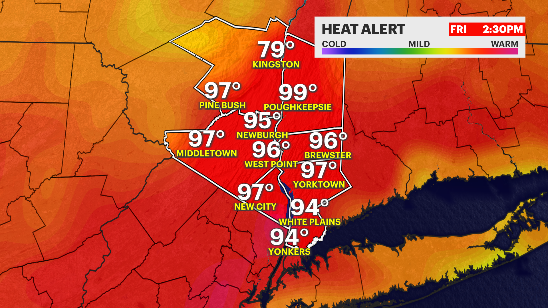
STORM WATCH: Heat advisory continues with scattered thunderstorms later this afternoon in the Hudson Valley
News 12 Storm Watch Team Meteorologist Matt Hammer says the Hudson Valley will continue to feel extreme heat with scattered thunderstorms on Friday.
More Stories


News 12 Storm Watch Team Meteorologist Matt Hammer says the Hudson Valley will continue to feel extreme heat with scattered thunderstorms on Friday.
FORECAST:
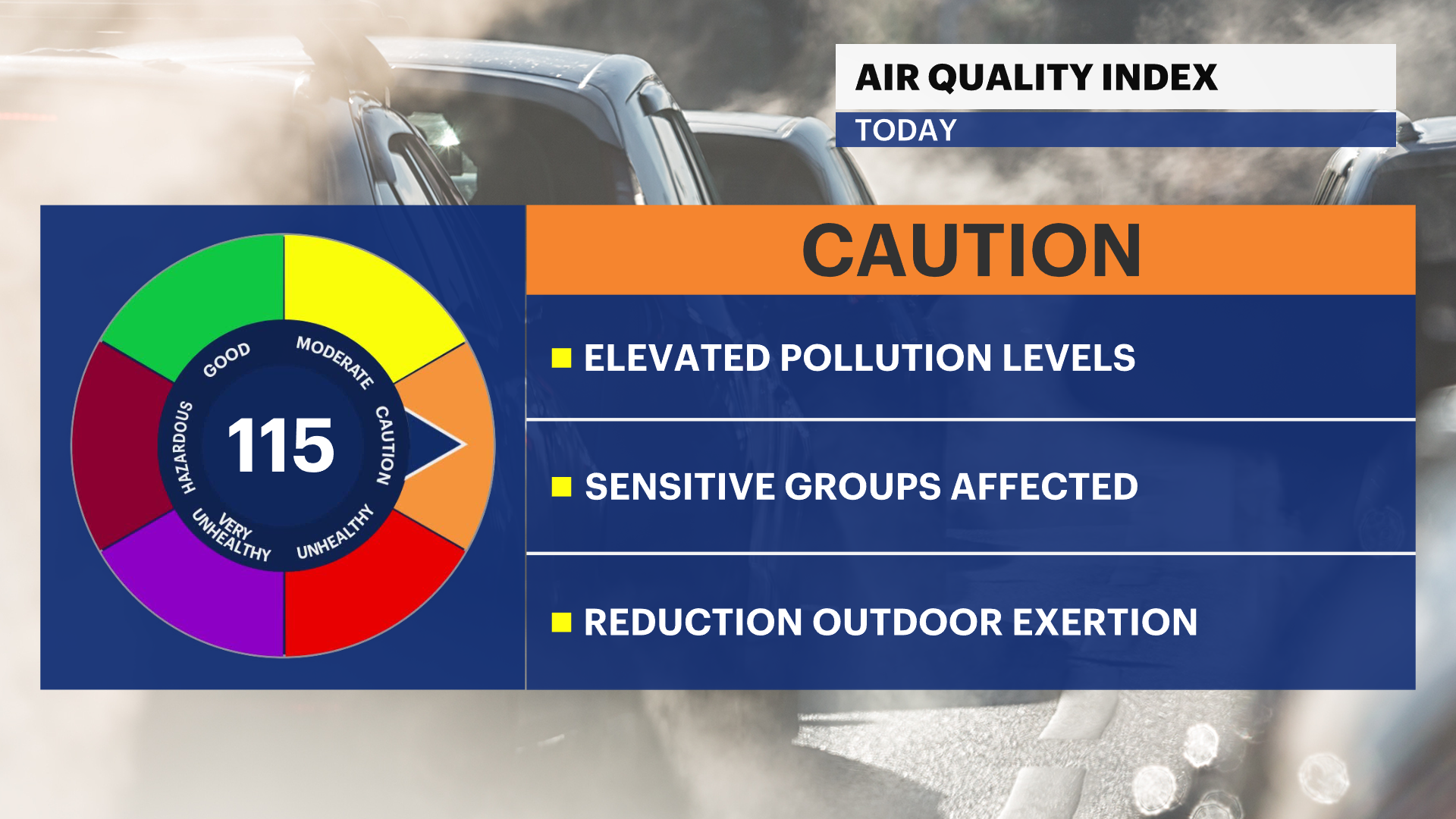
TODAY: STORM WATCH - HEAT ADVISORY - AIR QUALITY ALERT- A mix of sun and clouds. Hot and humid with feels-like temperatures in the upper-90s. Actual highs around 90 degrees.
Stay heat smart and take breaks from the heat and humidity, spend time in air conditioning and drink plenty of water.
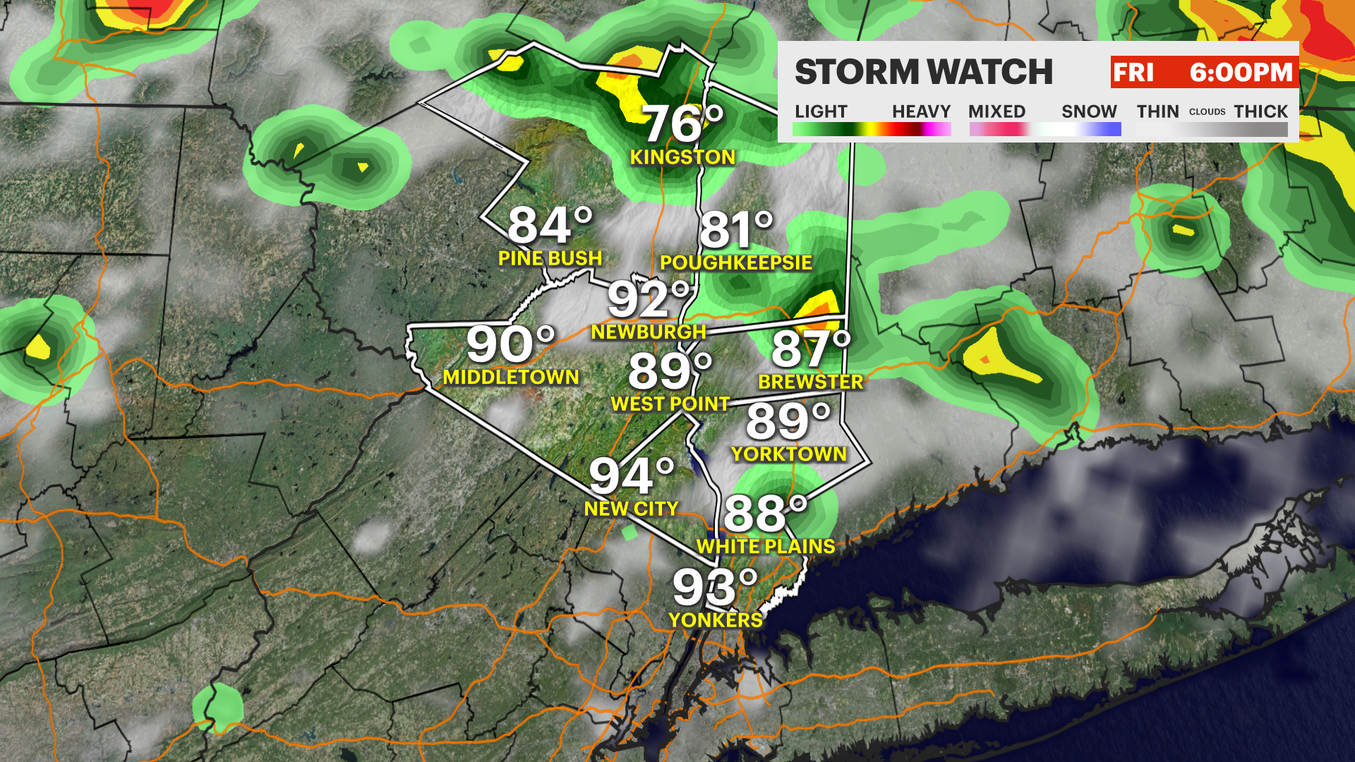
A few spotty showers and thunderstorms are possible this afternoon and evening with brief heavy rain and strong wind. Not everyone will get a thunderstorm.
TONIGHT: Spotty shower and thunderstorm chance ends by around 9 p.m. Mostly cloudy, warm and muggy. Lows around 72.
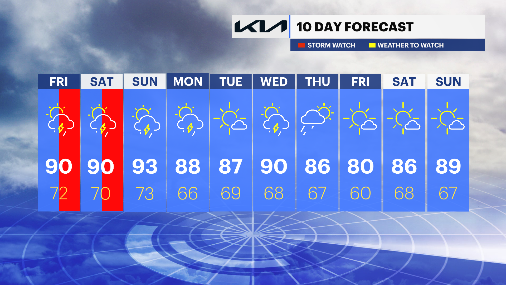
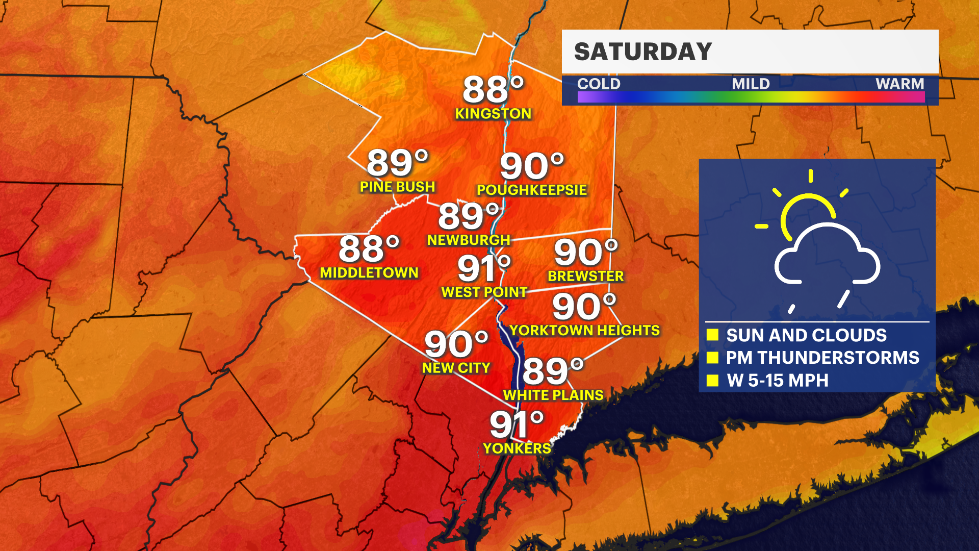
SATURDAY: STORM WATCH - HEAT ADVISORY - POOR AIR QUALITY LIKELY- Sun and clouds. Hot and humid. Highs around 90, but feels-like temperatures will remain above 95.
Scattered thunderstorms likely during the afternoon and evening. A few can have brief heavy rain and strong wind. Lows near 70.
SUNDAY: HEAT ADVISORY - POOR AIR QUALITY LIKELY - Sun and clouds, still hot and humid. Chance for an isolated shower or nonsevere thunderstorm.
The best chance for any rain is in the late afternoon and evening. Highs around 93. FEELS LIKE: around 100! Stay heat smart. Lows near 73.
MONDAY: Sun and clouds. A few showers and storms are possible. Still hot and humid. Highs around 88. Still stay heat smart. Lows near 66.
TUESDAY: Mostly sunny. Still hot, BUT with lower humidity for a day! Highs around 87. Lows near 69.