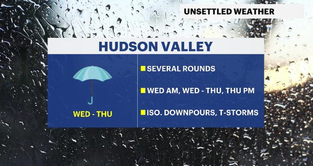
Weather To Watch: Rounds of rain are heading this way
Keep the umbrella around today and tomorrow as a system slowly moves towards the Hudson Valley
More Stories


Weather Alerts: Westchester and the Hudson Valley
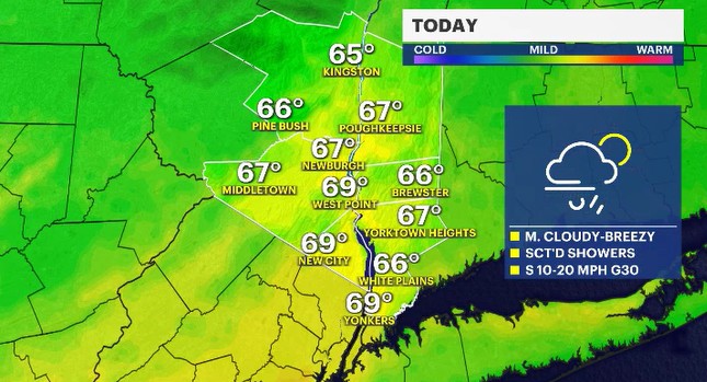
Scattered showers move through during the morning rush across portions of the Hudson Valley. There may be a brief period of reduced visibility if anyone gets a quick downpour. Brief, gusty winds will come throughout the day as we see some sunny breaks midday.
You can see the timing of the wet weather here:
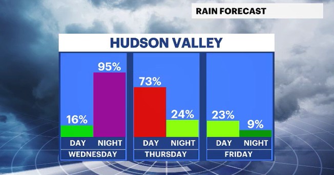
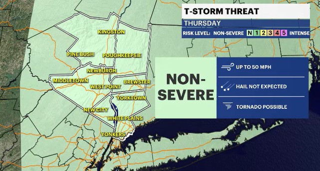
Another round of showers moves in late tonight, after 10 p.m. and will last throughout the overnight hours into Thursday morning. Some quick downpours will be possible, especially if any isolated thunderstorms develop. That chance for thunderstorms will slightly increase for the afternoon hours, especially east of the Hudson River. Any storms that do form will have the chance for producing a brief gusty downpour.
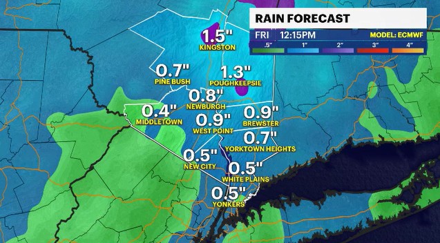
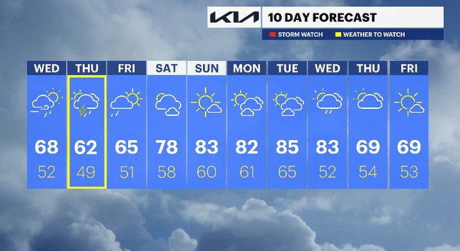
The wet weather will clear out slowly overnight Thursday into Friday morning. Afterwards though, will be a pleasant stretch of Summer-like weather! Temperatures will rise into the 80s by Sunday and could stay that way into midweek, next week.
ALMANAC:
Average High: 69 | Average Low: 49
Record High: 86 (1956) | Record Low: 34 (2020)
Sunrise: 5:39 a.m. | Sunset: 8:04 p.m.
THE FORECAST:
TODAY: Showers for the morning rush fade to mostly cloudy skies midday. Another round of showers is possible late in the day, after sunset. Highs: upper 60s.
TONIGHT: Showers slowly move through the night along with isolated downpours. Lows: low to mid-50s.
THURSDAY: WEATHER TO WATCH - Mostly cloudy with scattered showers through the day. There is a chance for isolated thunderstorms in the afternoon. Highs: upper 50s to low 60s. Lows: upper 40s.
FRIDAY: Morning spotty showers fade away to partly sunny skies with drier air moving in. Highs: mid-60s. Lows: upper 40s to low 50s.
SATURDAY: Partly cloudy with temperatures heating up. Highs: upper 70s. Lows: upper 50s.