Weekend winter weather: What to expect Saturday and Sunday
Saturday brings light, passing showers, but looming storm Sunday could impact coastal N.J. and eastern LI
More Stories


The tri-state area faces two rounds of snow this weekend. Most communities will see snow on Saturday, while a second round may hit the New Jersey coast and eastern Long Island on Sunday.
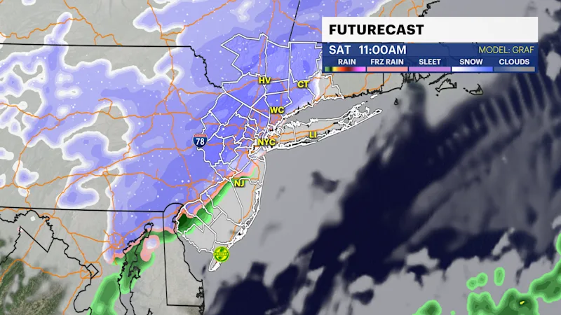
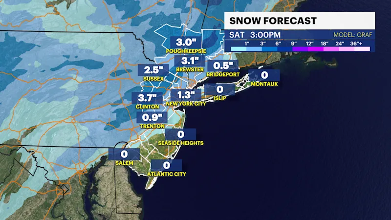
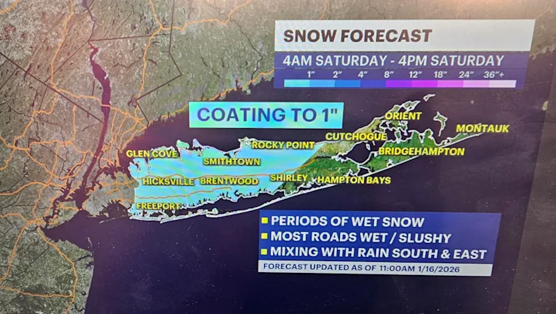
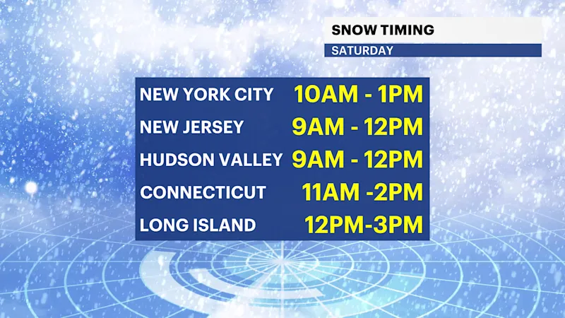
Saturday's light passing snow is expected to drop 1 to 3 inches of snow mainly west and north of New York City late morning into early afternoon. Start and end times are dependent on location, but for reference, it will be starting as scattered snow showers overnight before turning steady along western New Jersey by 9 a.m. and moving through NYC by 10 a.m. and out of Connecticut/Long Island by 3 p.m. This is a meager, low impact storm that isn't expected to be too problematic, but there could be some slippery spots, and snow can be fluffier at higher elevations. Saturday night will be quiet with a cloudy skies arriving for Sunday.
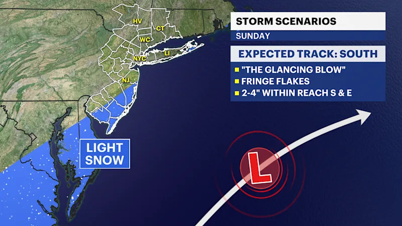
Sunday could see a glancing blow of a coastal storm that's expected to skirt just offshore of the area. However, it comes too close for comfort as areas along the New Jersey coastline and the East End of Long Island may experience light snow showers or flurries. Should this storm's track adjust slightly to the north or west, then 2 to 4 inches of snow is not out of reach across southern New Jersey west of the New Jersey Turnpike or eastern Suffolk County. This may also include some accumulations across New York City, Nassau County, and even parts of Connecticut and lower Westchester if this shift happens. If Saturday's storm is stronger, it is essentially "stealing" some energy from the Sunday event. If the Saturday storm is much weaker, then there is a potential for this to slide closer to the region. Based on the "glancing blow" forecast, the majority of the tri-state is not expected to receive snow on Sunday.
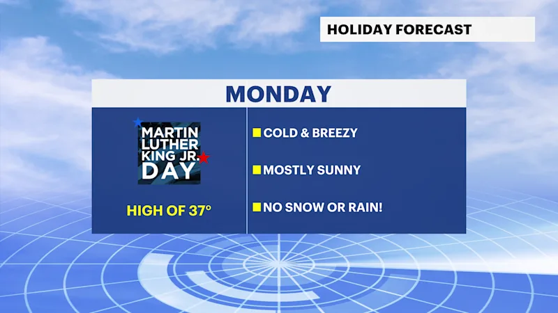
Expect cold with sunshine and breezy conditions on Monday.