Pleasant Wednesday before a warmer, stormier Thursday in the Hudson Valley
The Hudson Valley enjoys another comfortable day Wednesday with just a spotty shower or two. A stronger storm system arrives Thursday, with gusty winds, scattered thunderstorms and the potential for a few strong storms. Sunshine and seasonable temperatures return for the holiday weekend.
More Stories


What to Expect:
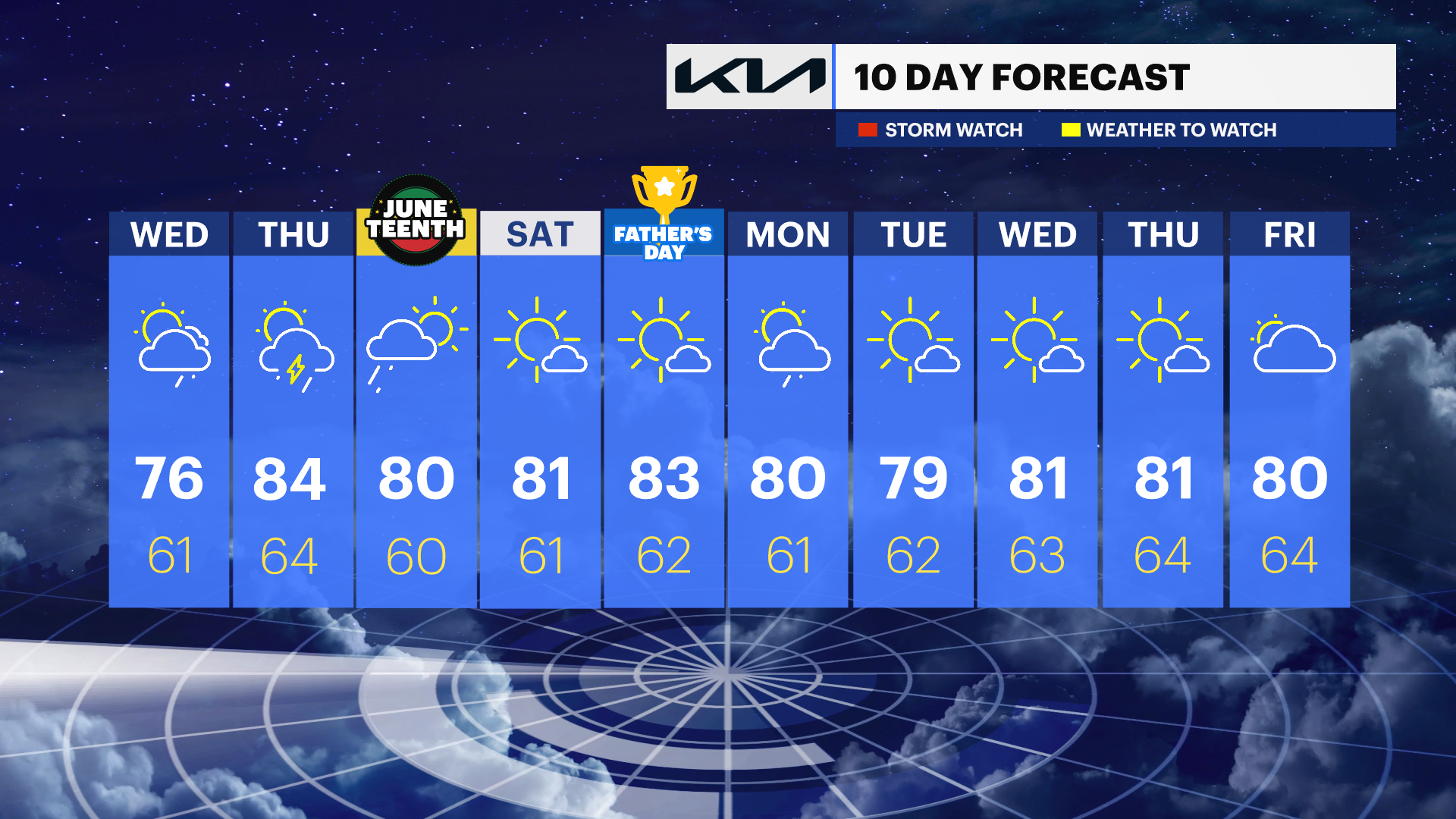
After another quiet and comfortable day Wednesday, weather conditions become more active Thursday as a strong storm system approaches from the Great Lakes. Showers and a few thunderstorms are expected, especially during the afternoon and evening hours. While widespread severe weather is not expected, a few storms could become strong and gusty south winds may develop even outside of thunderstorms.
Once the system moves through Thursday night, a stretch of pleasant weather returns for Juneteenth and continues through much of the weekend with sunshine, comfortable humidity and temperatures near or slightly above normal. Another chance for showers may arrive by Monday.
Hudson Valley Forecast
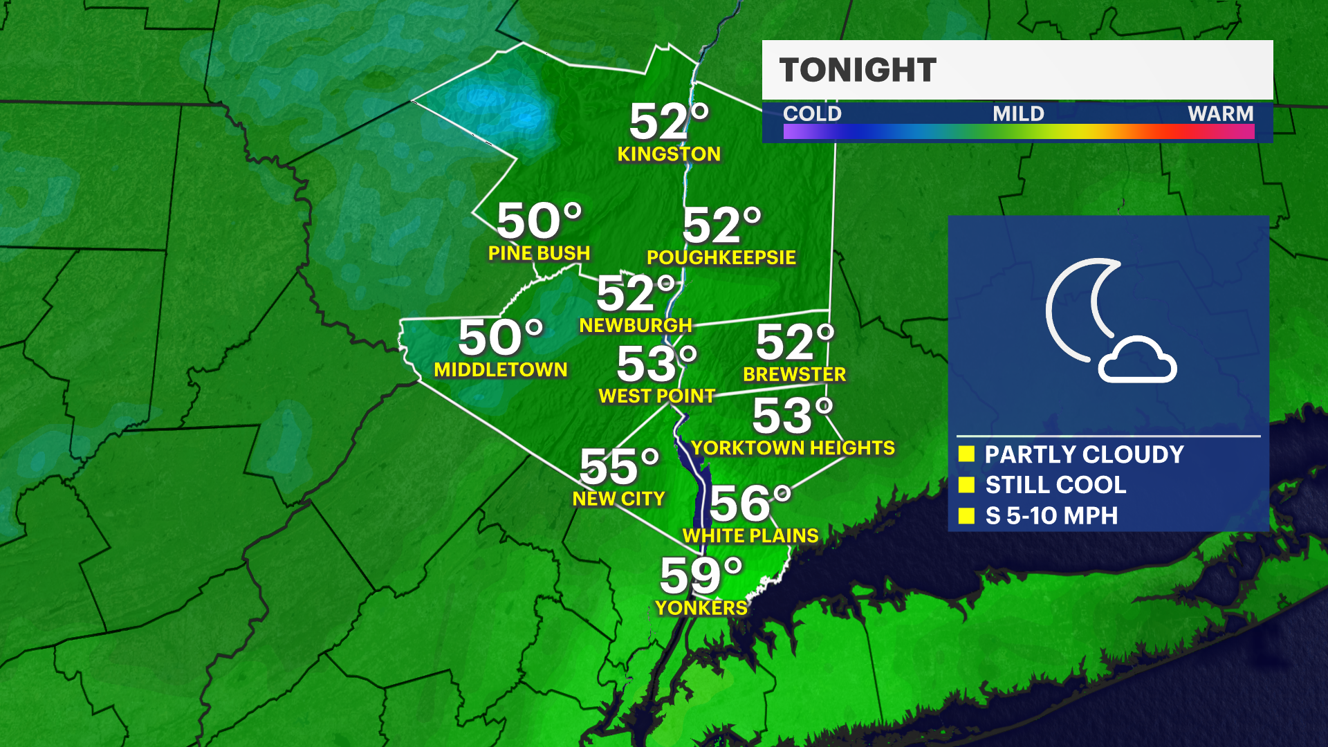
Overnight:
Partly cloudy and comfortable with overnight temperatures falling into the upper 50s to around 60. Winds become light overnight, making for another pleasant evening for outdoor activities and open-window sleeping.
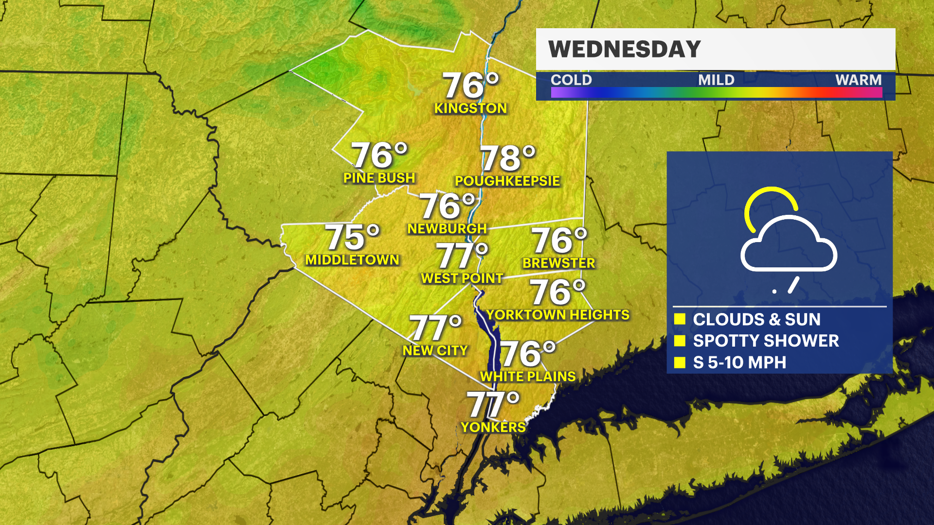
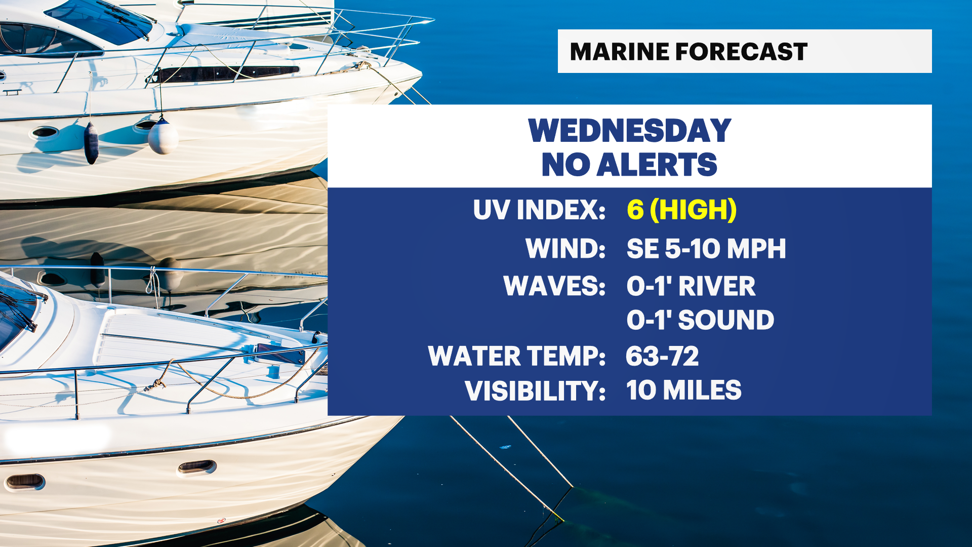
Wednesday:
Mostly sunny to partly sunny with temperatures reaching the mid- to upper 70s. A few isolated showers could develop during the afternoon, but most locations will remain dry. Humidity stays manageable, making it a comfortable day for outdoor plans. Keep a light rain jacket nearby if you'll be outside for extended periods.
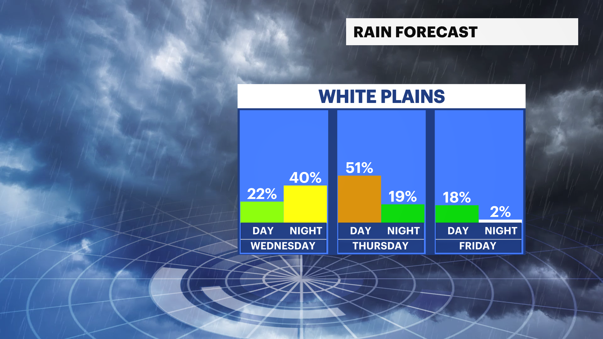
Wednesday Night:
Mostly cloudy, with a slight chance of an evening shower. Overnight temperatures settle into the upper 50s to low 60s. Most areas remain dry, but clouds will increase ahead of Thursday's approaching storm system.
Thursday:
Mostly cloudy, breezy, warmer and increasingly humid. Afternoon temperatures will climb into the low to mid-80s, with a few spots possibly approaching the upper 80s. Showers and thunderstorms become more likely during the afternoon and evening. Some storms could produce strong wind gusts, although confidence remains low as of Tuesday evening's forecast regarding the severity of any storms. South winds may gust between 25 and 35 mph at times, even outside of thunderstorms. Secure loose outdoor items and monitor forecasts if you have outdoor plans.
Juneteenth (Friday):
Mostly sunny and pleasant, with temperatures around the upper 70s to low 80s. Humidity levels decrease noticeably, making it an excellent day for outdoor celebrations, barbecues, festivals and travel.
Saturday:
Sunny and comfortable, with temperatures in the upper 70s to low 80s. Low humidity and abundant sunshine will provide ideal conditions for hiking, sports, outdoor dining and other weekend activities.
Sunday:
Sunny and seasonably warm, with temperatures reaching the low to mid-80s. Another beautiful day is expected across the Hudson Valley with light winds and comfortable conditions.
Monday:
Partly sunny, with temperatures near 80. There is a chance for scattered showers during the day, but it will not be a washout. Keep an umbrella handy if you have outdoor plans, especially during the afternoon.