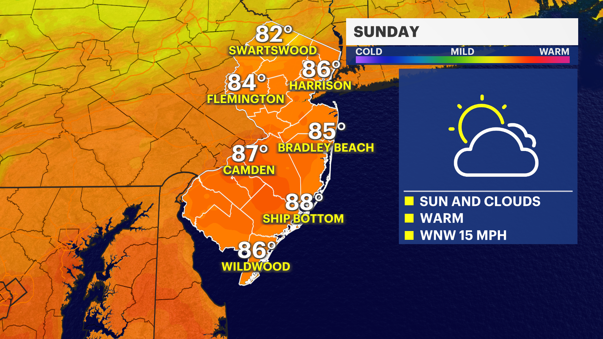
Mix of sun and clouds for Sunday across News Jersey before rain arrives Monday
Expect sunshine and clouds, with low humidity for Father's Day on Sunday before rain arrives on Monday.
More Stories


WHAT YOU NEED TO KNOW
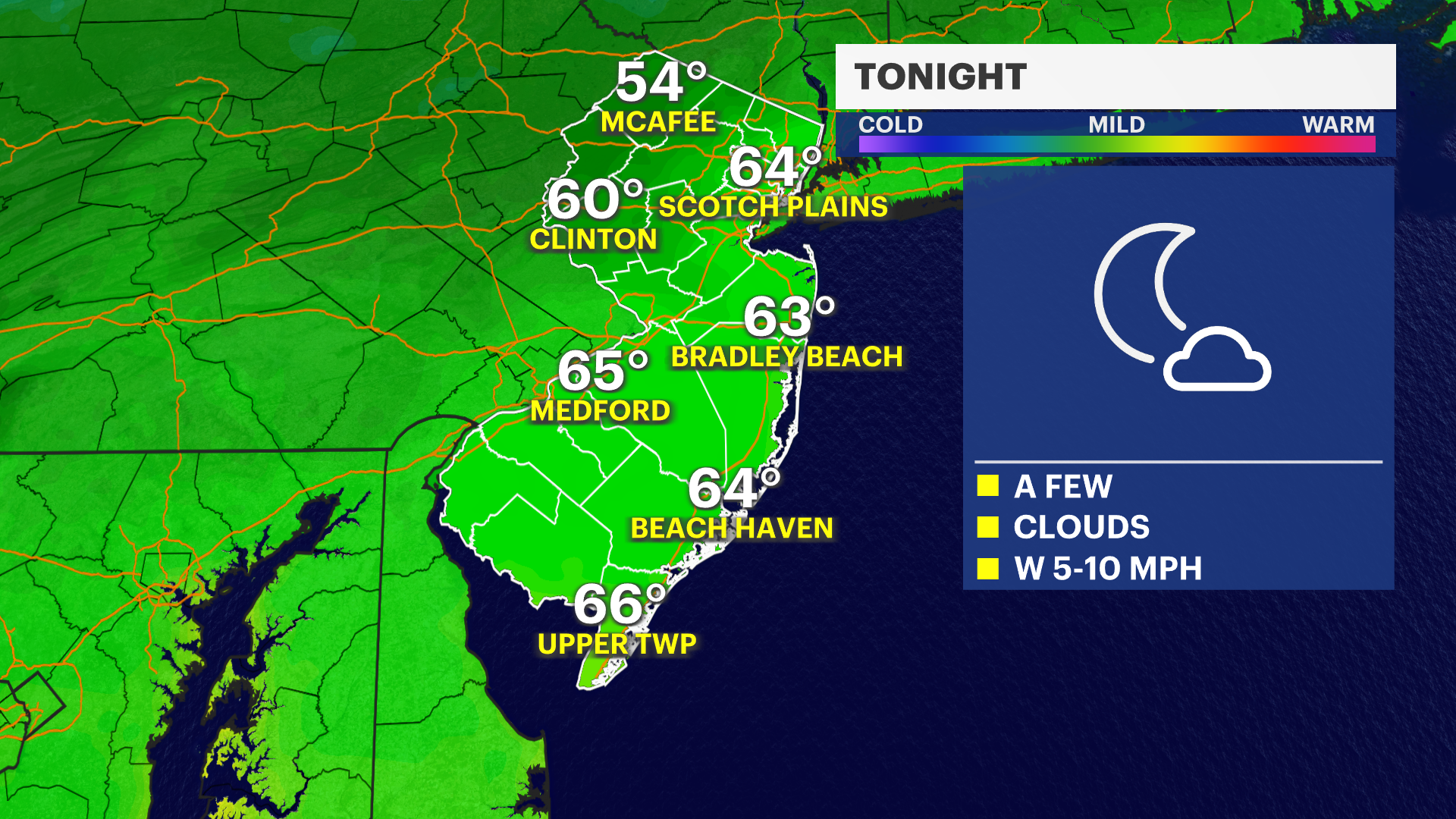
Temperatures drop into the 60s during the overnight hours under mostly clear skies.
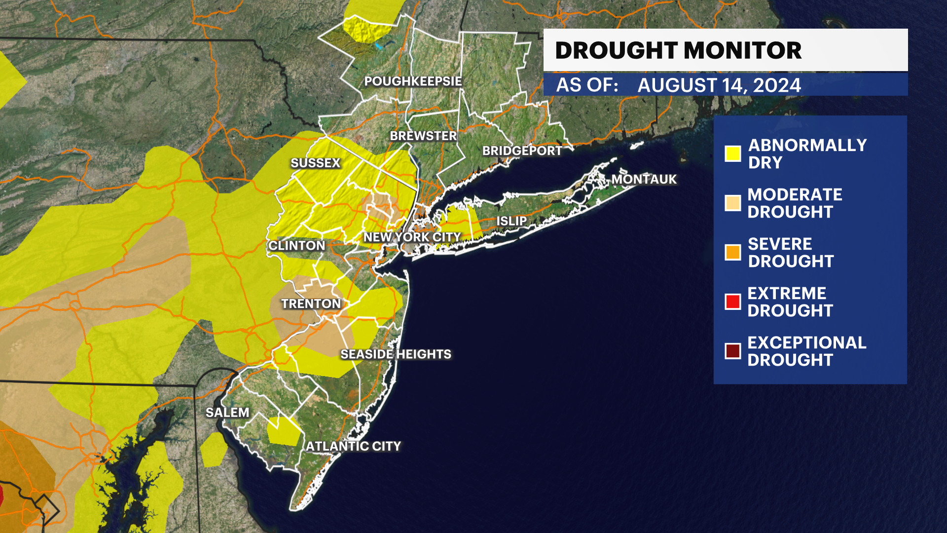
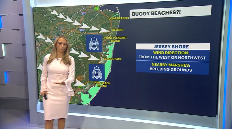
Because the drought has worsened and the ground is bone dry, a picking-up breeze means there is an elevated fire risk across the area. If you’re heading out camping and plan on firing up the charcoal grill, or planning a backyard fire pit, please use extra caution as any spark right could spread incredibly fast.
Moving into Sunday, Mother Nature is delivering a perfect mix for the first day of summer and Father's Day. Expect plenty of early afternoon sunshine and comfortable, seasonable temperatures. A few clouds will start drifting in late Sunday evening ahead of the next weather maker.
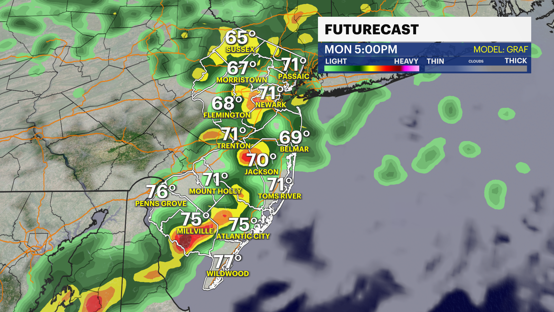
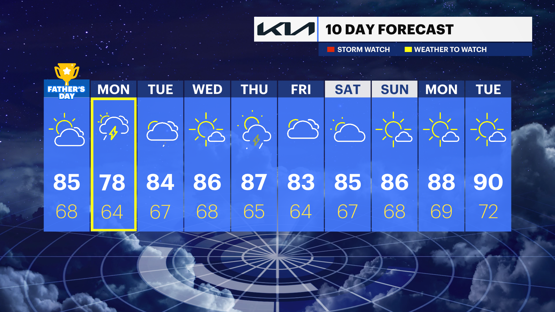
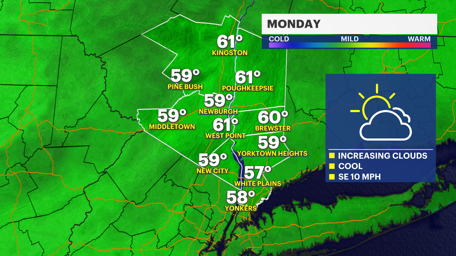
Monday brings the next chance for rain, and as of Saturday evening's forecast, it looks promising for a much-needed, good soaking. The News 12 Storm Watch Team will keep tracking this system as it moves closer and keep you updated on when that wet weather arrives.