STORM WATCH: Showers and thunderstorms this evening for the Hudson Valley
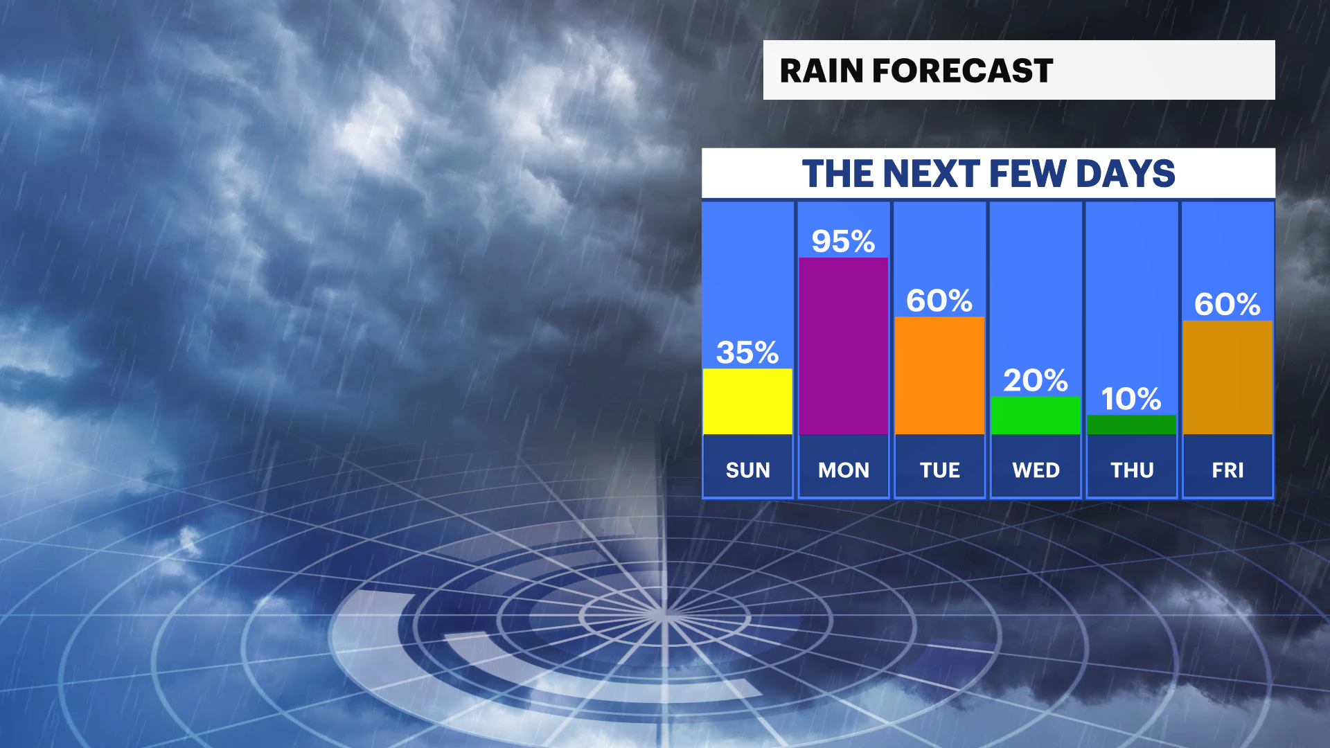
A few storms this evening could become strong, with damaging winds and torrential downpours. Several rounds of rain are expected Sunday through Tuesday, bringing the potential for localized flooding before conditions improve by midweek.
More Stories


What to expect:
Strong thunderstorms remain possible this evening, with damaging wind gusts the primary threat.
Locally heavy rainfall may lead to ponding on roads and isolated flash flooding, especially in poor drainage and flood-prone areas.
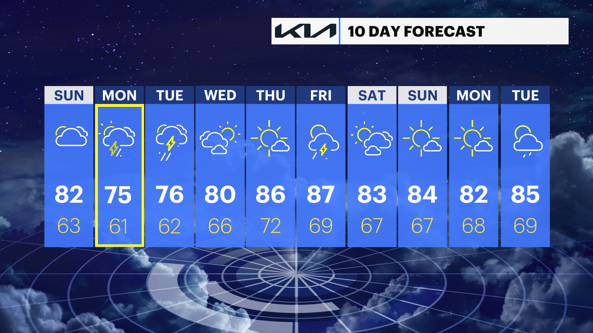
Multiple rounds of showers and thunderstorms are expected Sunday through Tuesday, with storm totals of 1.5" to 2.5" and locally higher amounts possible.
Cooler, more comfortable weather settles in by midweek before temperatures warm again late in the week.
Slight Risk of Severe Thunderstorms
There is a slight risk of severe thunderstorms in effect through this evening. Strong to severe thunderstorms may produce damaging wind gusts, frequent lightning and torrential rainfall.
Slight Risk of Flash Flooding
There is a slight risk of flash flooding in effect from late Sunday into Monday for portions of the Lower Hudson Valley, including Orange and Rockland counties. Multiple rounds of heavy rain could produce localized flash flooding, especially in urban and poor drainage areas.
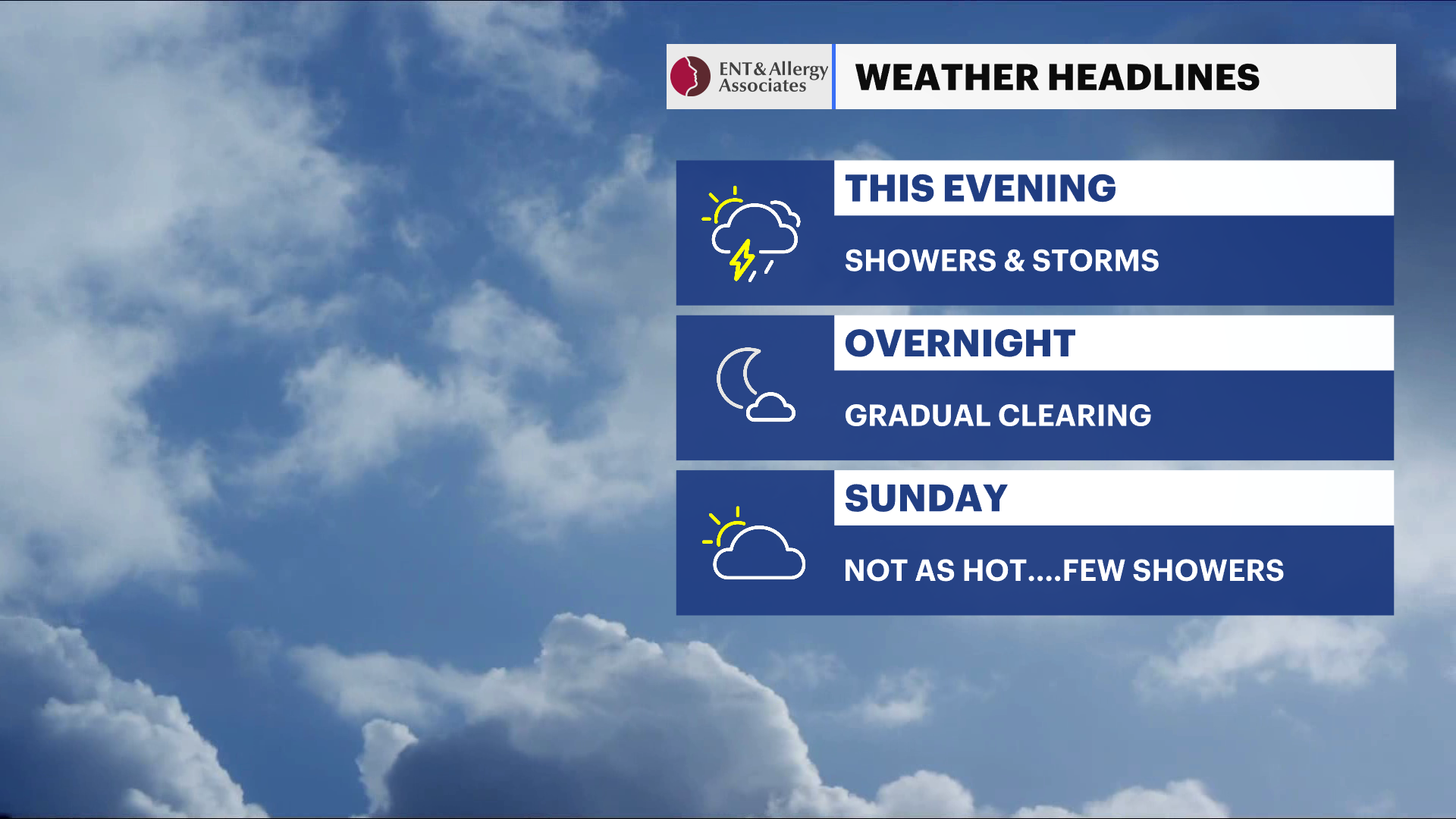
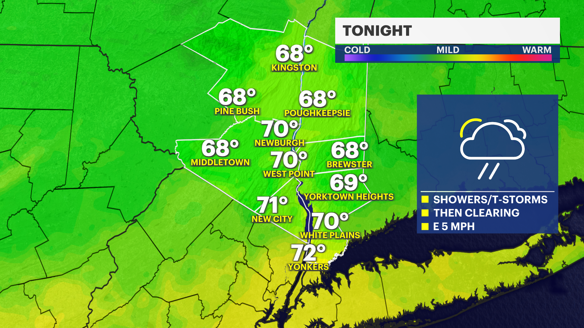
This evening: Showers and thunderstorms are likely through mid-evening, with a few storms capable of producing damaging winds, frequent lightning and heavy downpours. Rainfall of .25" to .50" is expected, with locally higher amounts in stronger storms.
Overnight: Showers gradually become more scattered overnight with mostly cloudy skies. Lows will fall into the upper 60s.
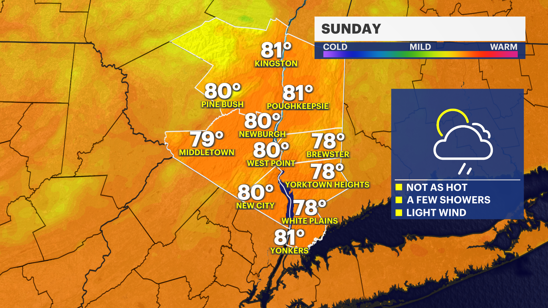
Sunday: Mostly cloudy to partly sunny, with several rounds of showers and thunderstorms developing, especially during the afternoon. Temperatures will reach the low 80s.
Sunday night: Periods of showers and thunderstorms continue, with locally heavy rainfall possible. Temperatures will fall into the low 60s.
Monday: Cloudy with showers and thunderstorms likely throughout the day. Some rainfall may be heavy at times. Temperatures will remain in the low to mid-,70s.
Tuesday: Mostly cloudy with additional showers and thunderstorms possible, especially during the afternoon. Temperatures will be in the mid- to upper 70s.
Wednesday: Partly sunny and noticeably drier. Temperatures will reach the low 80s.
Thursday: Mostly sunny and warmer, with temperatures in the mid- to upper 80s.
Friday: Partly sunny, with another chance of showers and thunderstorms. Temperatures will be in the upper 80s.