Clouds and a passing shower start the day before brighter skies take over
Quiet conditions through midweek before a late-week coastal storm brings widespread rain
More Stories




Bridgeport Information
FORECAST
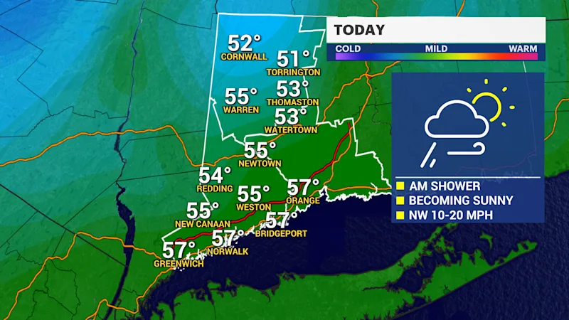
Connecticut will start the day on a cloudy note, with a brief passing shower possible as a weak frontal system moves through the region. Breezy conditions are expected, with wind gusts ranging from 10 to 20 mph.
Improving weather is expected by late morning as skies quickly clear. Afternoon temperatures will rise into the upper 50s, providing a seasonable and comfortable day across the state.
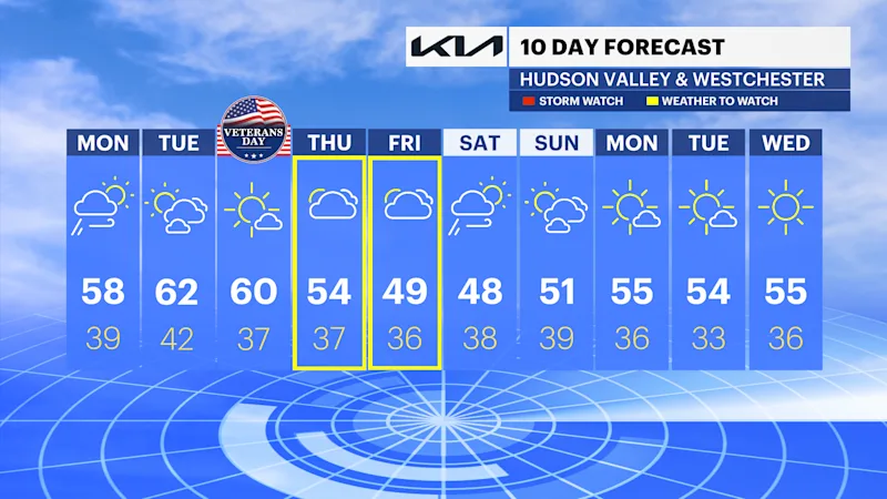
Tonight will feature mostly clear skies and lighter winds, with overnight lows settling into the upper 30s and lower 40s. Quiet weather continues through the middle of the week, with temperatures remaining close to 60 degrees.
LATE WEEK STORM
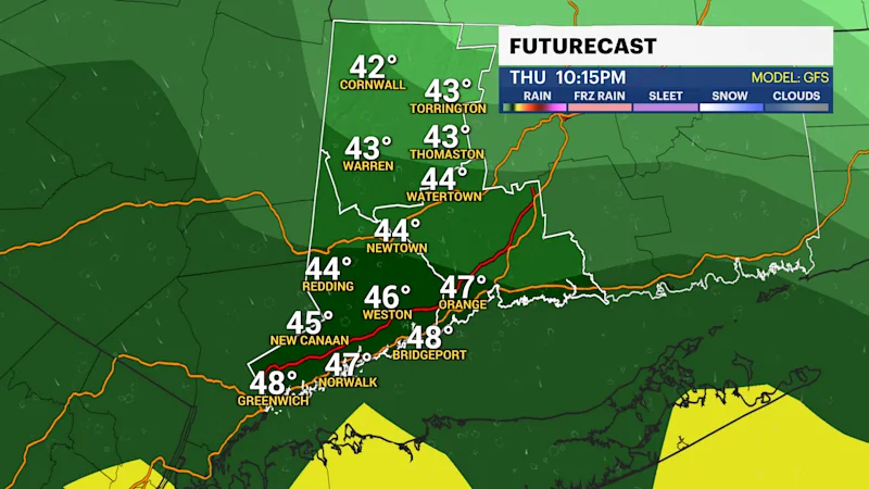
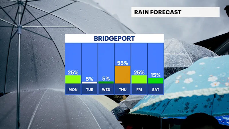
A more significant storm system is expected to arrive late Thursday. After a mostly dry start to the day, rain will develop during the afternoon and continue through Friday and early Saturday morning.
Friday is expected to bring the heaviest rainfall, with periods of steady rain and occasional downpours.
The storm is forecast to strengthen as a coastal low develops, leading to a wet and occasionally windy end to the week. Wind gusts may approach 30 mph by Saturday before conditions begin to improve.
Current projections favor a widespread soaking rain across much of Connecticut, while any wintry weather should remain confined to far northern and higher-elevation areas. Forecast confidence in exact rainfall amounts will continue to improve as the event approaches.