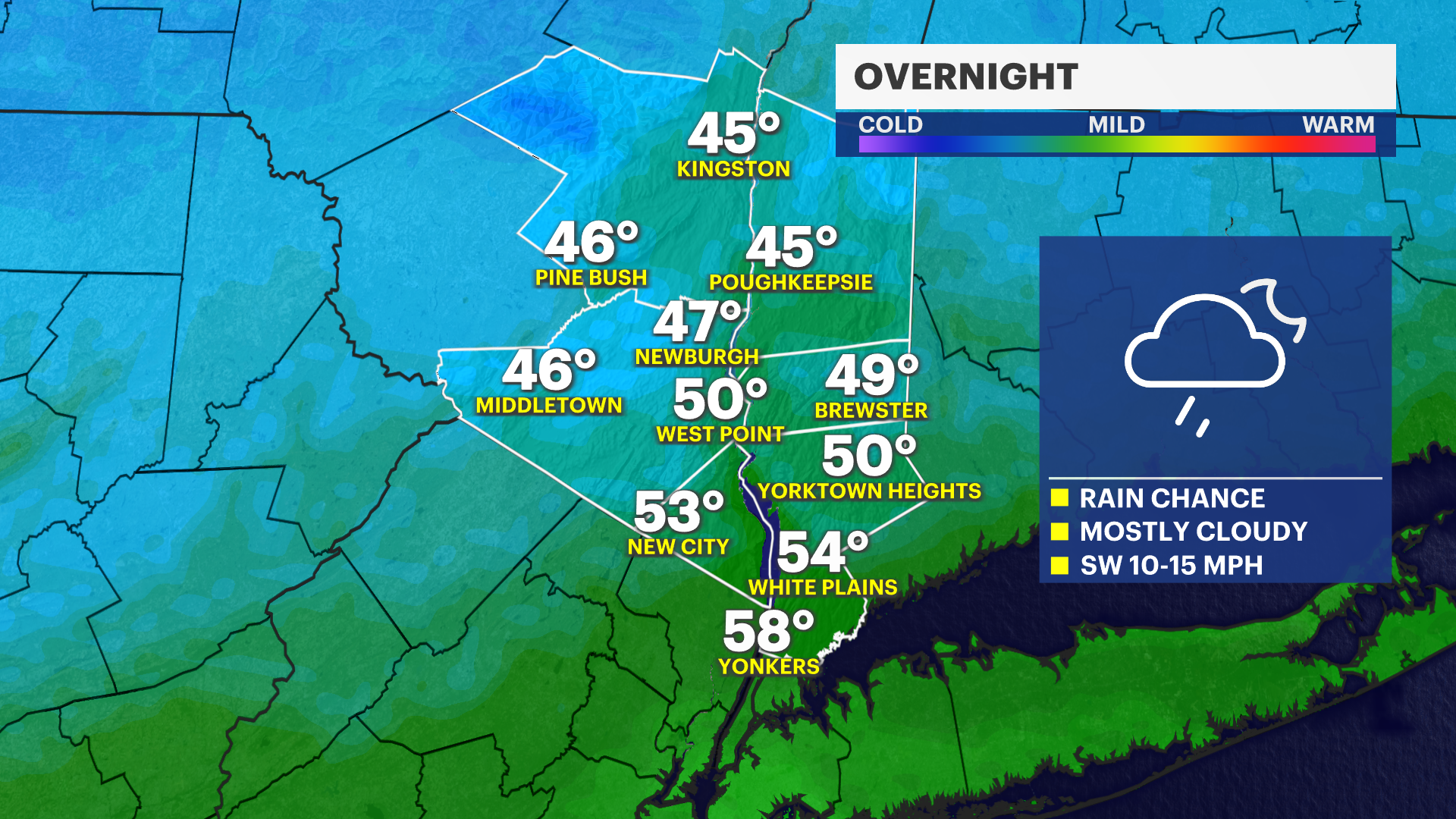
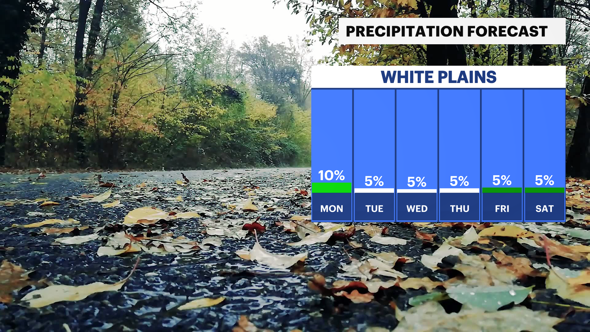
Light rain possible overnight in the Hudson Valley; chilly mornings ahead
Overnight and early Monday could see some stray showers – but most of the week remains dry. Morning lows this week are going to be cold with temperatures in the high 30s and low 40s.
Share:
More Stories


TONIGHT: Lows in the 50s. Mostly cloudy. Stray shower possible but mainly dry.
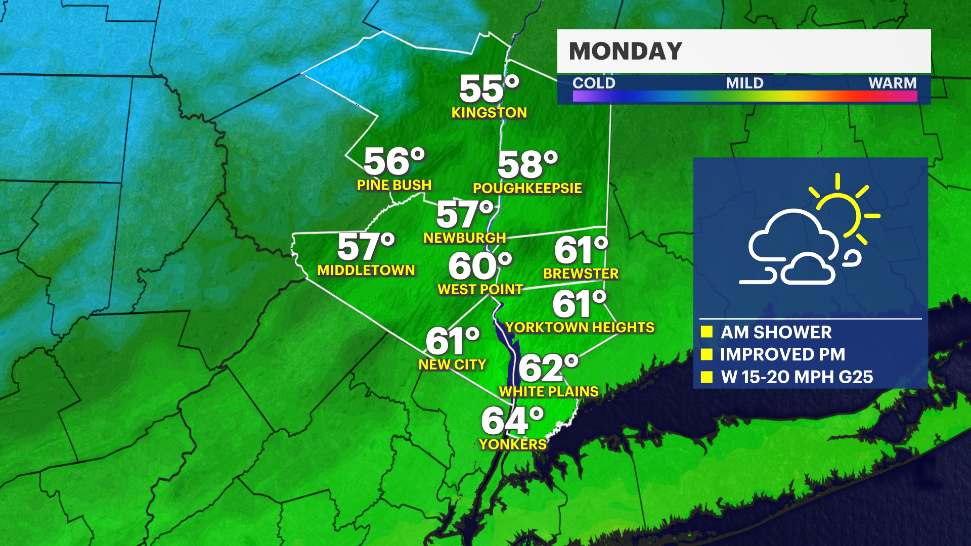
MONDAY: High of 64, low of 40. Am rain chances, clears out by midday and the rest of the day is nice! Clouds and sun and drier. Breezy.
TUESDAY: High of 57, low of 39. Sun and clouds. Still breezy.
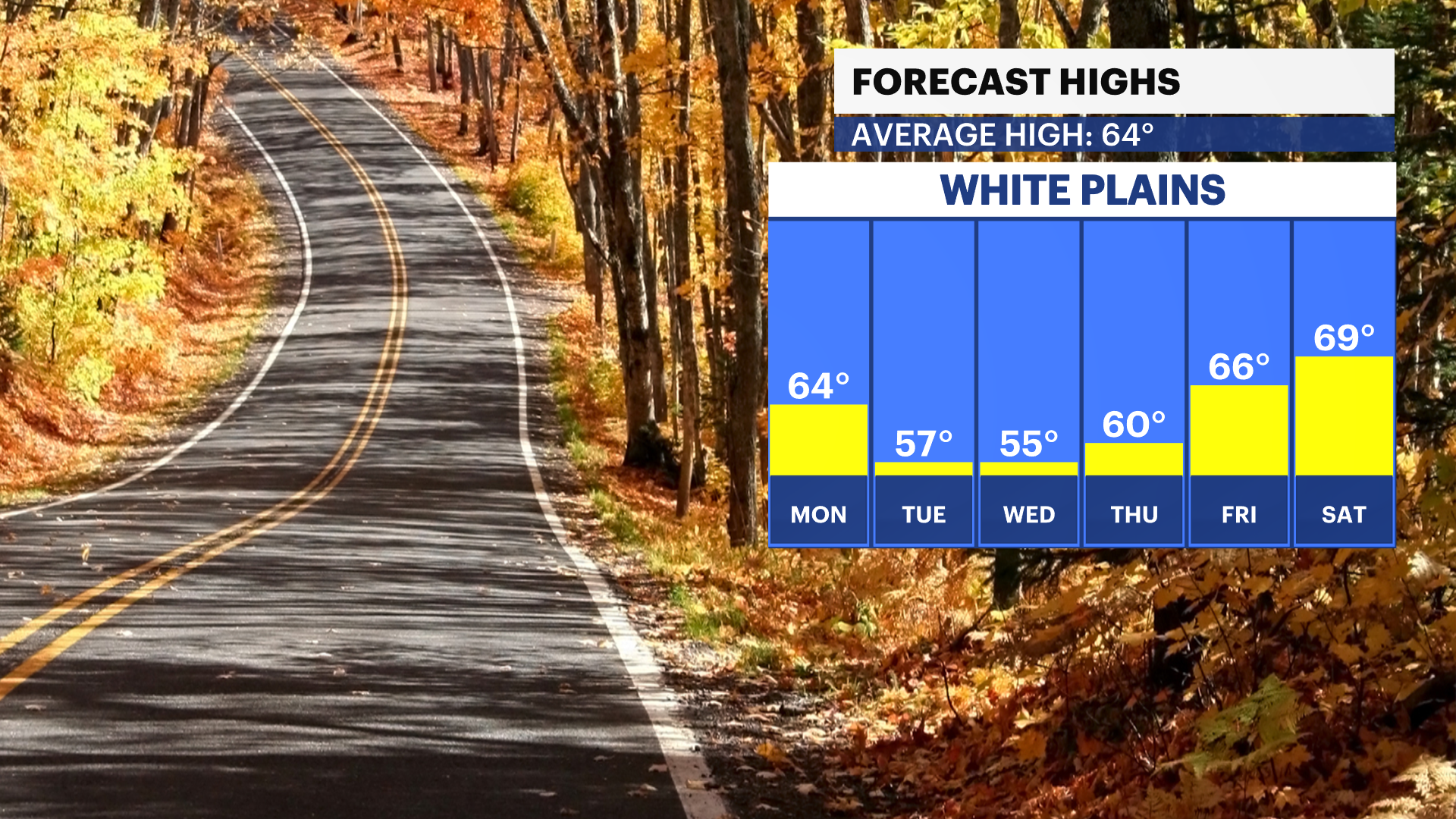
WEDNESDAY: High of 55, low of 38. Mostly sunny.
THURSDAY: High of 60, low of 38. Sunshine and a few clouds.