Hurricane Ernesto bring dangerous rip currents to local beaches
A high risk of rip currents has already arrived and will remain at the Atlantic-facing beaches through the entire tri-state through at least Sunday evening.
Share:
More Stories
3:14

Better air quality today; Increasing rain chances into Saturday morning
4h ago3:14

Wet start to the week in the Hudson Valley; sunshine returns midweek
4ds ago1:16

Streak of weekends with rain set to continue for lower Hudson Valley
10ds ago3:14

Sunny and clear Monday in the Hudson Valley before temps soar later this week
11ds ago3:14

Memorial Day weekend ends with beautiful evening in the Hudson Valley
17ds ago
News 12 weather blog
28ds ago3:14

Better air quality today; Increasing rain chances into Saturday morning
4h ago3:14

Wet start to the week in the Hudson Valley; sunshine returns midweek
4ds ago1:16

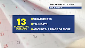
Streak of weekends with rain set to continue for lower Hudson Valley
10ds ago3:14

Sunny and clear Monday in the Hudson Valley before temps soar later this week
11ds ago3:14

Memorial Day weekend ends with beautiful evening in the Hudson Valley
17ds ago
News 12 weather blog
28ds agoAs Hurricane Ernesto approaches Bermuda this weekend, the storm's closest approach to the tri-State area will bring it roughly 400 miles away. Yet, there will be indirect impacts at our area beaches that are dangerous for anyone attempting to enter the water.
A high risk of rip currents has already arrived and will remain at the Atlantic-facing beaches through the entire tri-state through at least Sunday evening. That is when the current rip current statement from the National Weather Service is currently set to expire.
The risk is one of the highest in 2024 so far, and there will be numerous rip currents, likely peaking on Sunday. It is sometimes difficult to spot a rip current, and easy to get stuck in one. If you are not an experienced swimmer, do not enter the water and remain on the sand. No children should be in the water unless they are experienced and with an experienced parent or guardian. There are likely going to be red flags that discourage swimmers from swimming at most beaches.
Take a look at some of the Storm Watch Team's safety tips on rip currents:

High surf is also expected, especially toward the East End of Long Island, where wave heights just offshore could top 10 feet. Boating and other ocean-based activities are not recommended with the especially rough surf.
Conditions slowly taper starting Monday and return to safer levels mid-week next week.
More from News 12
0:33

‘Let kids breathe.’ Ulster residents raise concerns about proposed pet crematorium feet away from schools
0:53

Dutchess County martial arts studio instructor accused of sexually abusing children pleads guilty
0:20

Play Airlines ending Stewart to Iceland route in September
0:53

322 grams of cocaine seized during Ulster County stop, Yonkers man charged
2:09

Beloved music festival makes a return to the Hudson Valley this weekend
1:14
