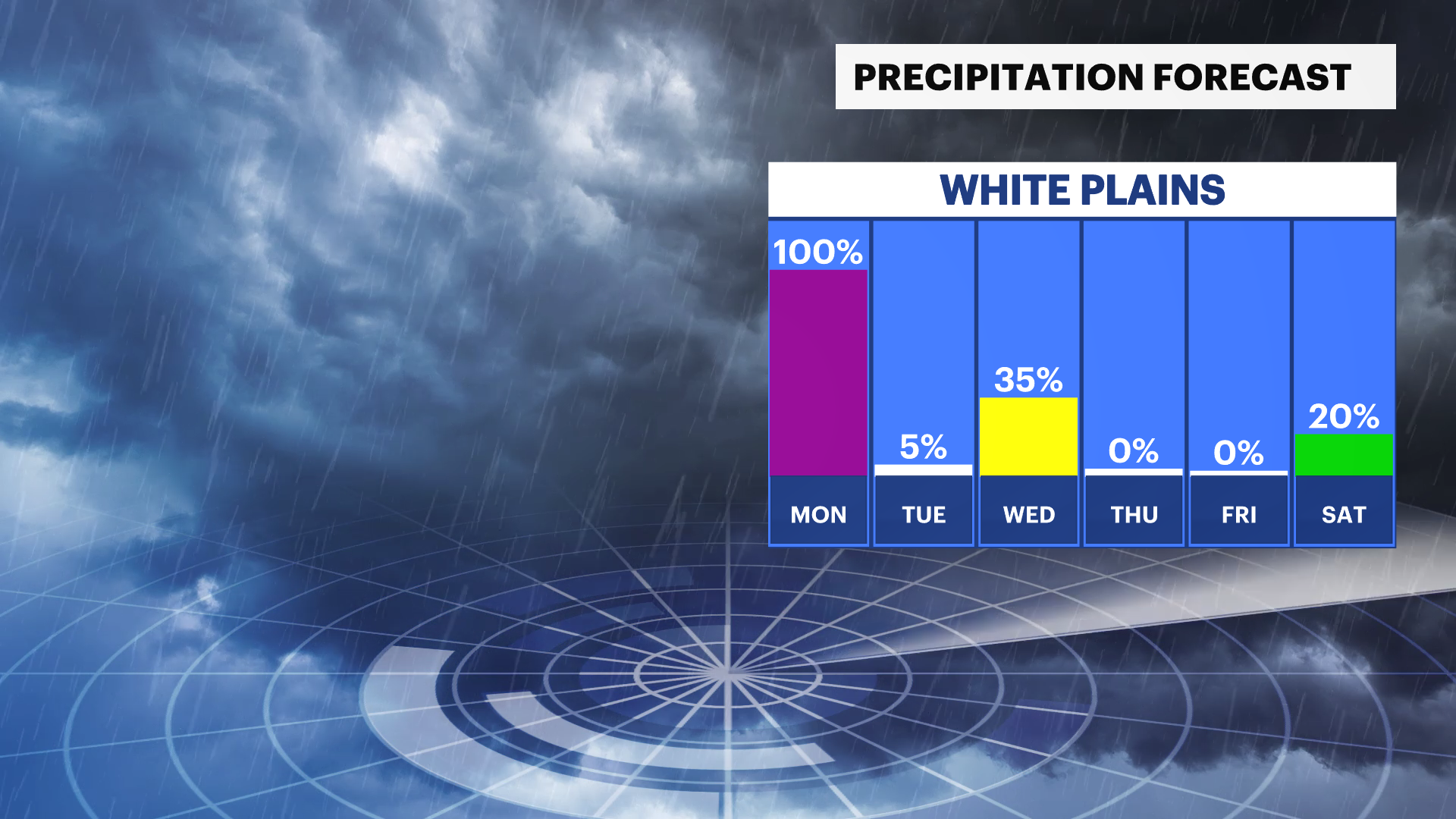
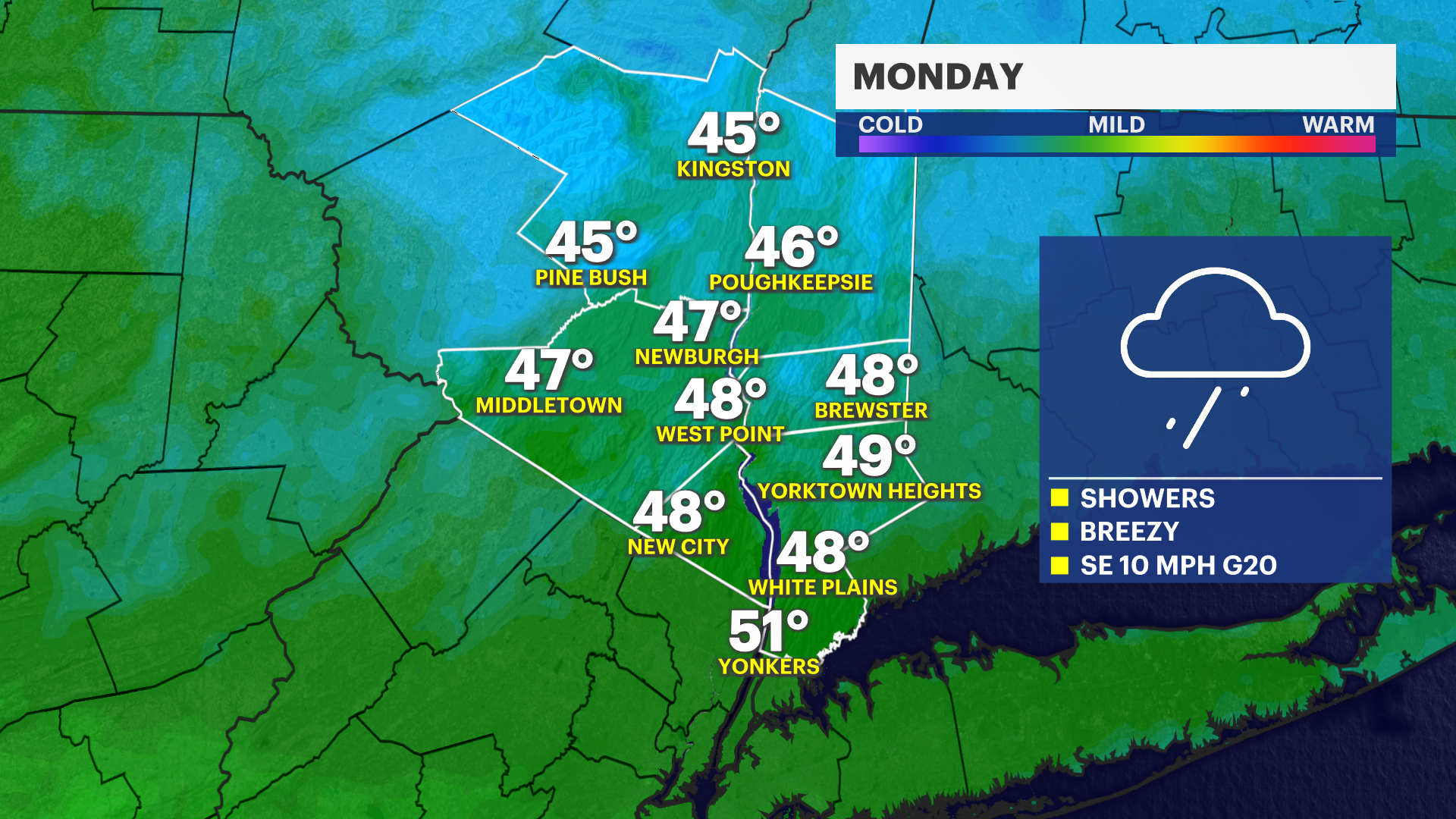
STORM WATCH: Rain, wintry mix overnight ahead of sloppy Monday commute in the Hudson Valley
Give yourself some extra time to navigate sloppy road conditions during the Monday morning commute.
More Stories


MORNING COMMUTE: A winter weather advisory is in effect for western portions of Ulster County from 2 a.m. until 10 a.m. Monday. This is due to a chance of lower snow totals, sleeting, and glaze concerns. Roads will be very slippery for your morning commute. Allow extra time or, if you can, try to have a later start when heading to work.
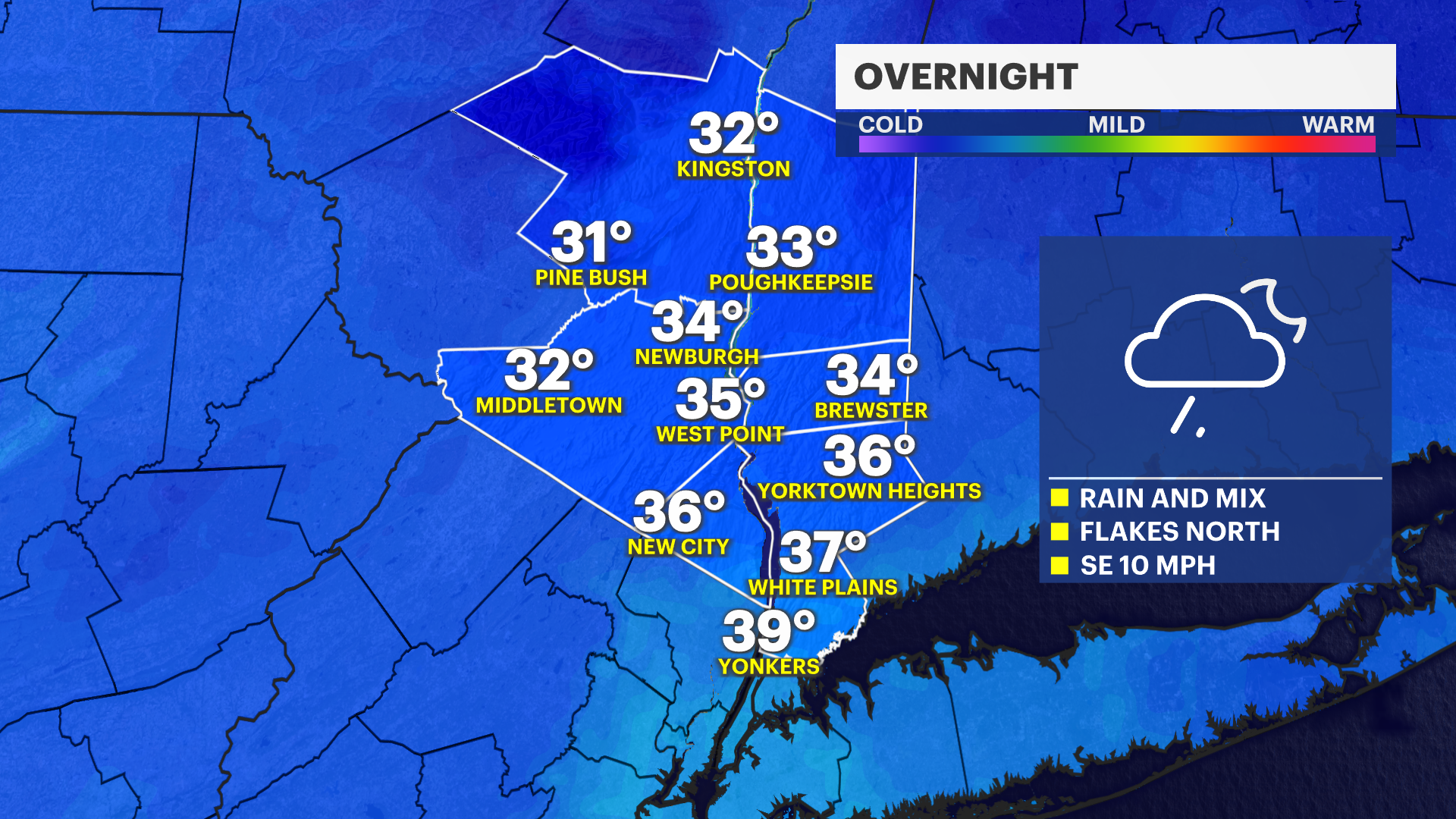
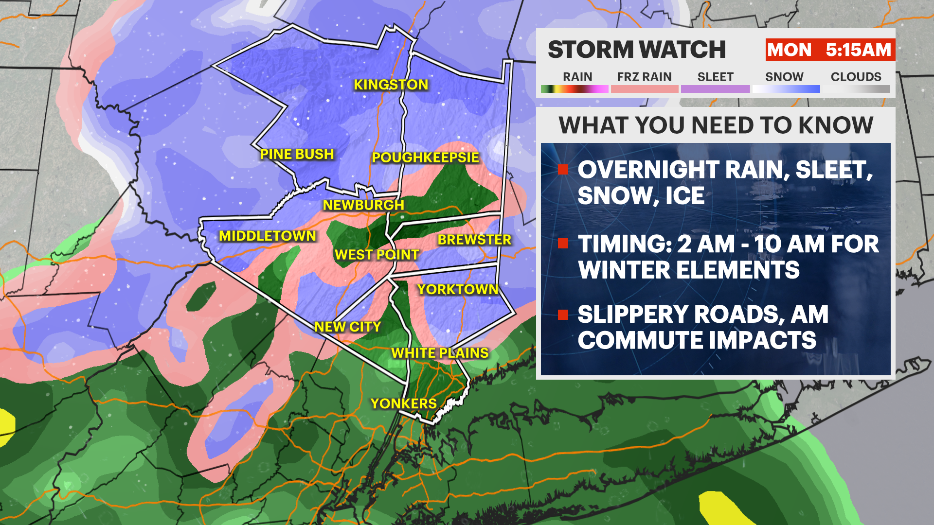
MONDAY: Freezing rain and a wintry mix moves through during the early morning hours and rush hour too. This will change over into plain rain mid-morning. The rain tapers off during the day, then we will see drier and partly cloudy conditions for the overnight hours.
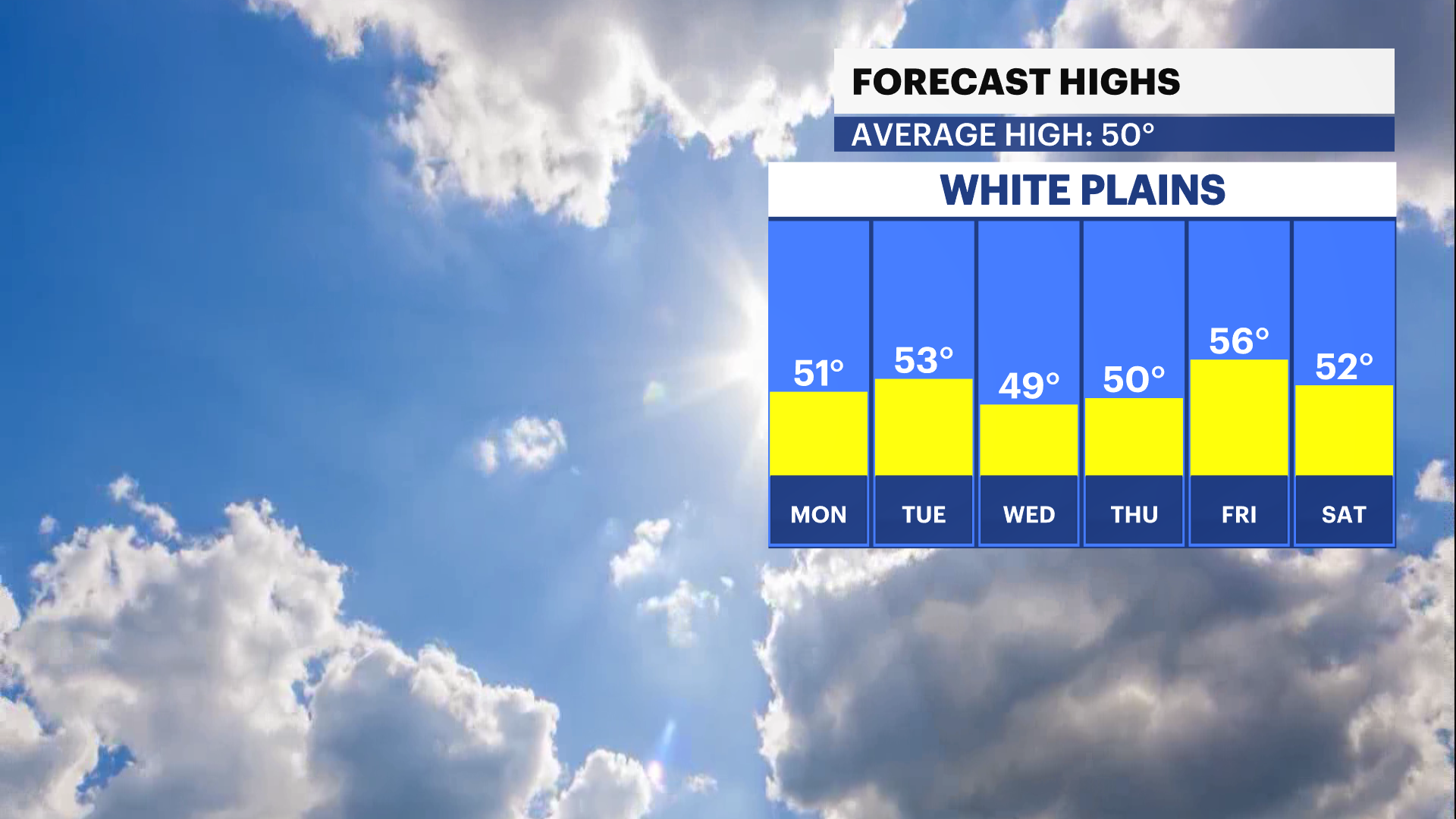
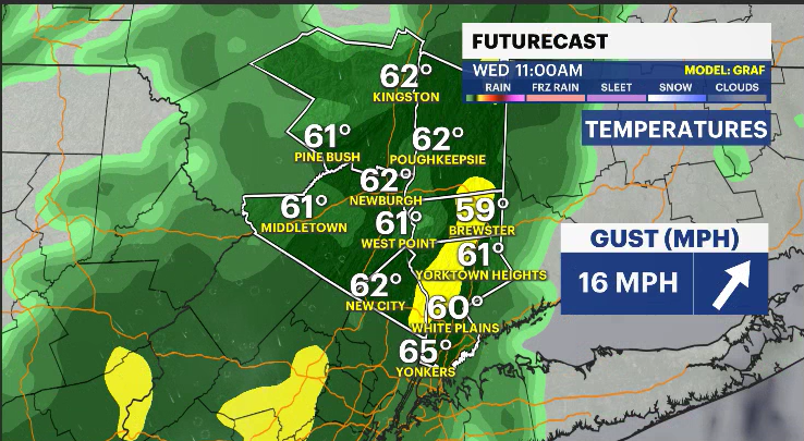
TUESDAY: It will be breezy during the overnight and throughout Monday with gusts in the teens and 20s. Gusts pick up again Tuesday into that 20/30 mph range. Temperatures will be in those lower 50s and higher 40s through Thursday, then a slight warm up is expected for Friday.