More Stories
NEW: Hurricane Ian will make landfall between Tampa and Fort Myers, Florida, on Wednesday but will remain over Florida until Thursday evening. Hurricane Ian is bringing torrential rain, life-threatening
flash flooding and dangerous storm surge to western Cuba. Ian is expected to
intensify to a Category 4 strength as it moves NW towards the Florida coast.
The entire state of Florida is bracing for hurricane conditions Wednesday into
Thursday. The primary issue with this system is how long it’ll be slowly moving
across Florida. Time span is between Wednesday into Friday from the Tampa Bay
area to Jacksonville. Life-threatening storm surge of six to 10+ feet will impact the west coast of
Florida. Several evacuation alerts are in place for western parts of Florida.
Models are coming into agreement for catastrophic impacts sweeping across
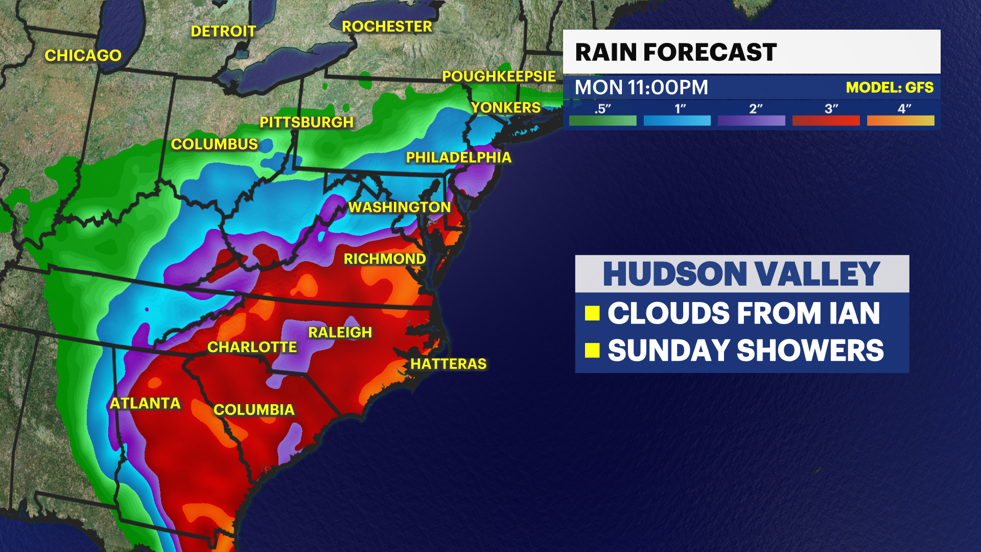
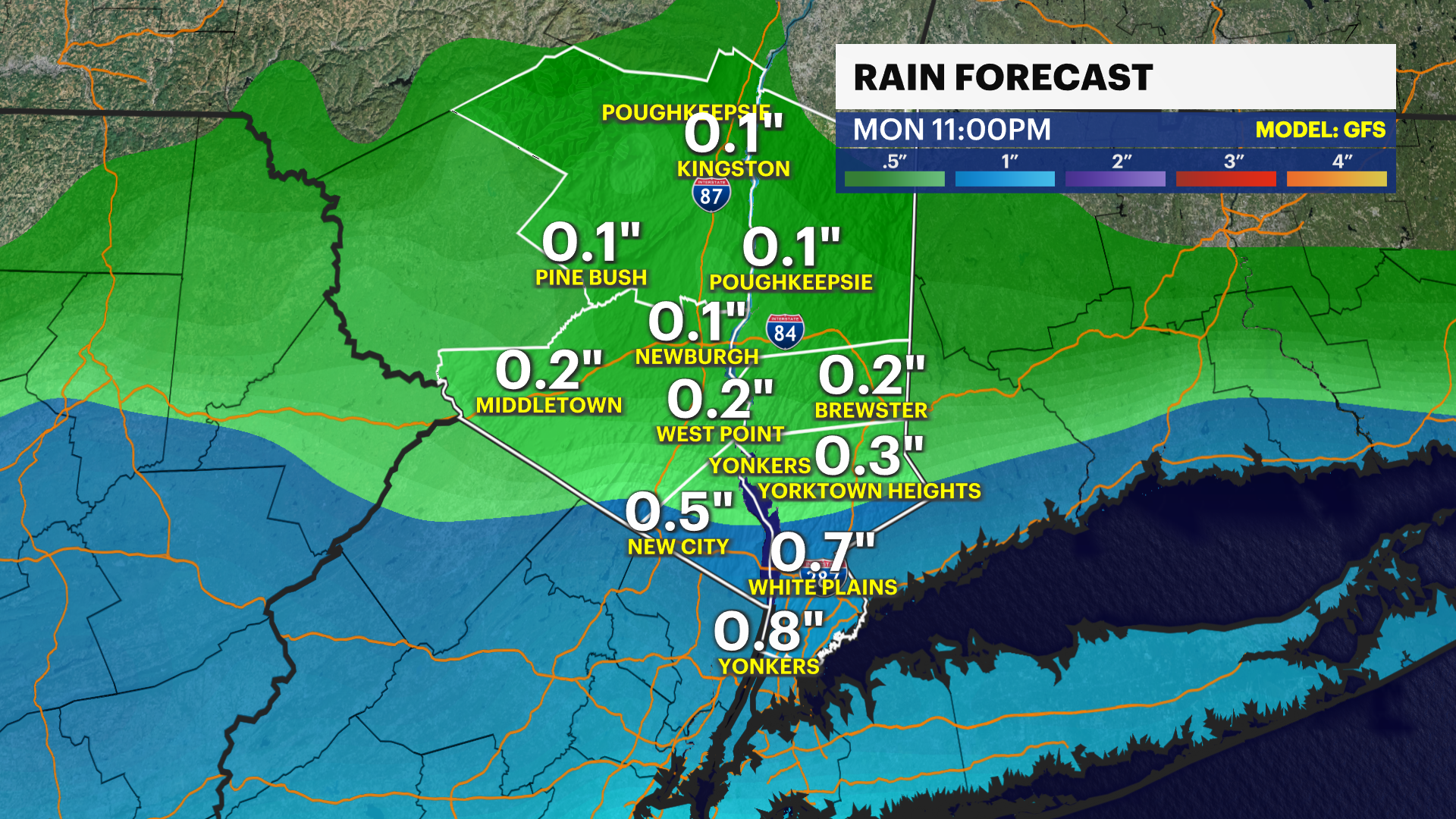
central and west Florida. The remnants of Ian will stall south of our area this
weekend. Impacts from Ian will be minimal to our area. We will see mostly
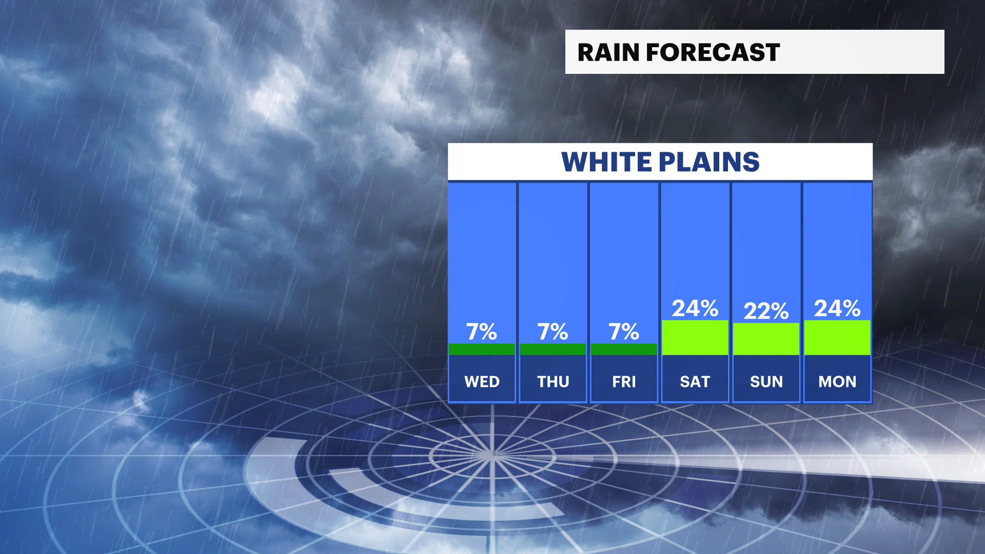
cloudy conditions with the chance of showers Sunday evening into Monday. Stay
tuned for any changes!
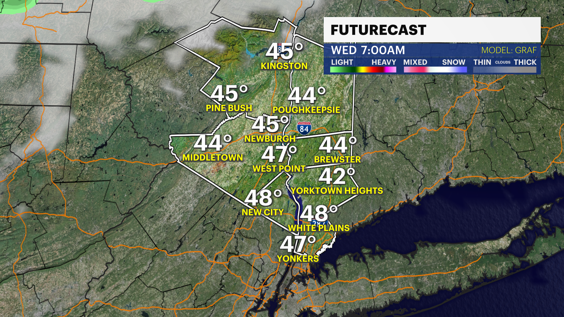
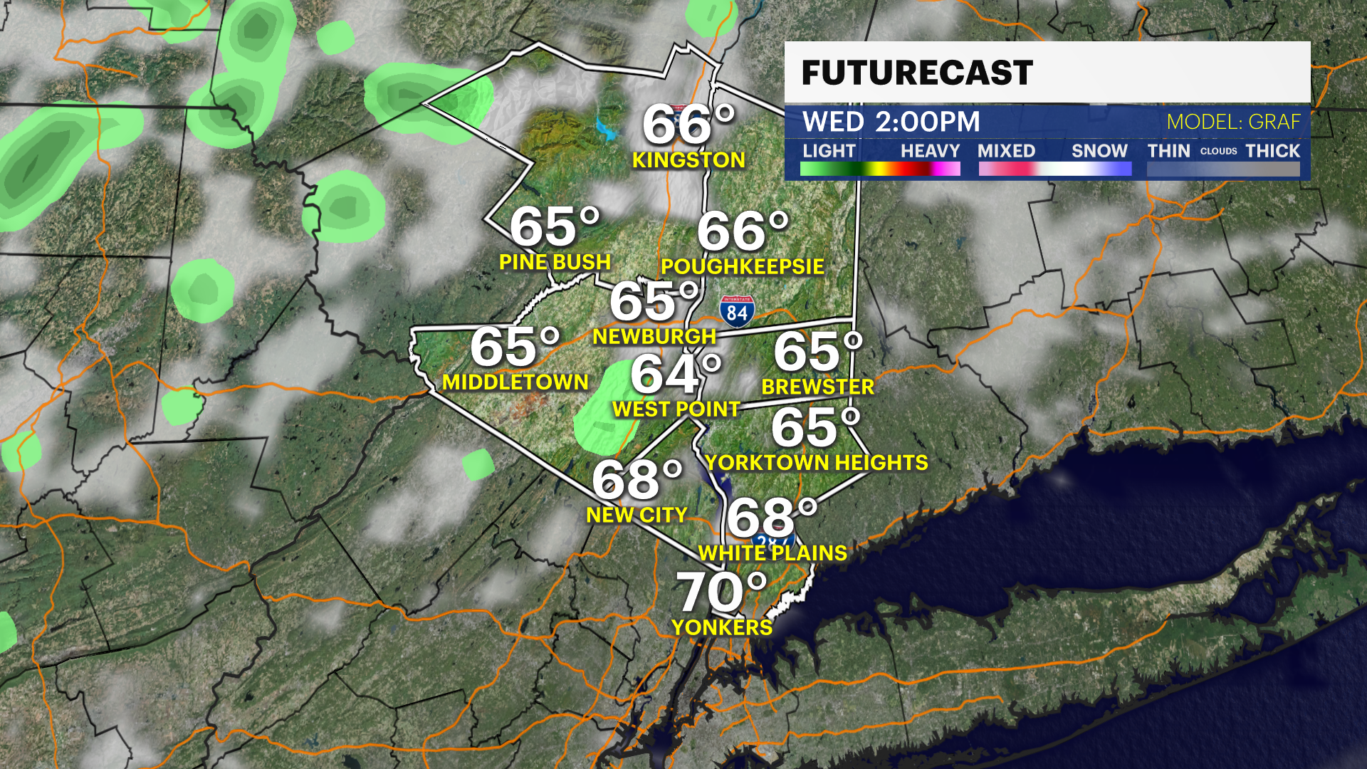
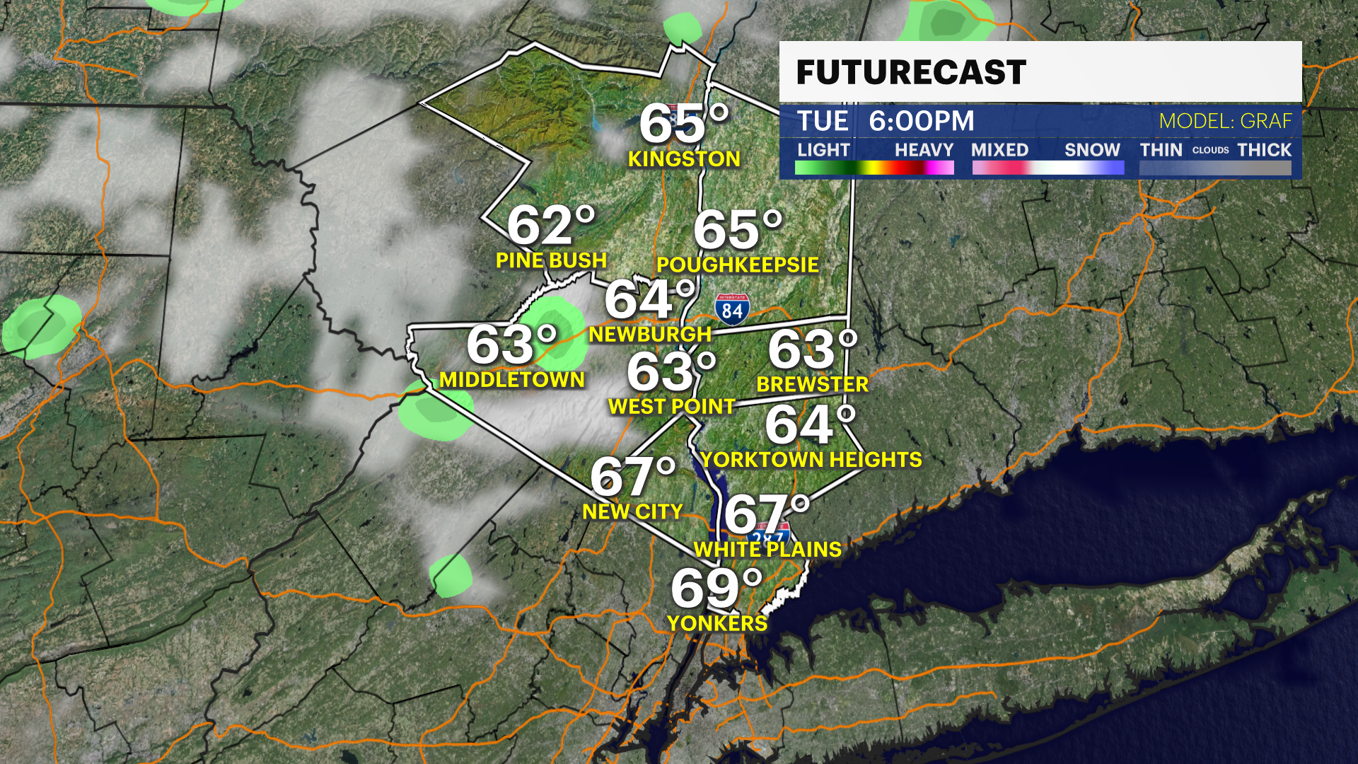
Storm Watch Team Meteorologist Alex Calamia says cooler air will arrive Wednesday in the Hudson Valley.
WHAT'S NEW: Clouds are expected for the weekend. A few showers are possible with the remnants of Ian off to the south.
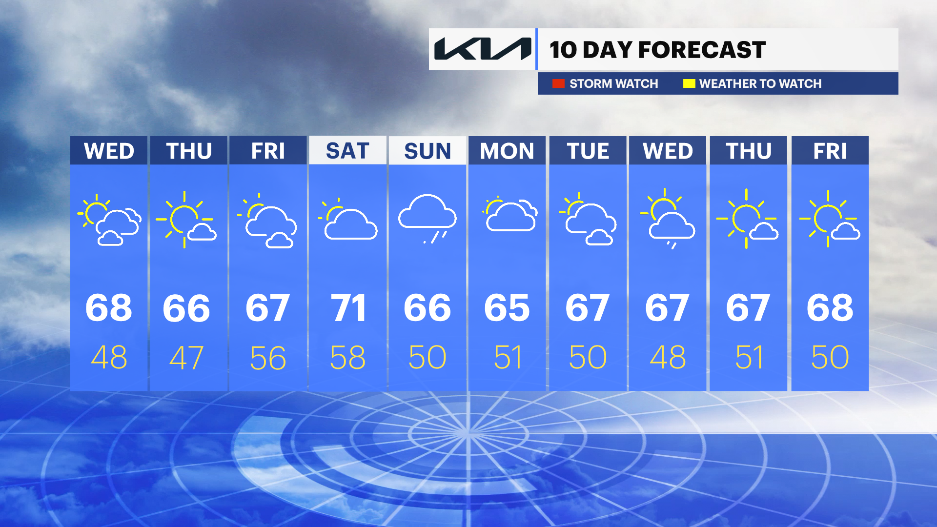
WHAT'S NEXT: The weekend will be warmer and cloudy, with highs closer to 70 degrees.
FORECAST:
Wednesday: Cool with a mix of sun and clouds. Highs in the upper-60s with lows near 50.
Thursday: Chilly in the morning and cool in the afternoon. Highs in the mid-60s and lows in the low- to mid-40s.
Friday: A mix of sun and clouds and still cool. Highs in the mid-60s with lows in the 40s.
THIS WEEKEND: Warmer and cloudy with highs closer to 70 degrees. A few showers are possible with the remnants of Ian off to the south.
More from News 12
1:18

Woman dead after New City house fire
2:12

Hudson Valley heats up before midweek storms roll in
1:40

Lakeland school safety program in Yorktown caught in budget standoff as costs rise
2:01

Safe Roads Act: Rockland County lawmaker proposes legislation to hold New York state accountable for vehicles damaged by potholes
2:06

'She was an amazing person.' Private funeral service held for Yorktown college student fatally shot in Chicago
2:17
